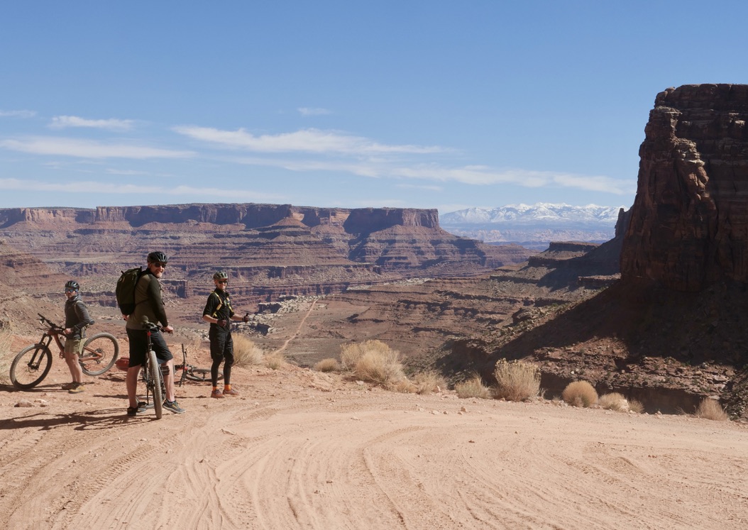
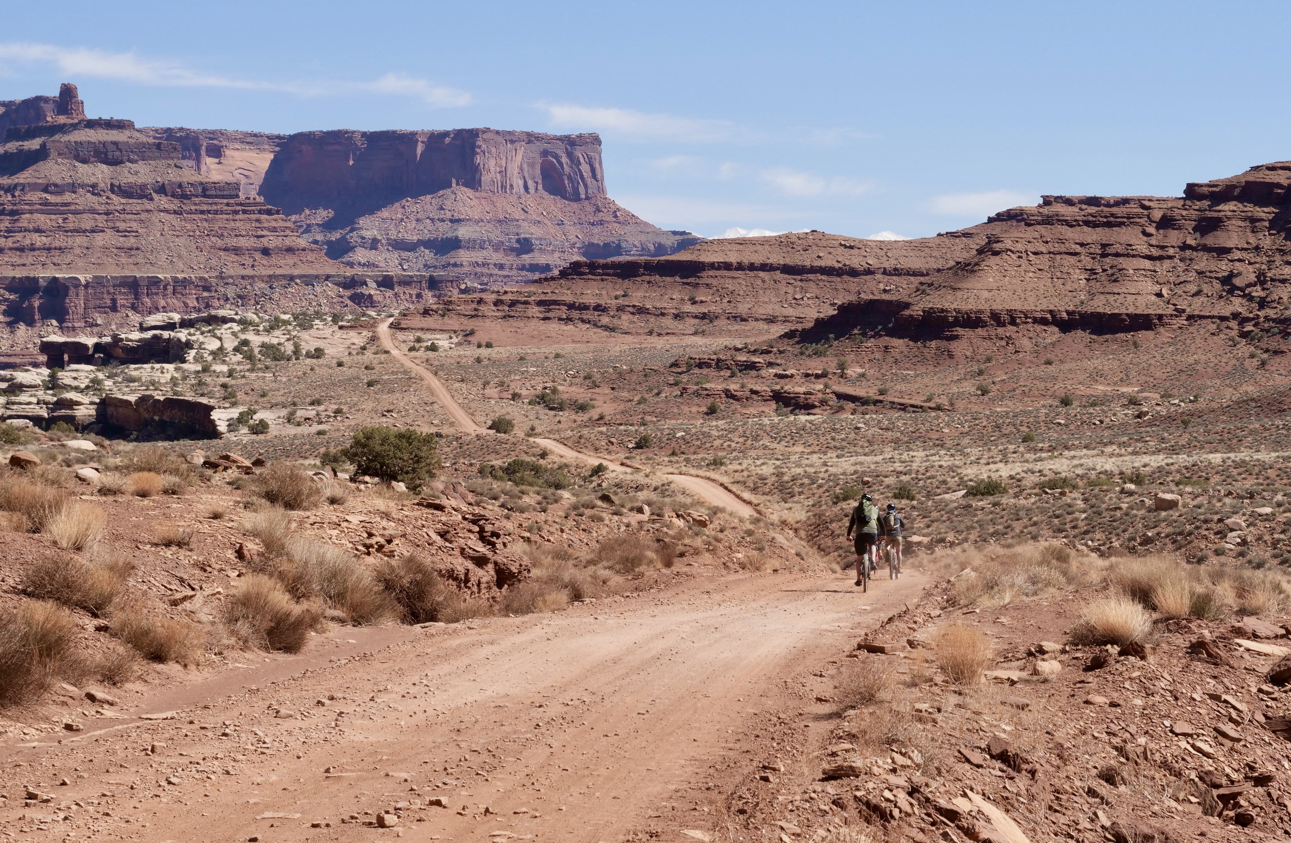
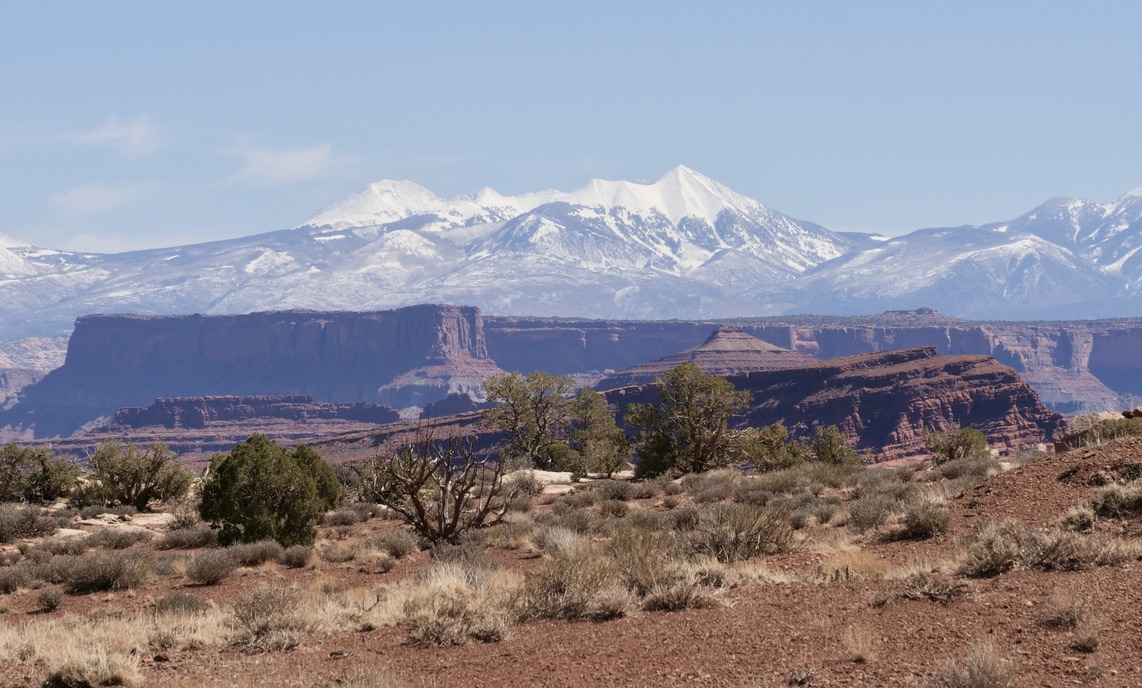
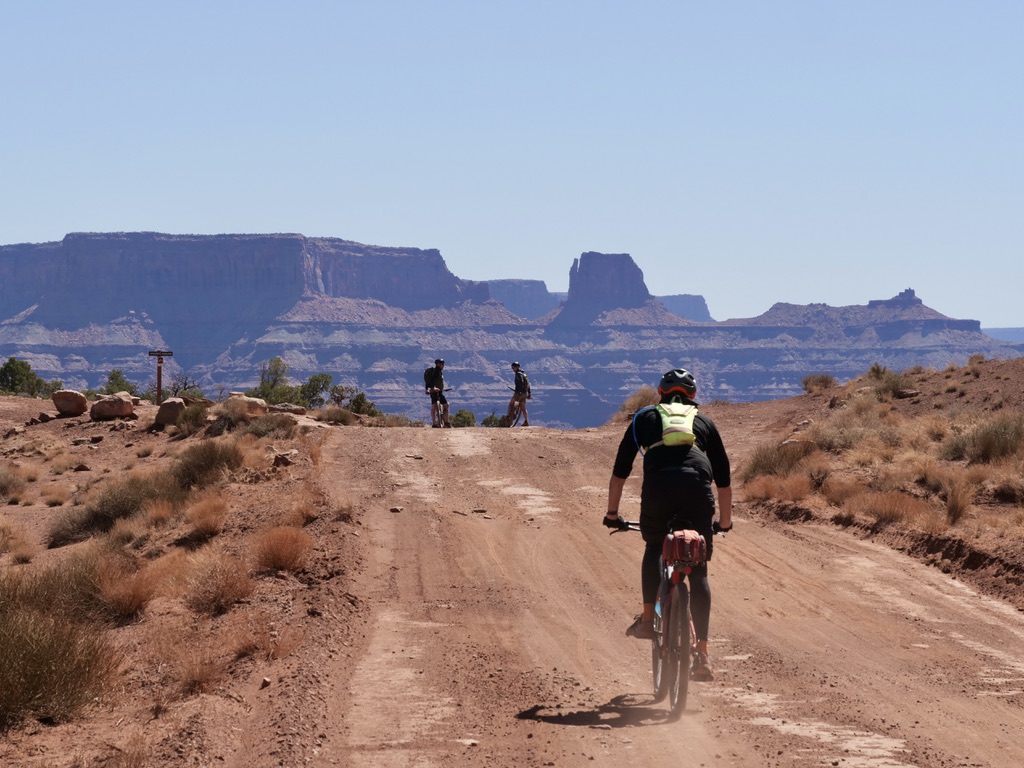
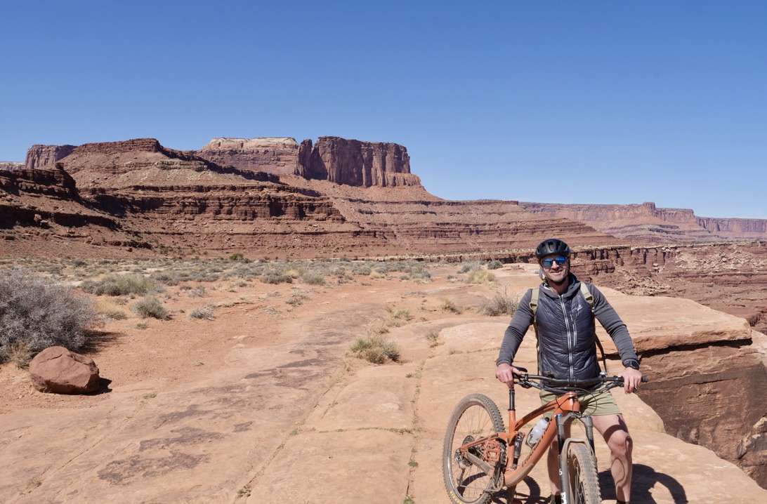
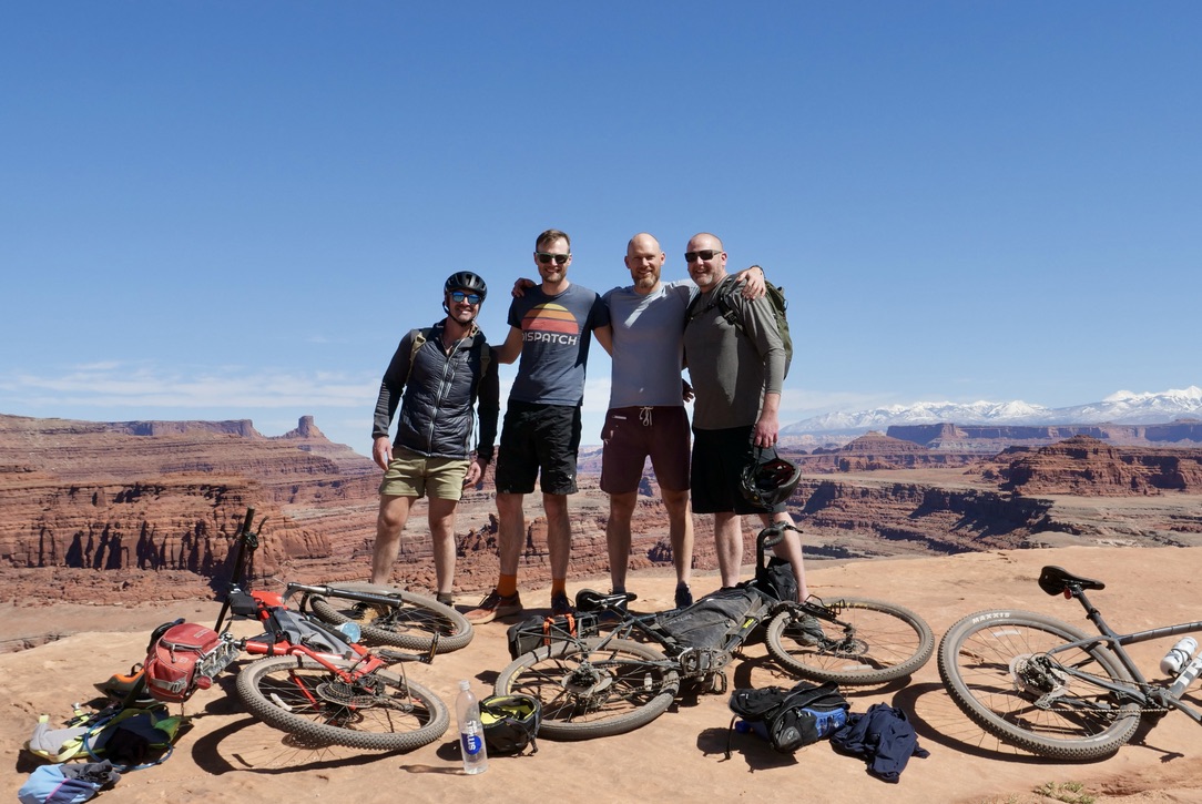
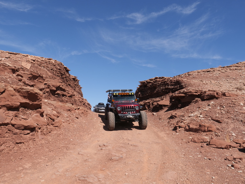
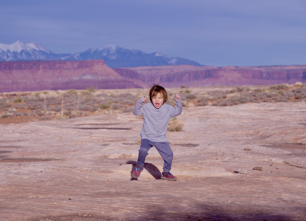
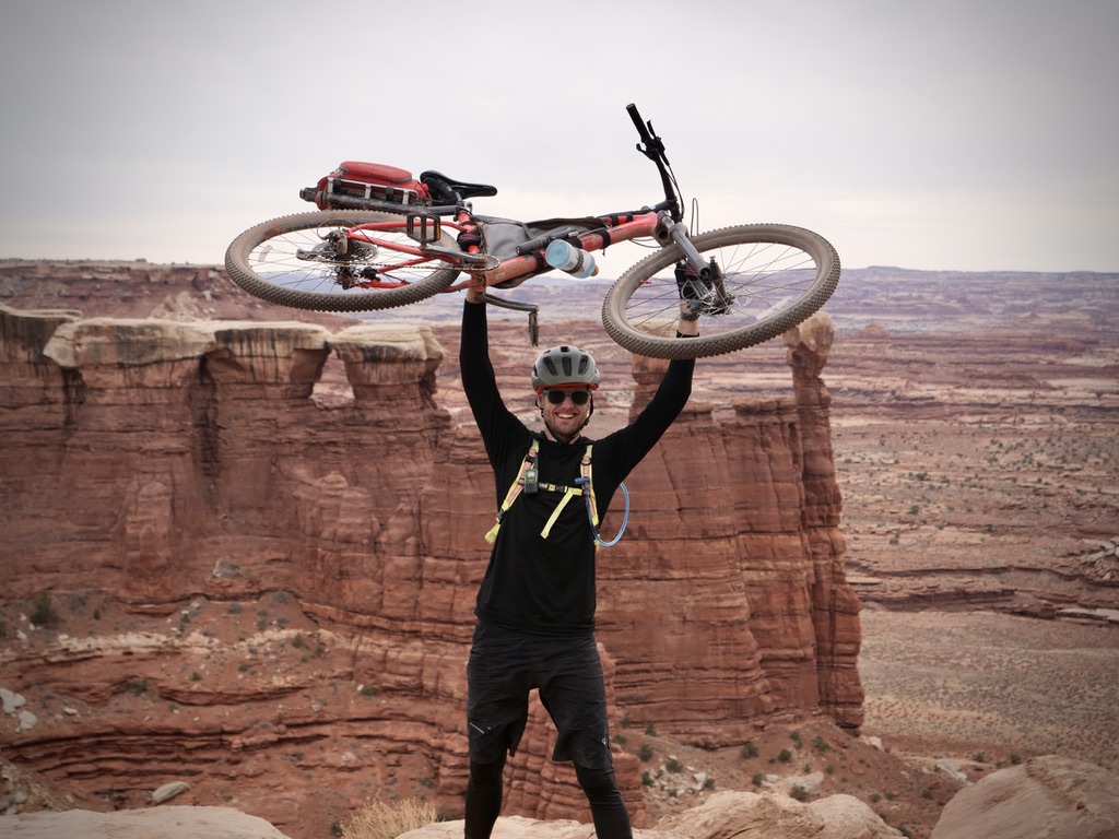
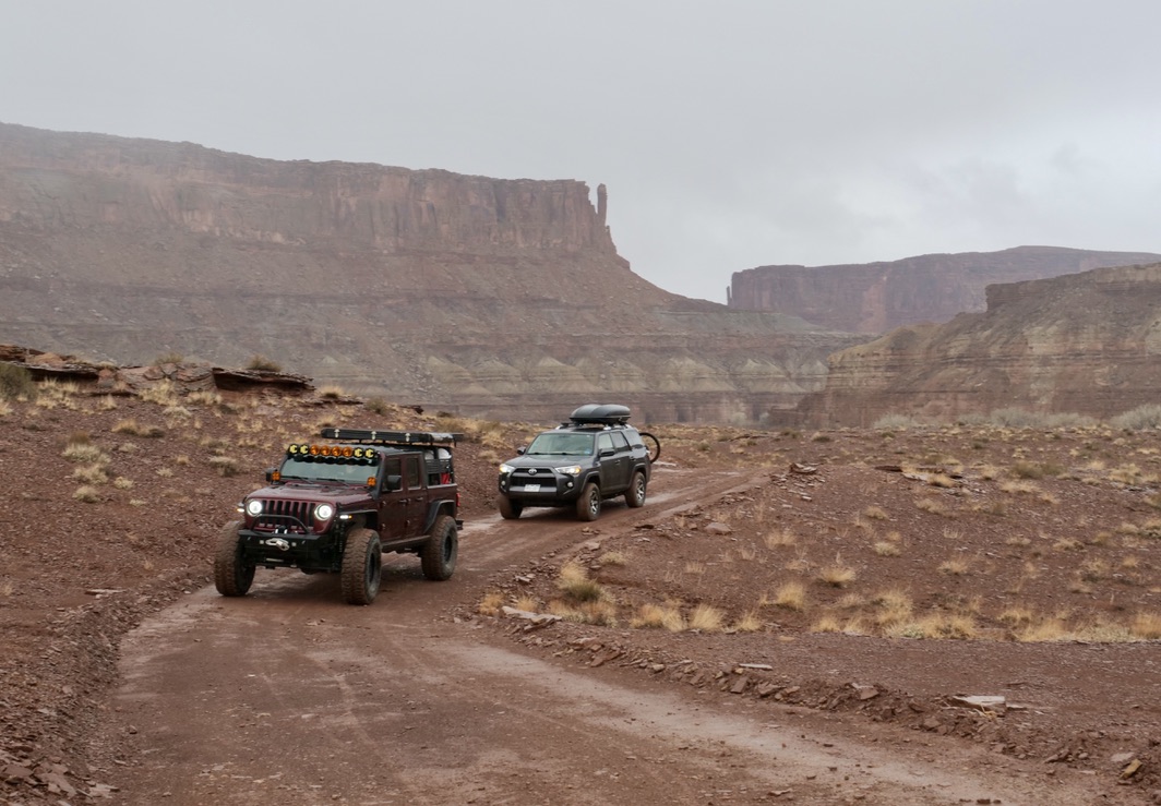
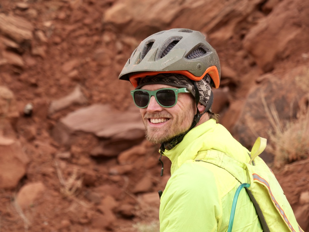
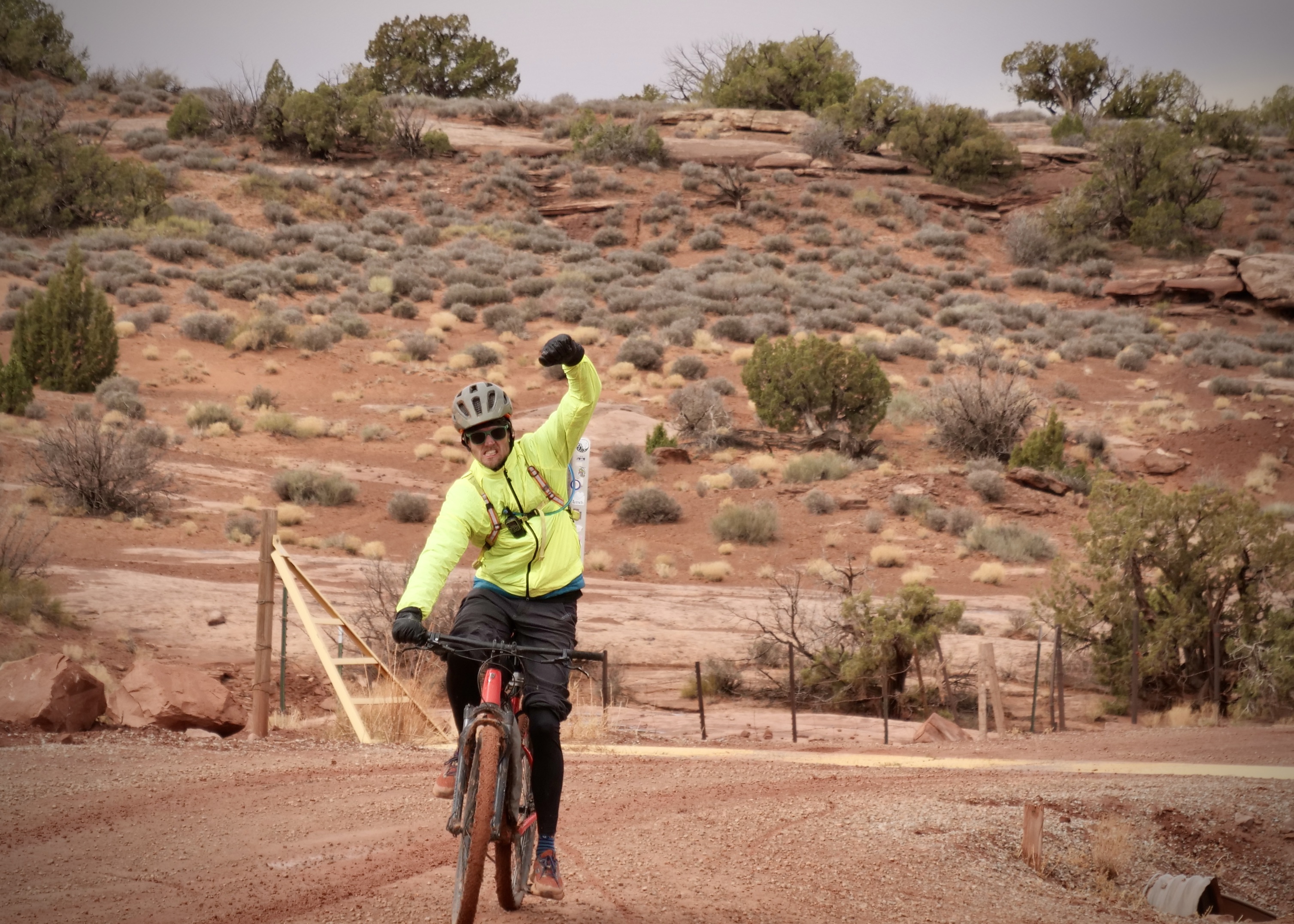
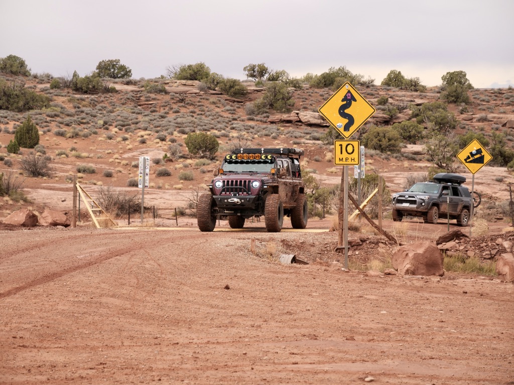
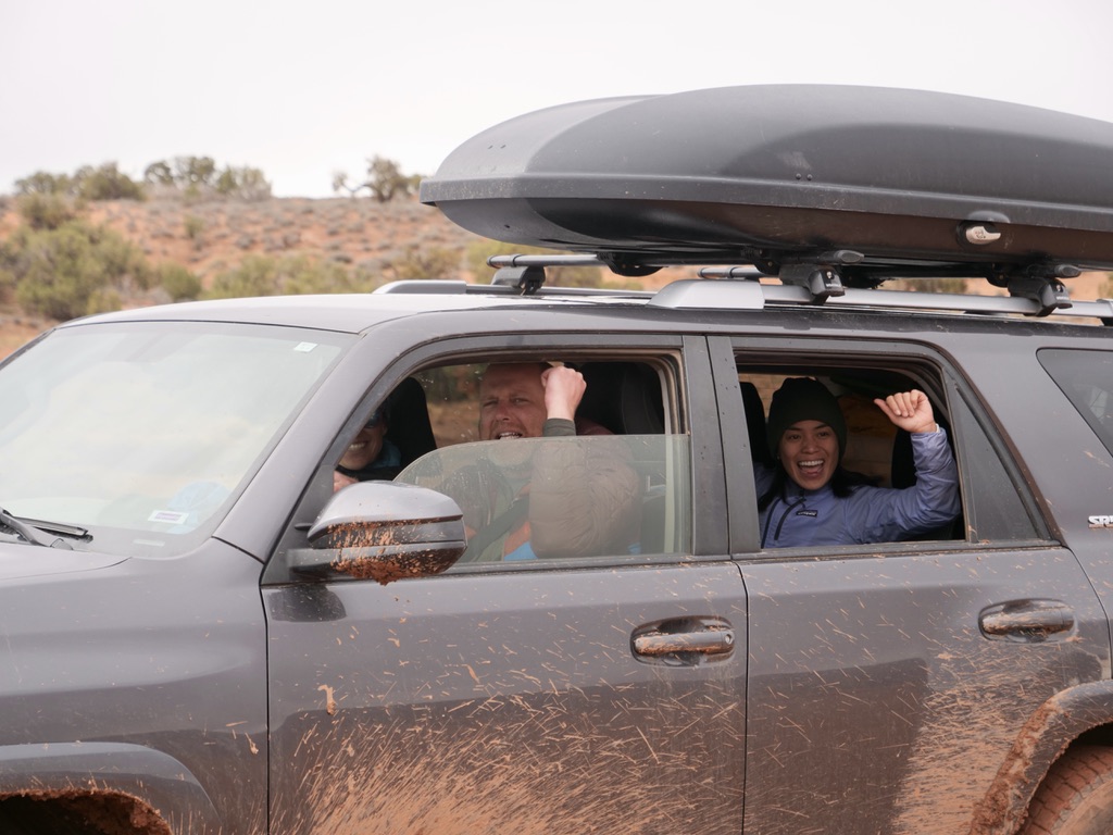
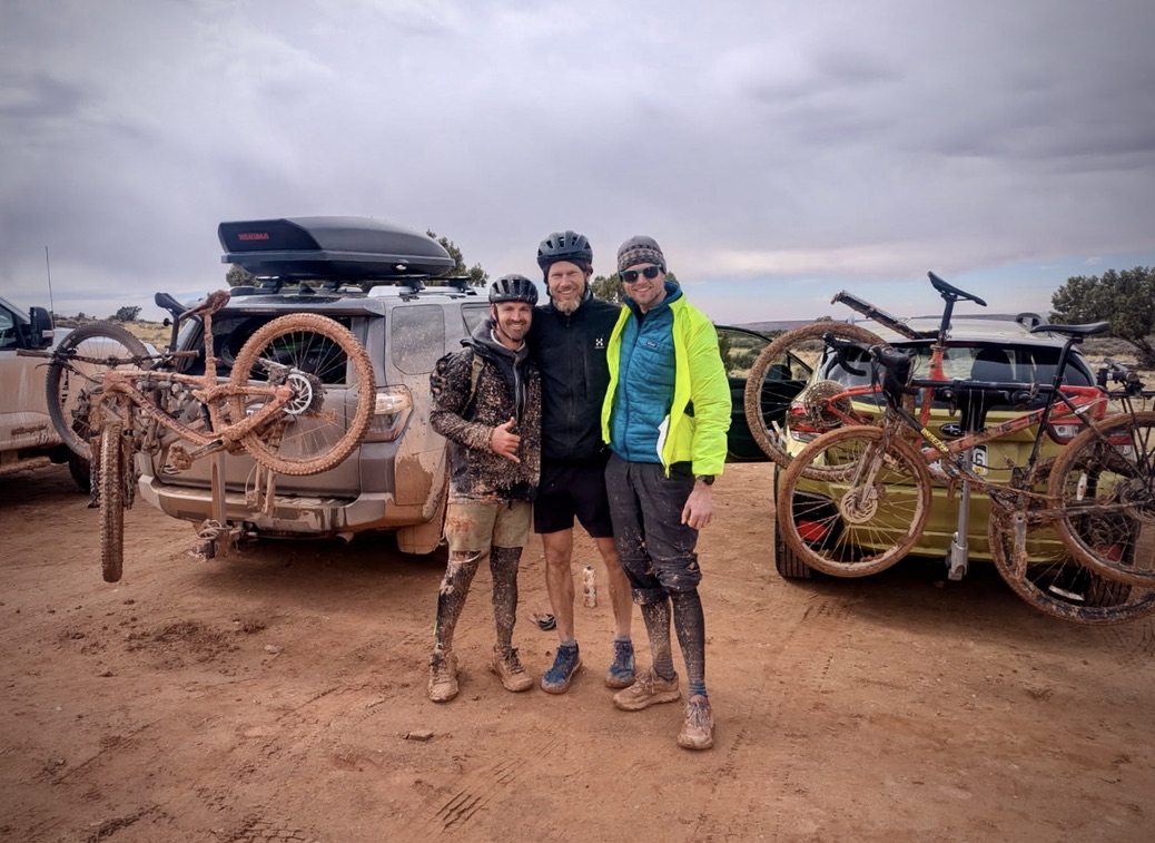
I did this trip in March 2025. I will admit that I cheated a bit on this one since it was not self-supported as all of my other trips have been. My good friend Cameron had arranged the trip with a bunch of my best friends, so there was no way I could not go! We had our families going too and the support of a jeep, but even though it wasn’t the way I usually do it, it was still great fun!
We did the trip over 3 days from March 16-18 with great weather. We did have a rain storm on the last night, it didn’t give us any trouble in the canyon but after we climbed out of the canyon and we thought we where out of harms way, it turned out that the last bit of dirt road had turned in to complete peanut butter mud. So, I actually ended up snapping my derailleur clean off in the last 10k or so. So I guess it was not the worst trip to have some support on!
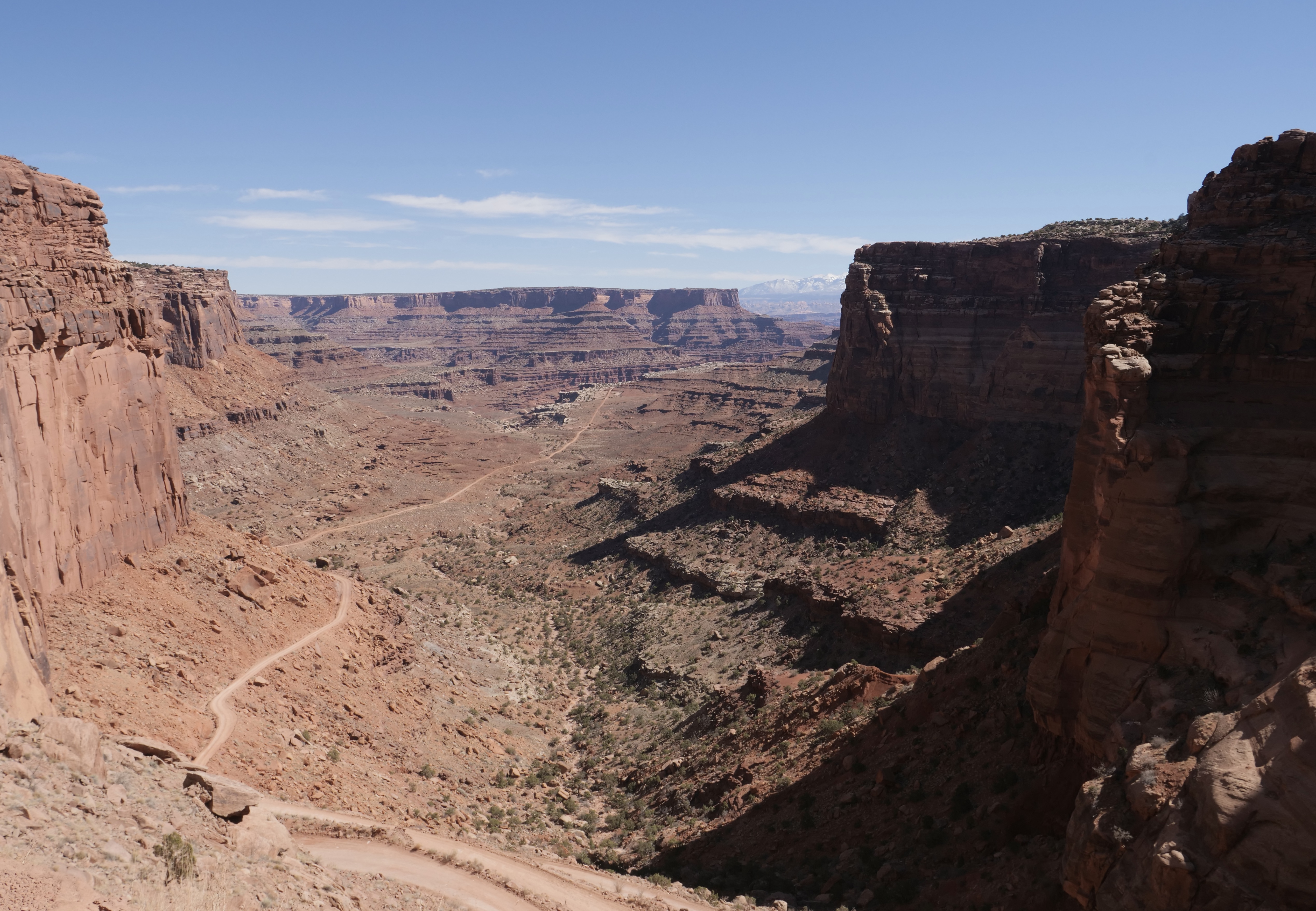
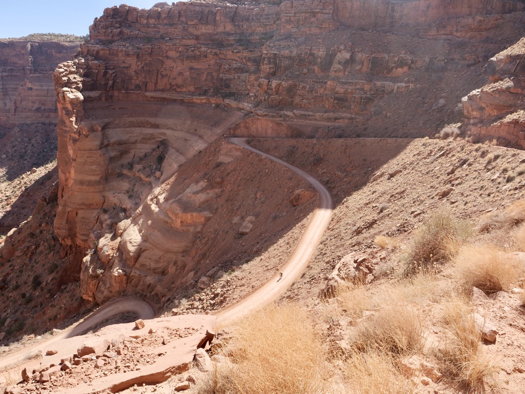
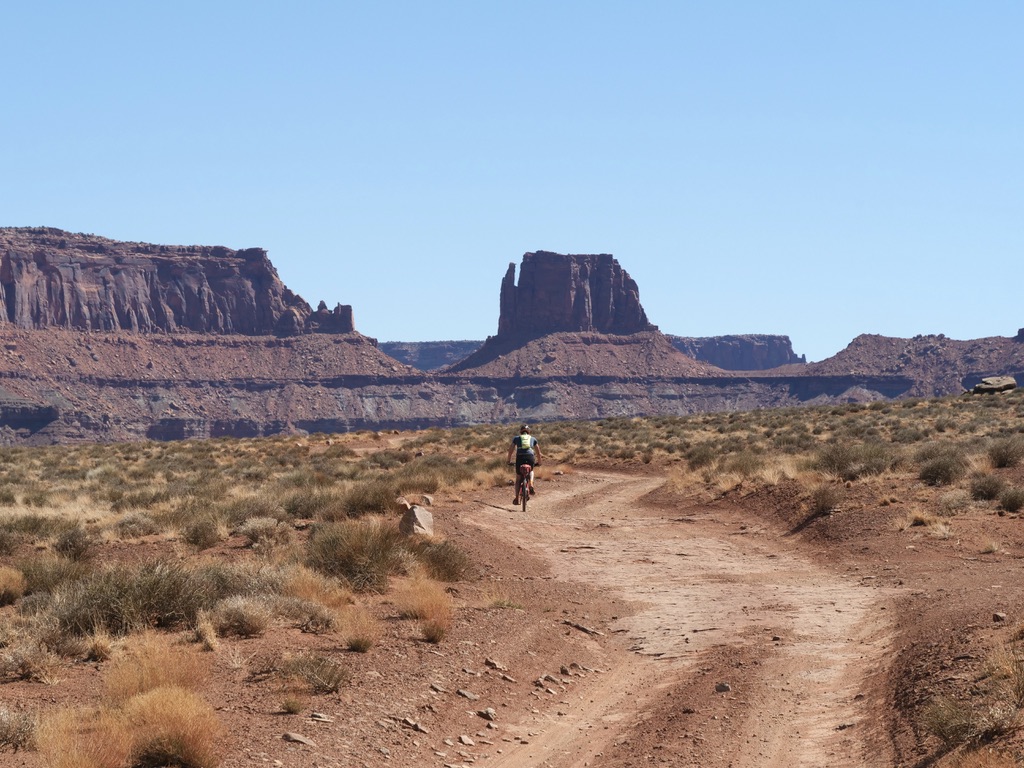
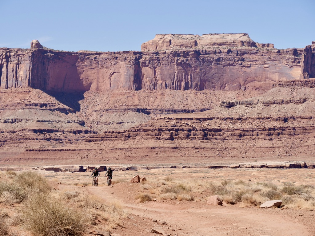
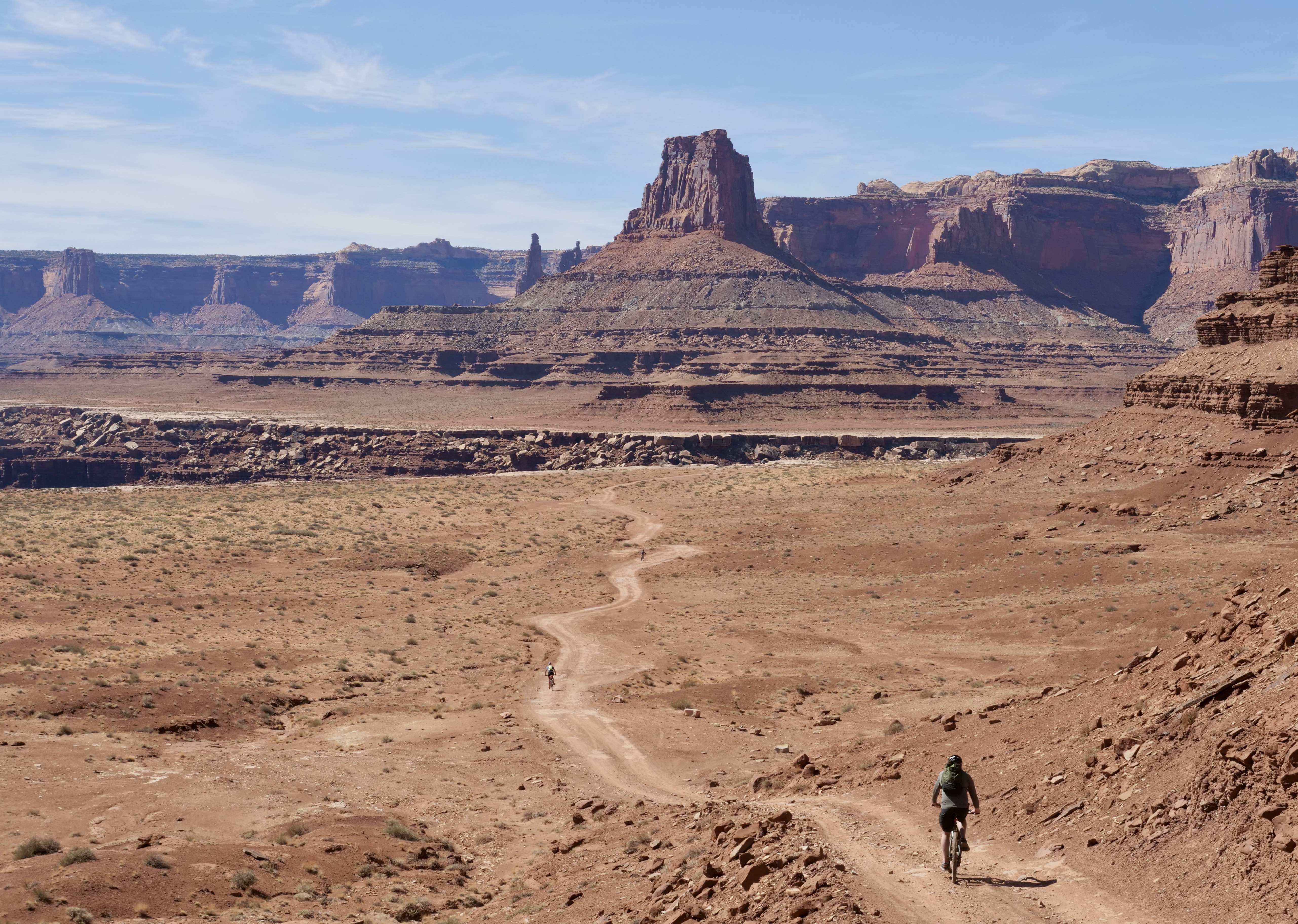
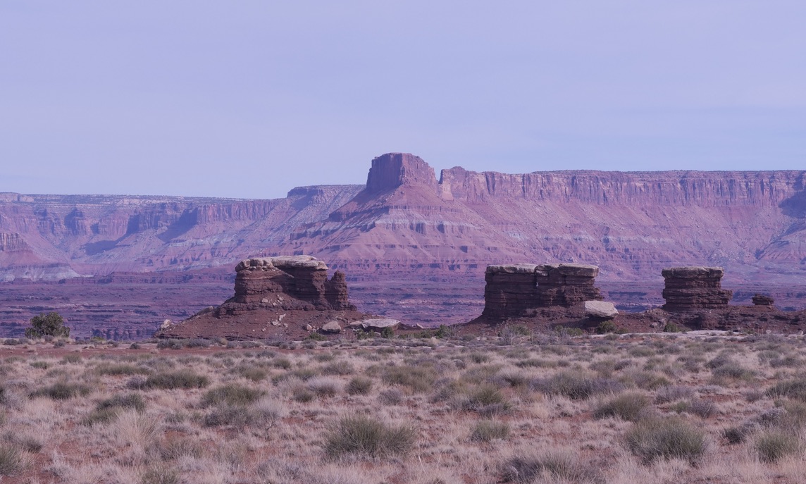
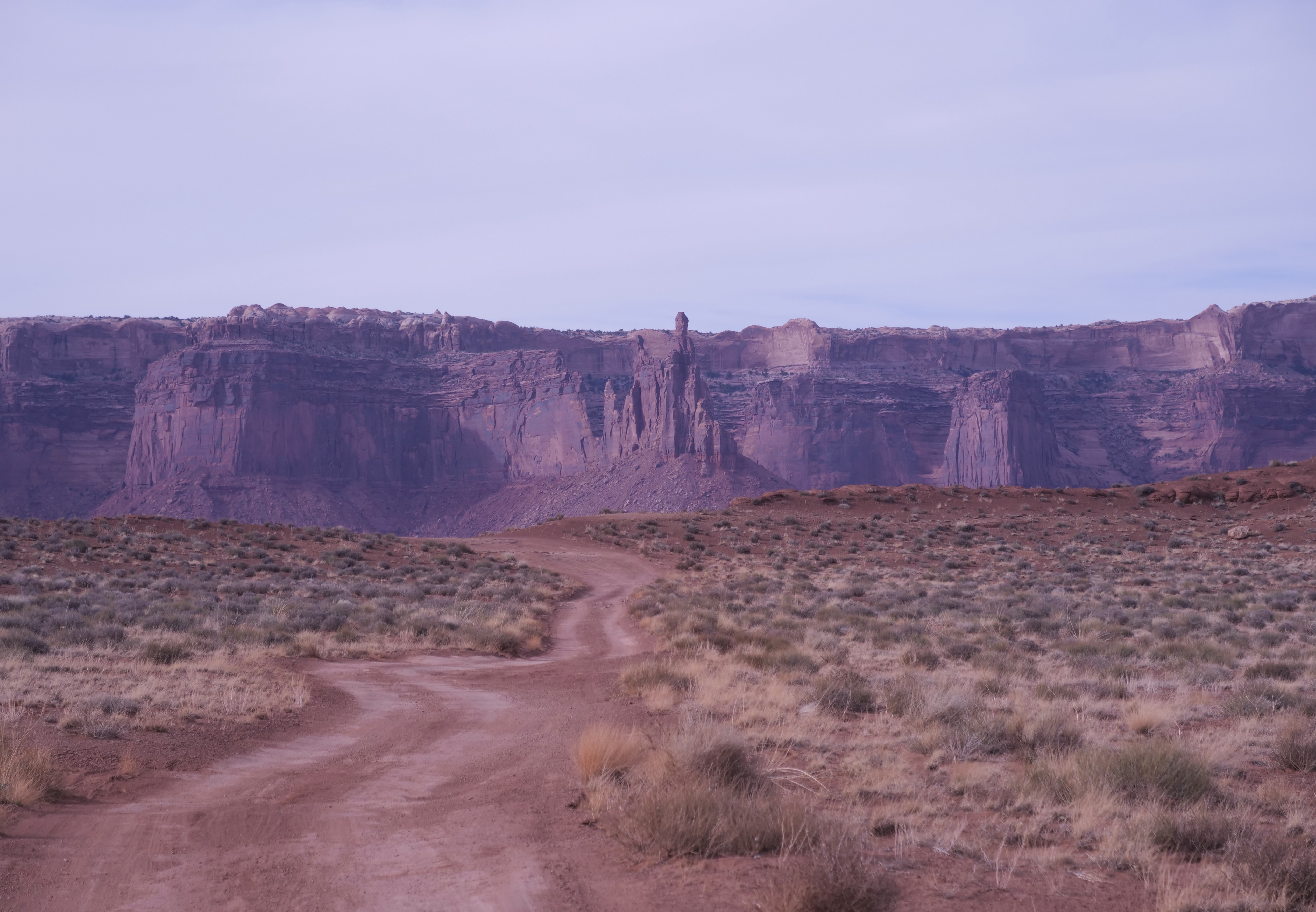
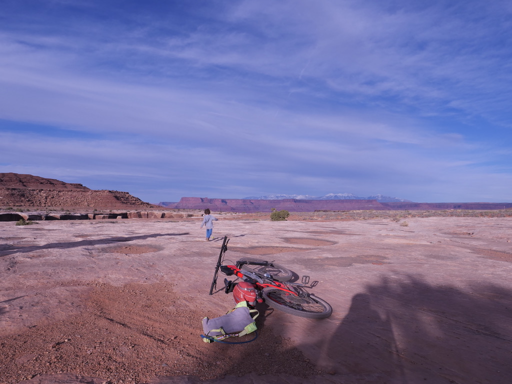
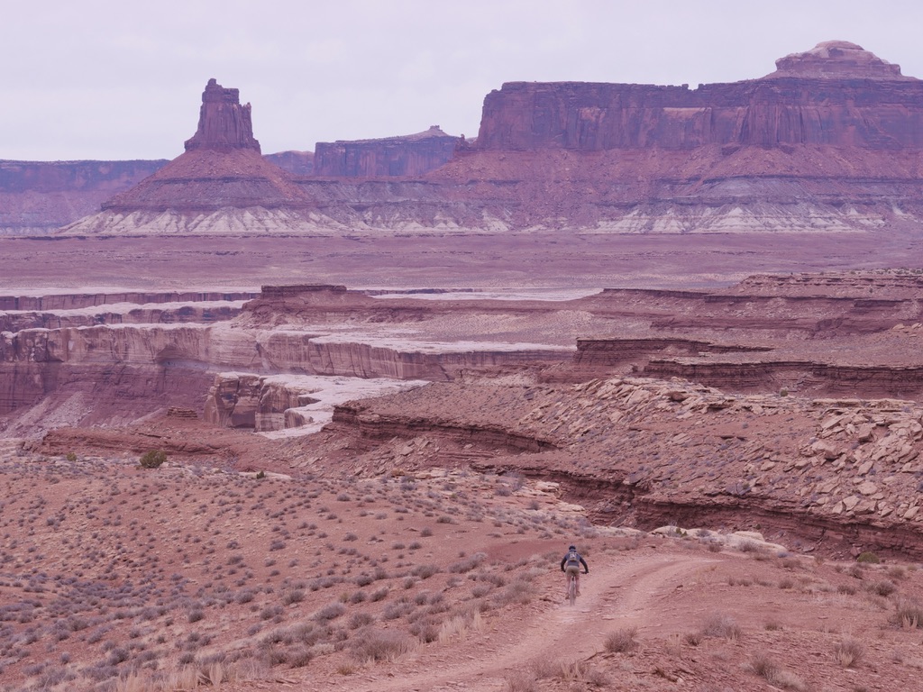
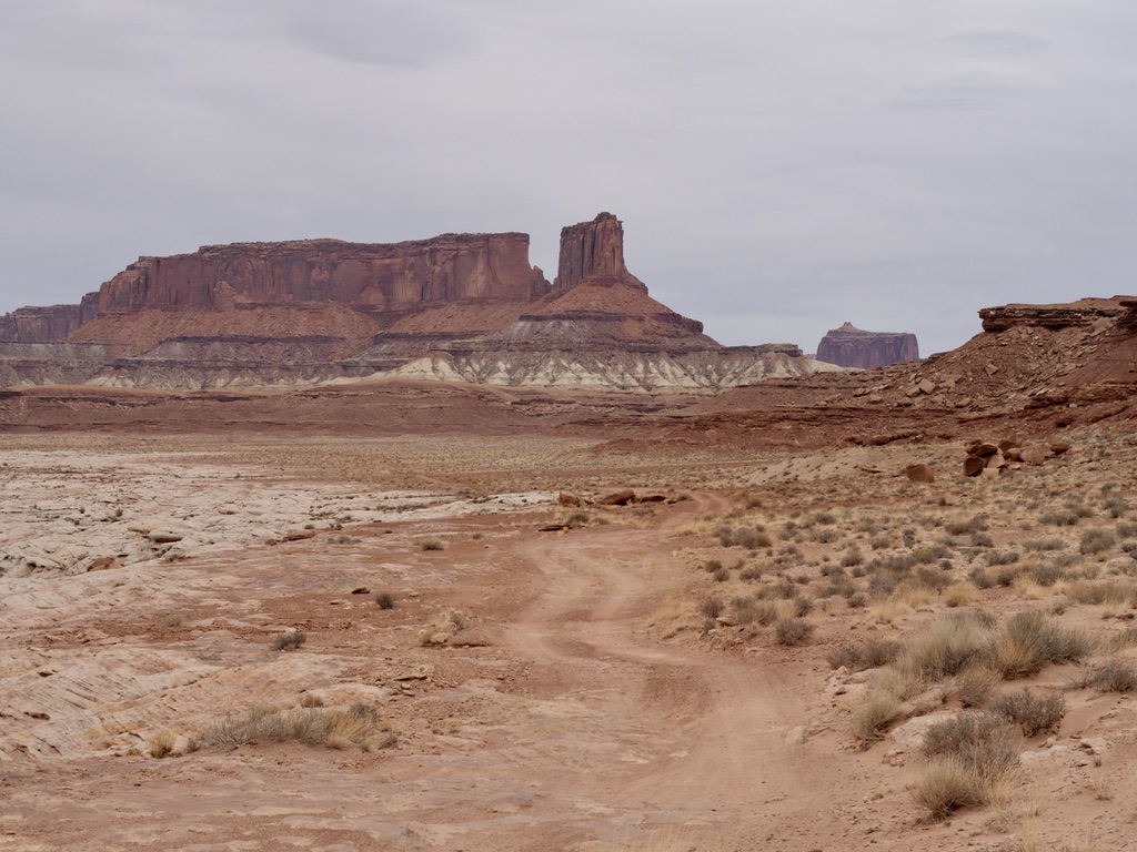
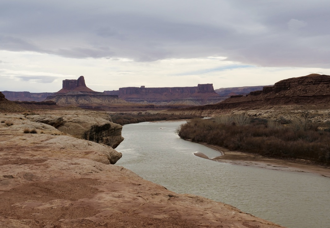
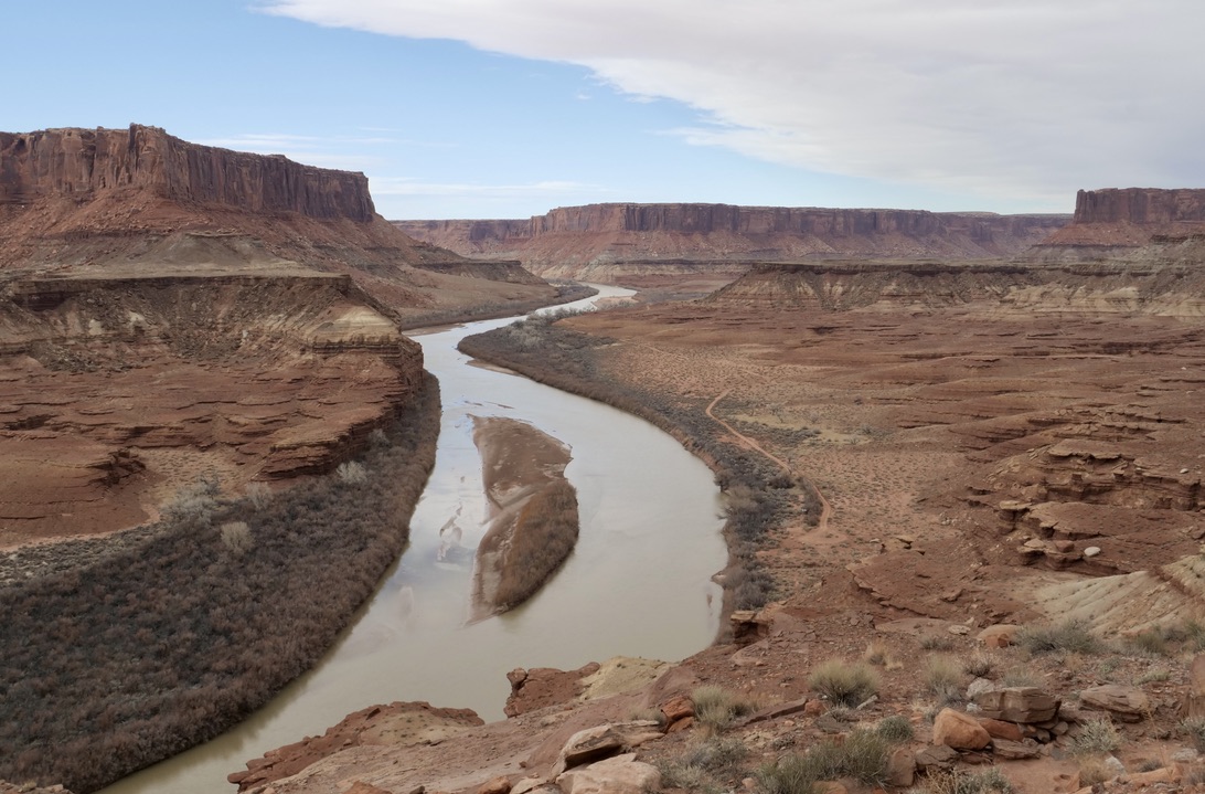
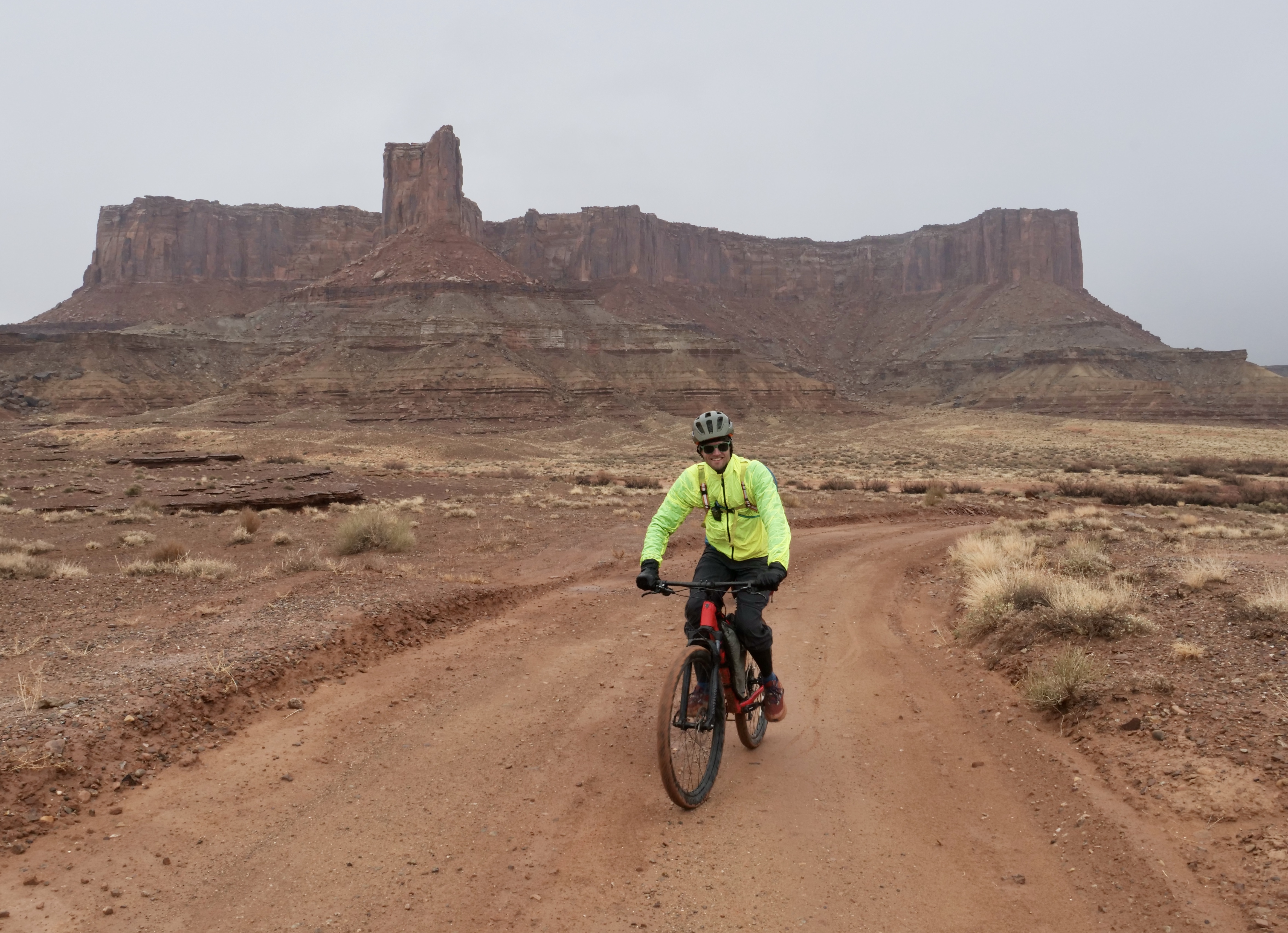
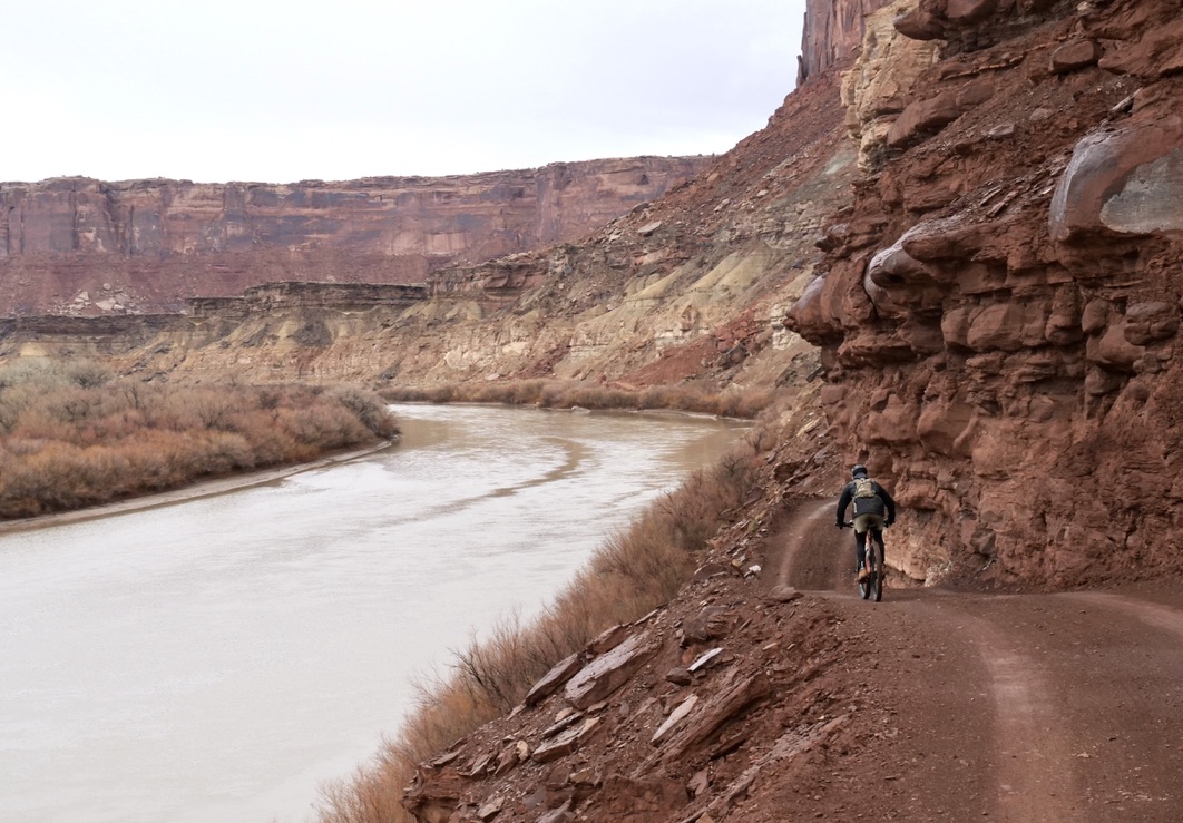
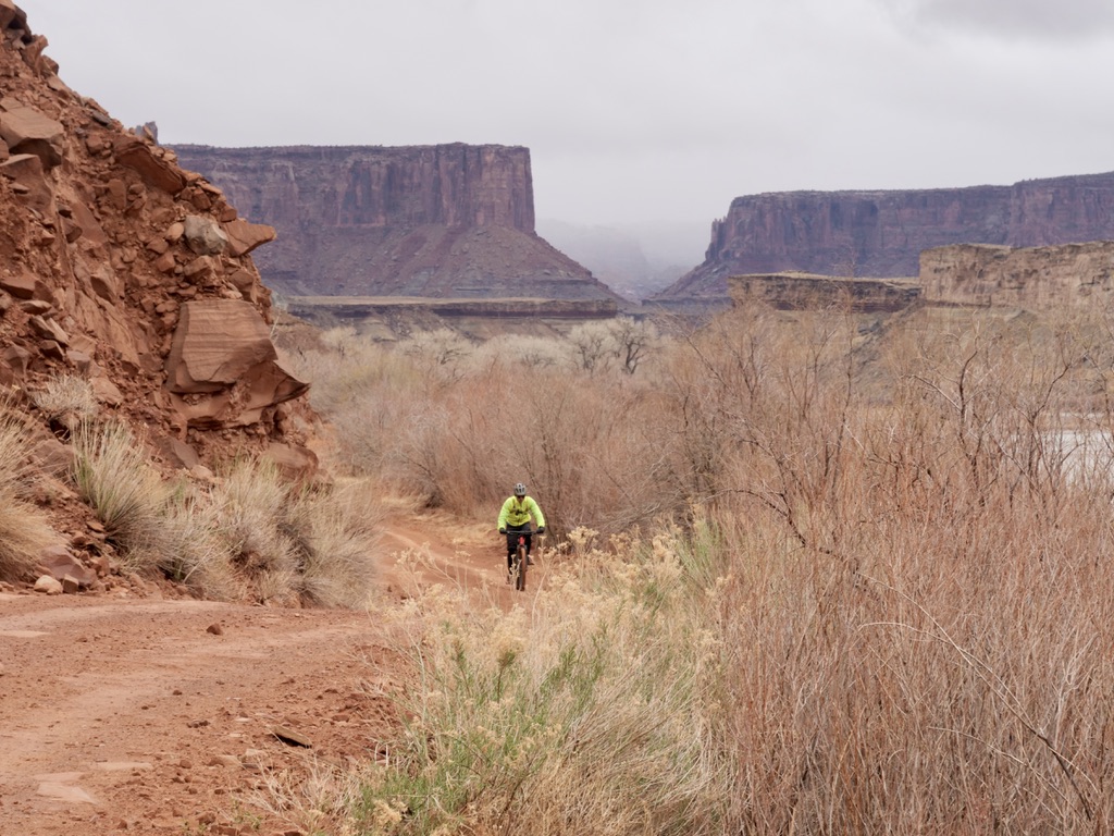
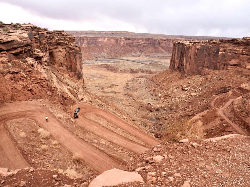
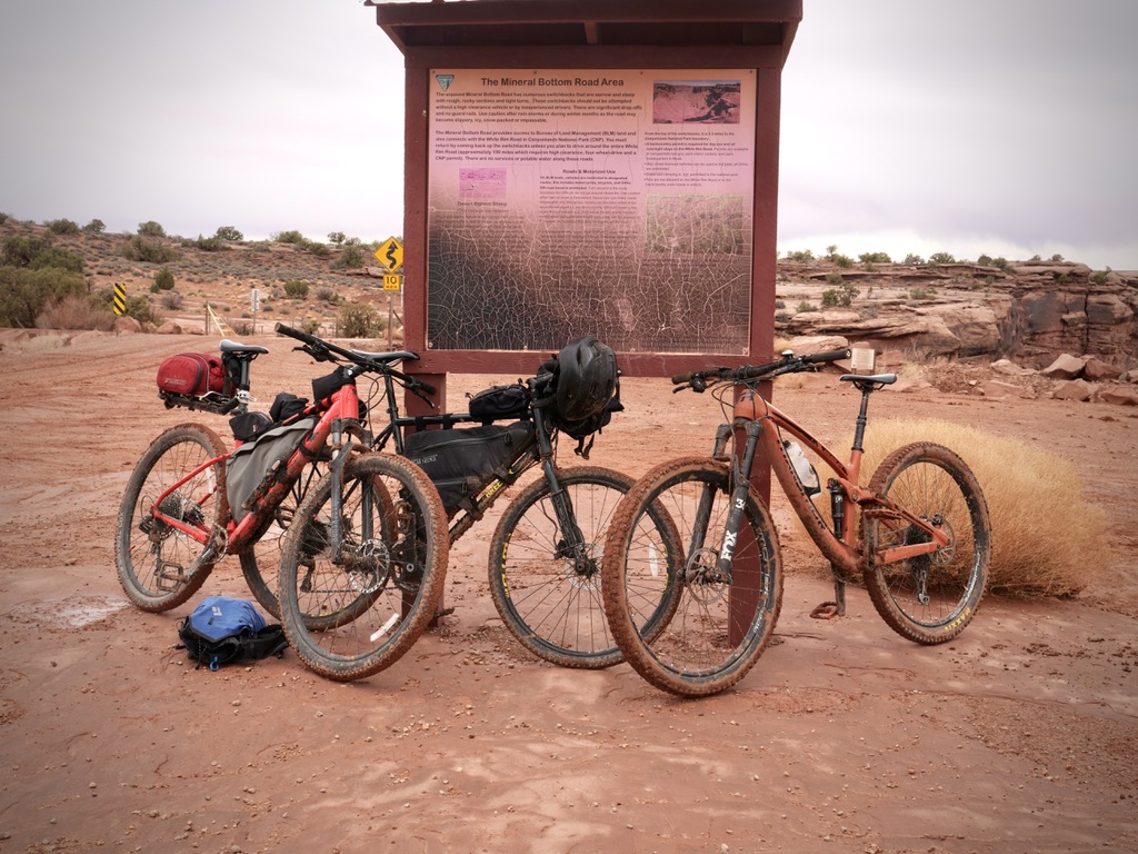
We stayed at the Gooseberry and Hardscrabble campgrounds which were both great. I did the ride on my steel gravel bike with 650b 47mm tires, which worked out totally fine however, not ideal. I guess the ideal bike would be a bit wider tire and maybe front suspension. The trail is not technical at all, it is all a 4×4 road so I’d probably give it a 5/10 in technicality.
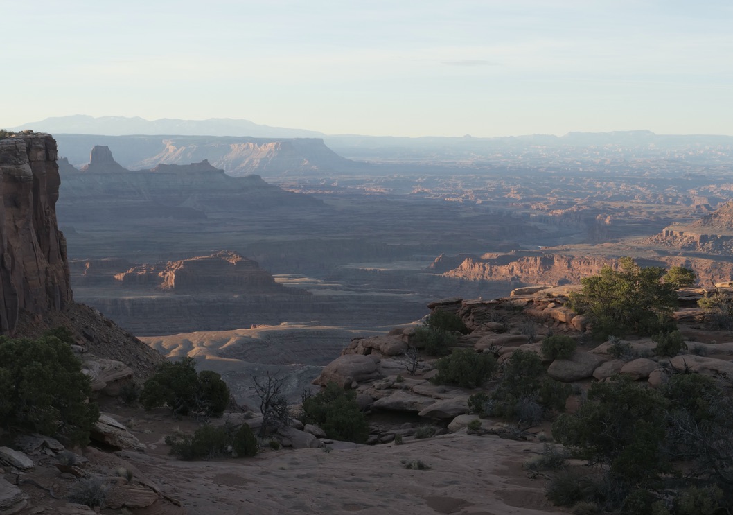
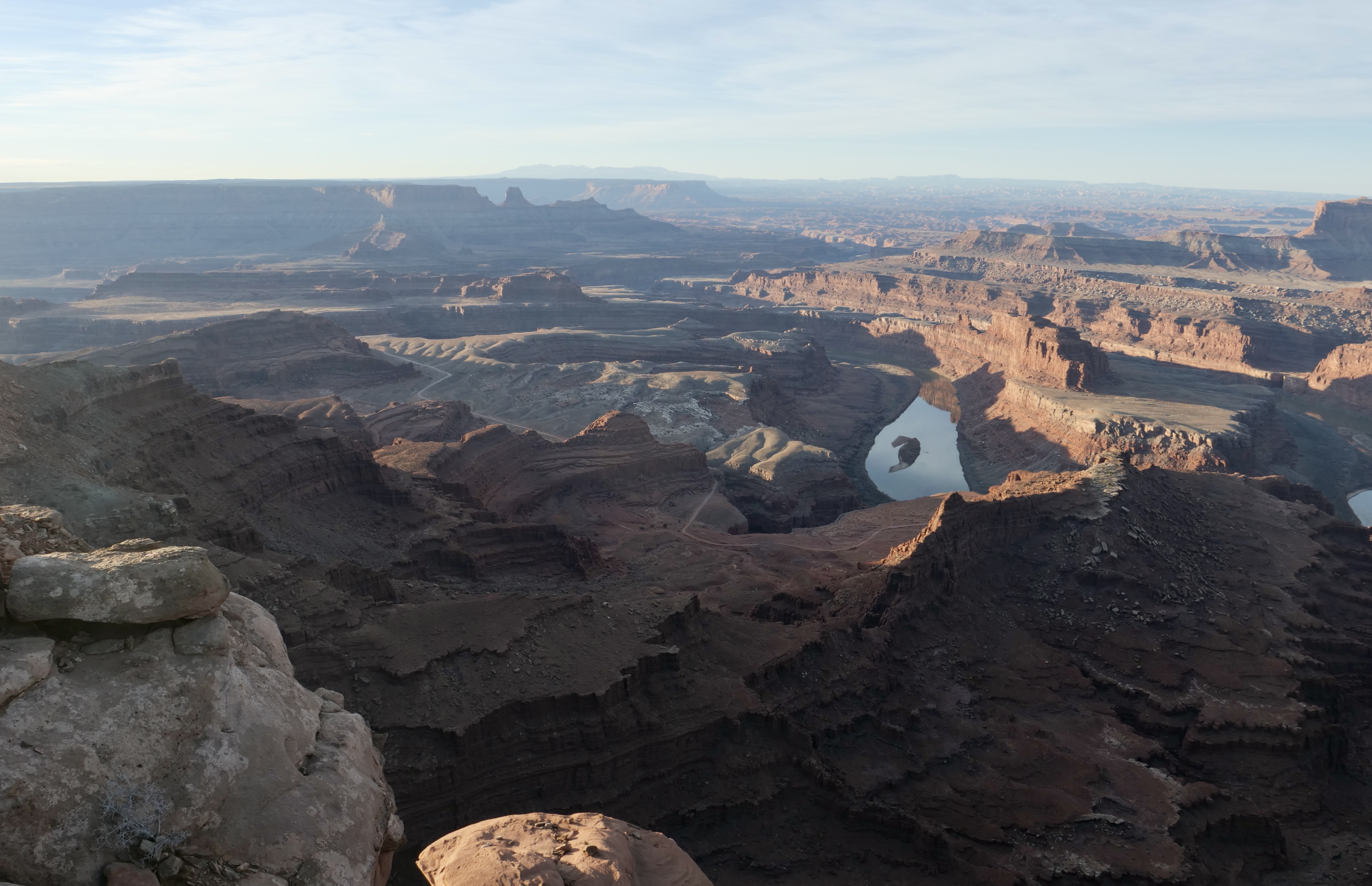
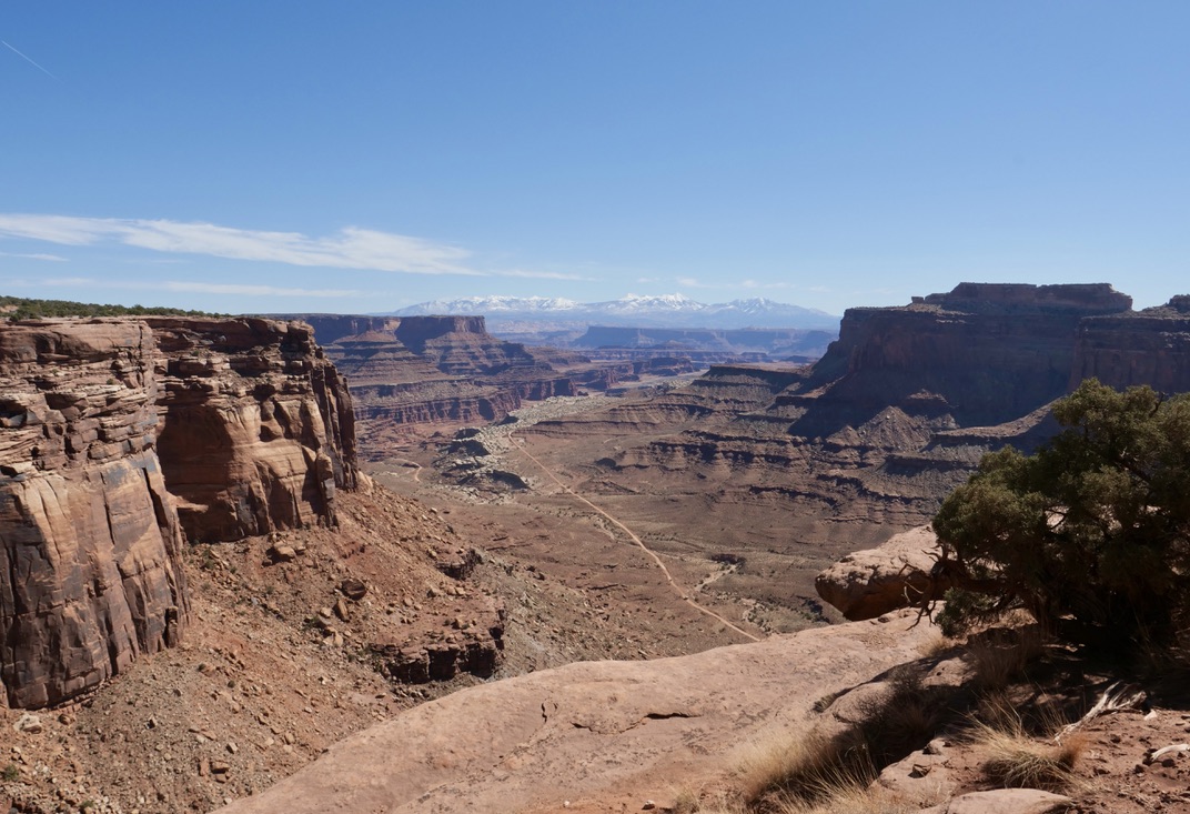
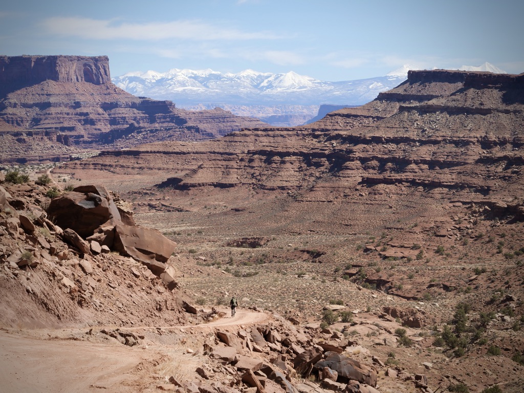
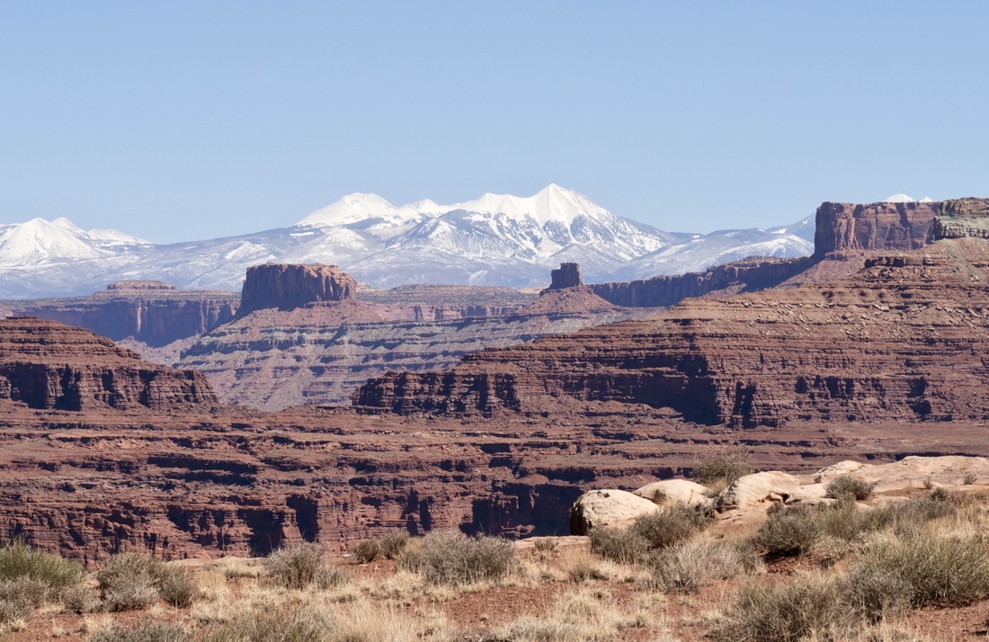
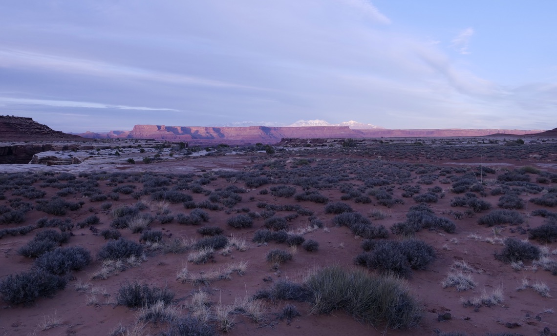
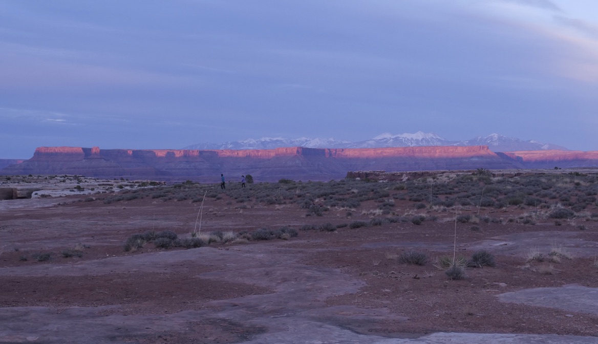
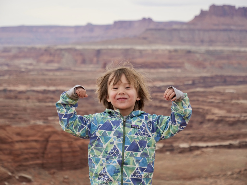
I have some great memories from the trip since my family and a bunch of my best friends were there. Below are the pictures and my stats from strava. I thought 3 days was the perfect amount of time. There is so much to see so I was glad that I wasn’t in a hurry. Water can be an issue, so if you are doing it self-supported there’s an argument for doing it over two days I guess. The trip is very well described on bikepacking.com.
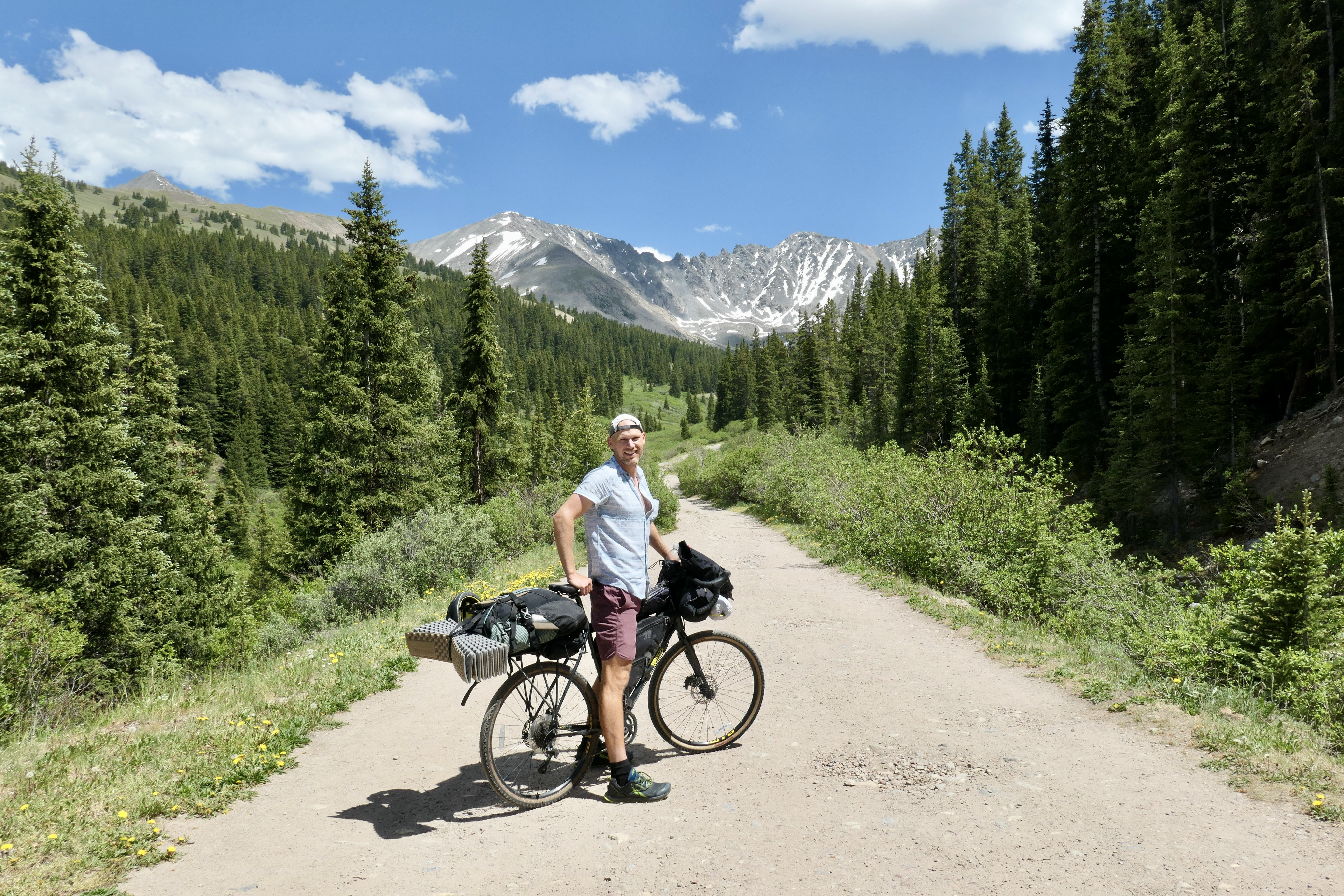
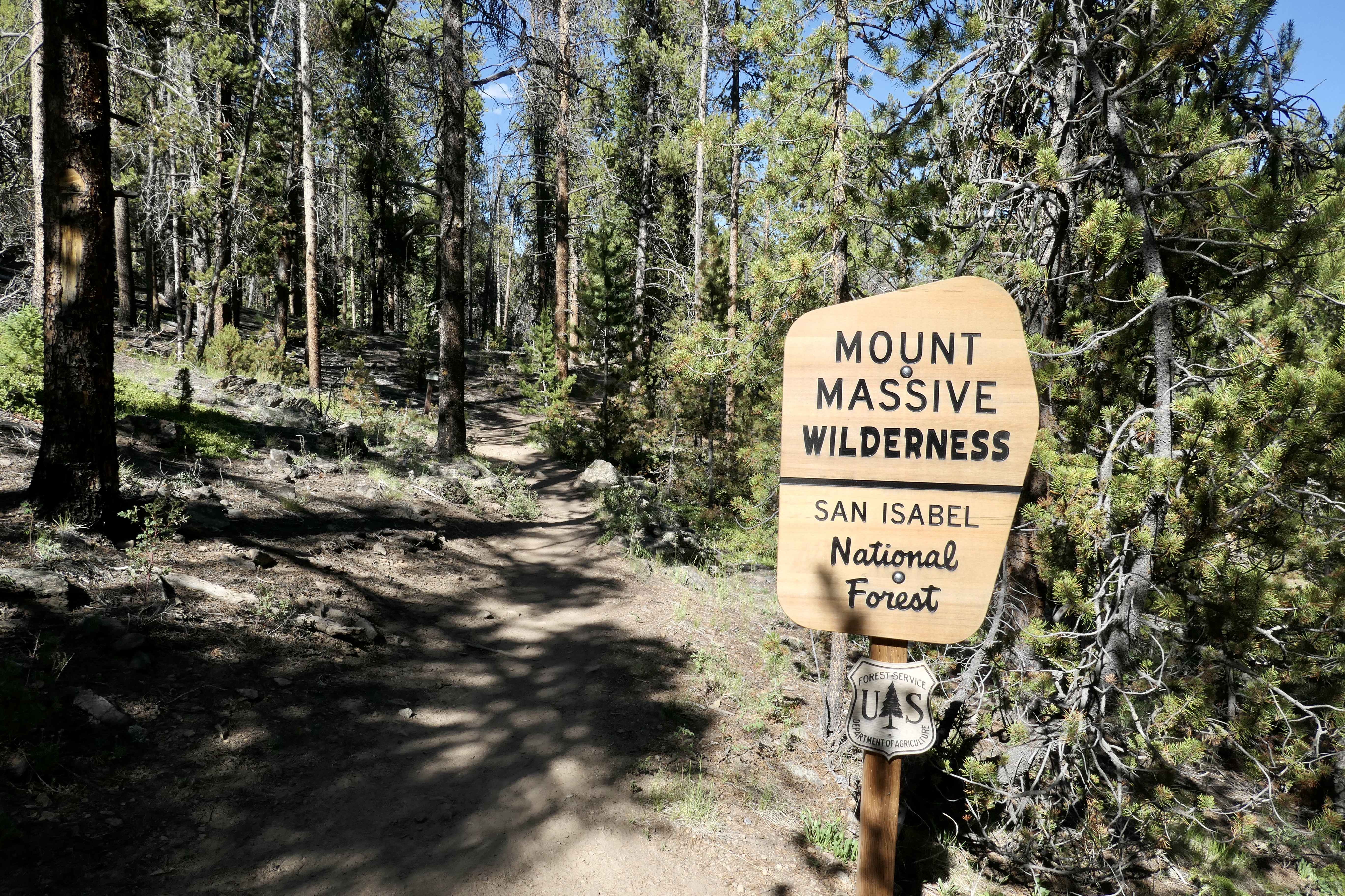
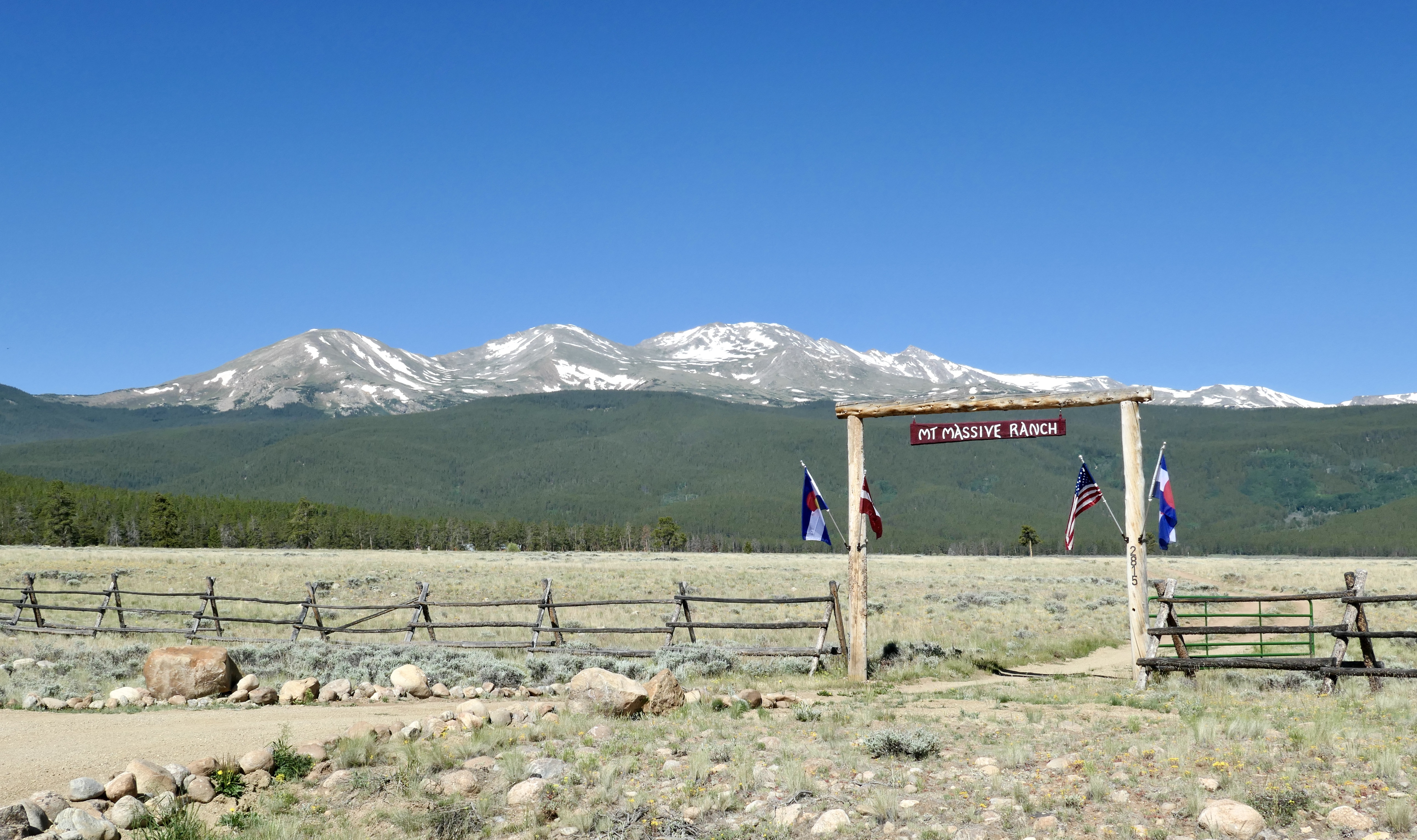
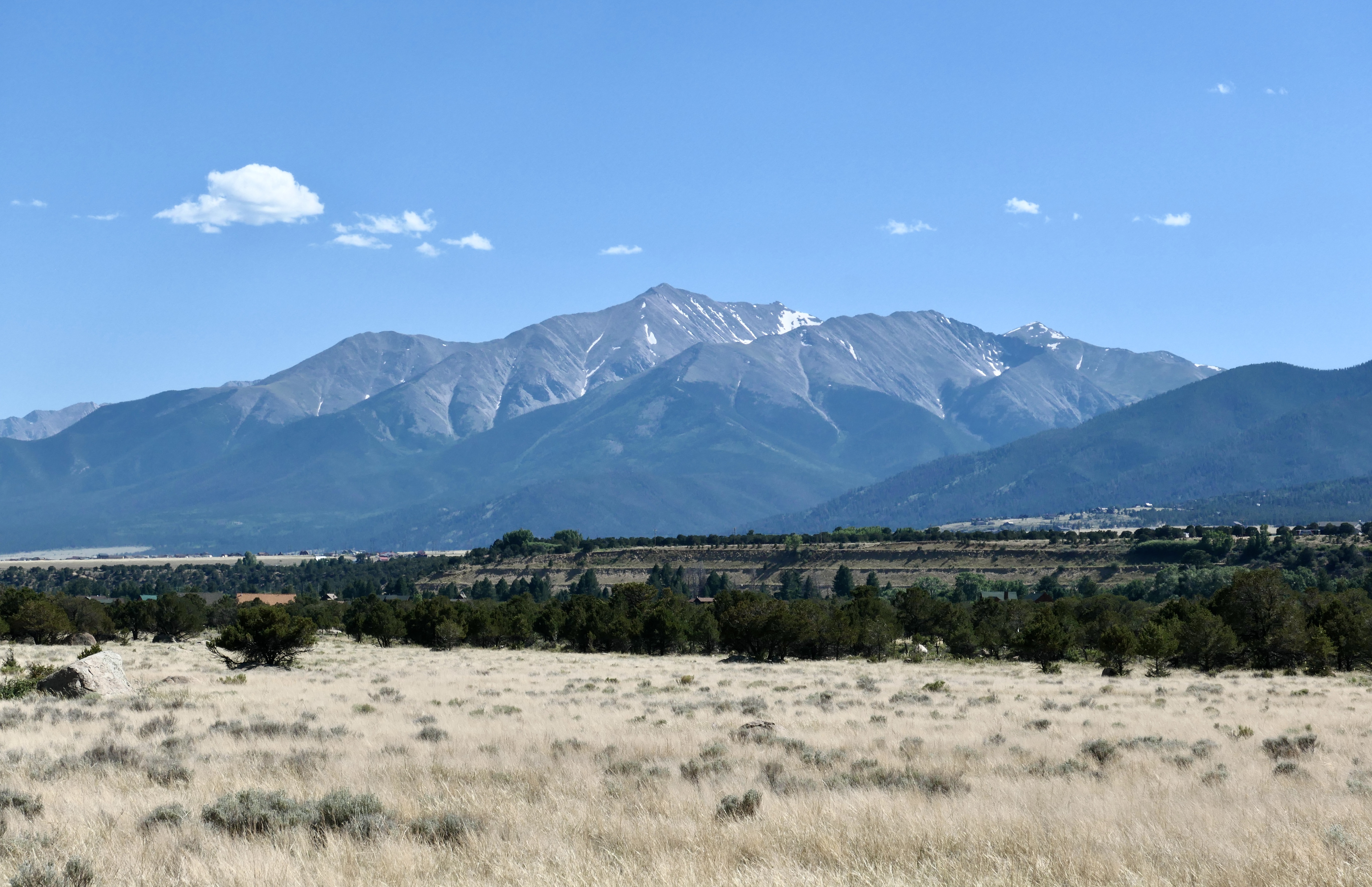
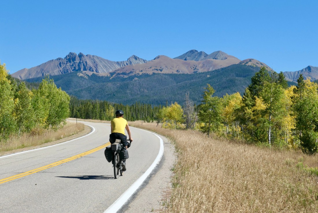
I’ve been wanting to explore the Mt. Massive and Collegiate Peaks area for some time and I finally had some time to do it. The Bustang buses here in Colorado are great, very comfortable, cheap, bring the bike for free, and they go all over Colorado into the mountains and the cities. I took the bus from Fort Collins to Denver and then from Denver to Frisco, 22 usd total including the bike.
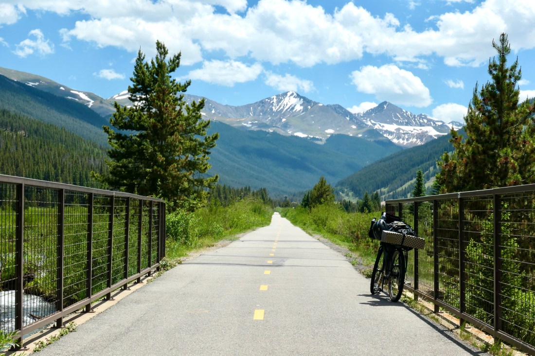
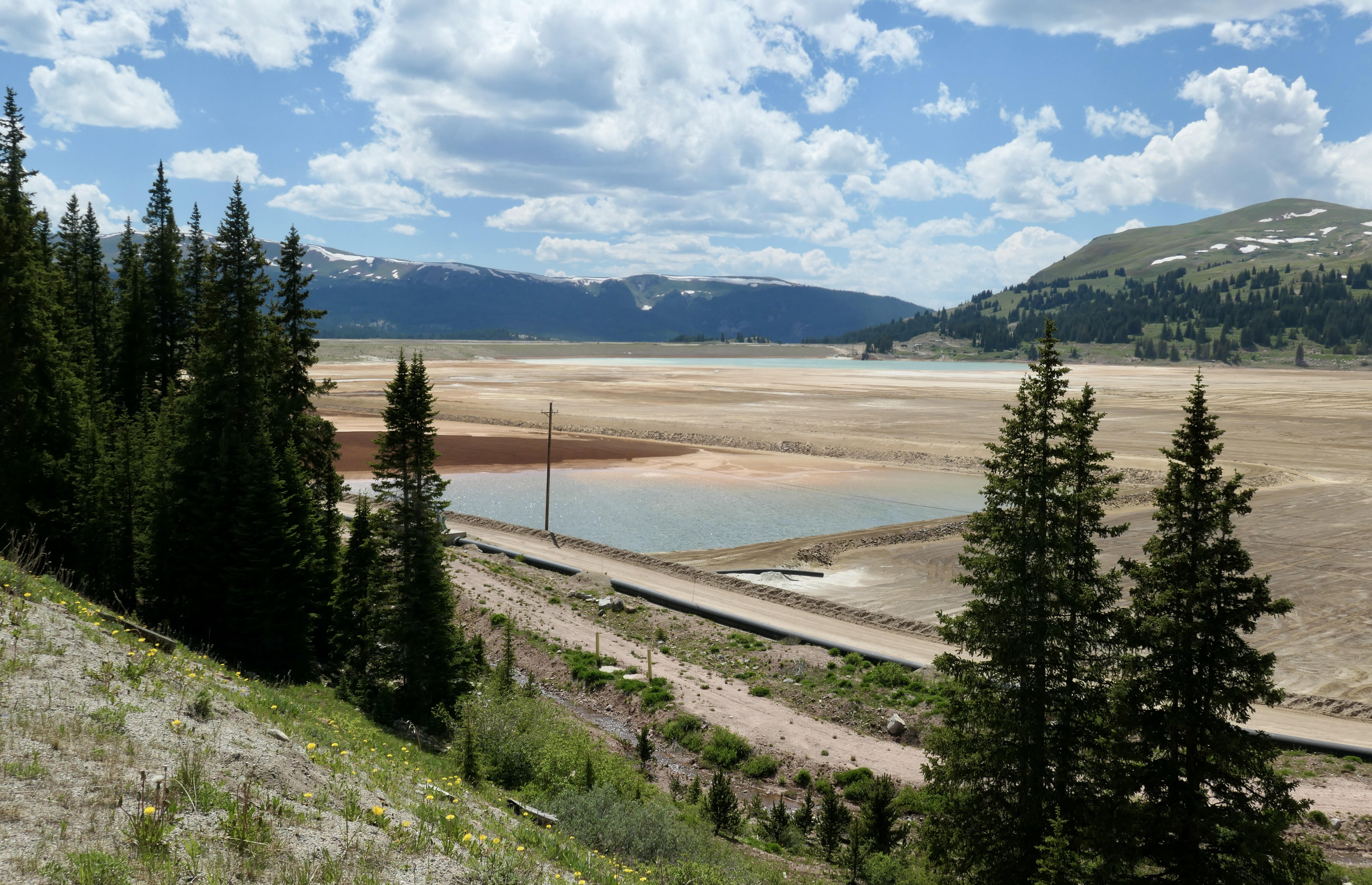
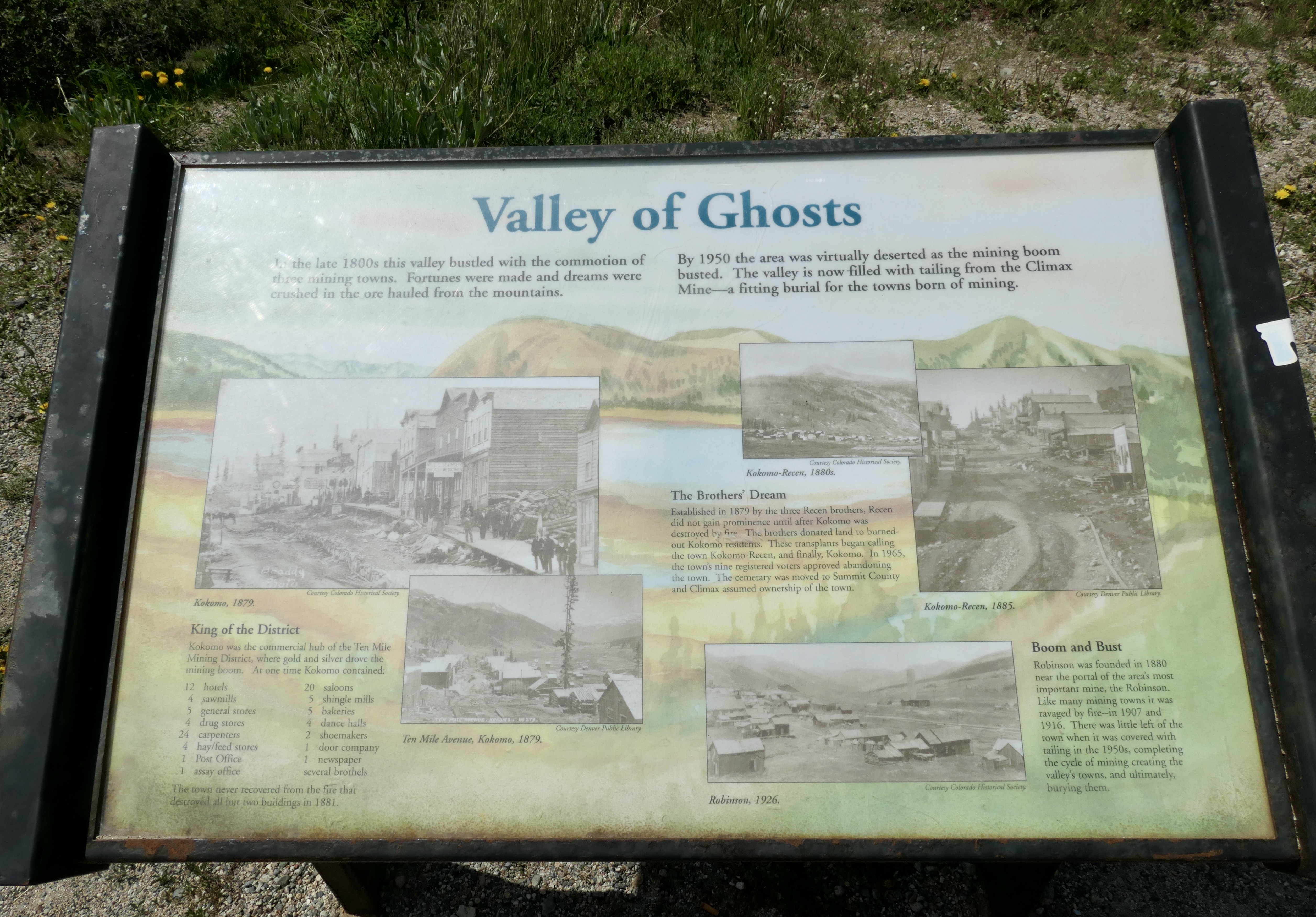
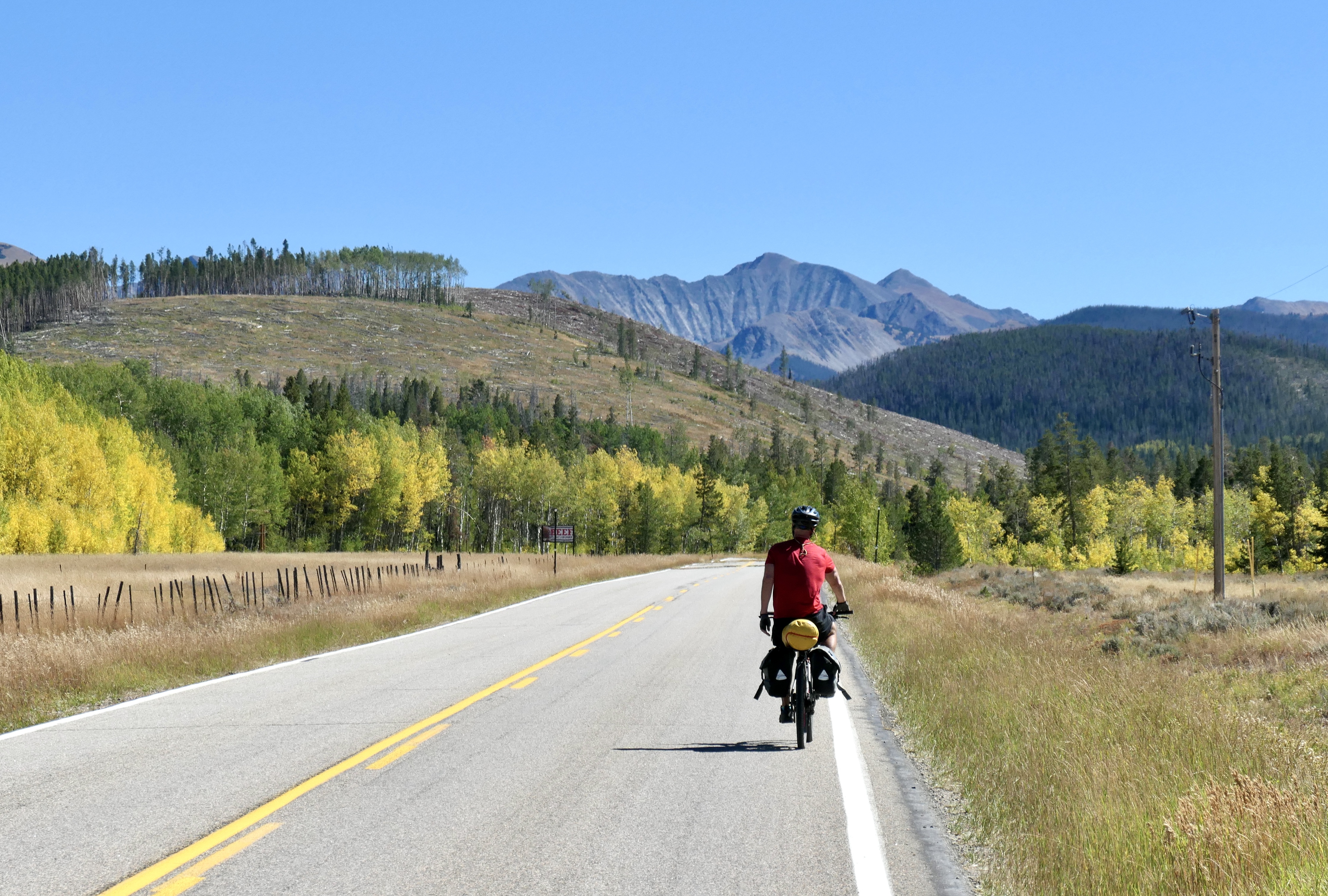
I arrived in Frisco around 12 noon and started out with a sandwich. The plan was to bike to the Mount Massive trailhead and pitch the tent in that area so I could wake up and climb it the next day. The route went over a pass through Leadville so I thought it would be a good idea to get some food for the trip in Leadville to keep the weight down a bit. There’s a beautiful bike trail that runs along the main road for the first 10-15k or so and then you connect with the road. It is not the most fun biking on a narrow shoulder on the road Friday afternoon when everyone is going in the mountains, but it is not the worst either. It’s a beautiful ride and I’ve done it in the car before but being on the bike is just way different having time to really enjoy the scenery. There’s a big mining history in the Leadville area and I keep thinking about those people coming here to settle. At the very top of the pass before reaching Leadville I met this cool guy selling beef and Elk jerky. The business started in the climax mine area some years back. He was fun and I took a few pictures with him and also got some water since I ran out (I only ran out because I didn’t fill up earlier, there are plenty of options to fill from creeks and rivers). Reaching the pass was nice since from hear it was mostly downhill to Leadville. I wanted to grab a beer in Leadville but I was a little pressed for time so I did my groceries, got some extra patches from the bike store, and a beer can to go for later in camp. The way from Leadville to trailhead was really nice, no more traffic! The area around Massive is wilderness and national forest so I could basically pitch my tent wherever, so I found a great spot right on the river (don’t worry – more than 100 ft from it) close to the trailhead. So first day ended up being 69k and 986m of elevation, what a great start to my trip – and the beer was still cold and tasted amazing!
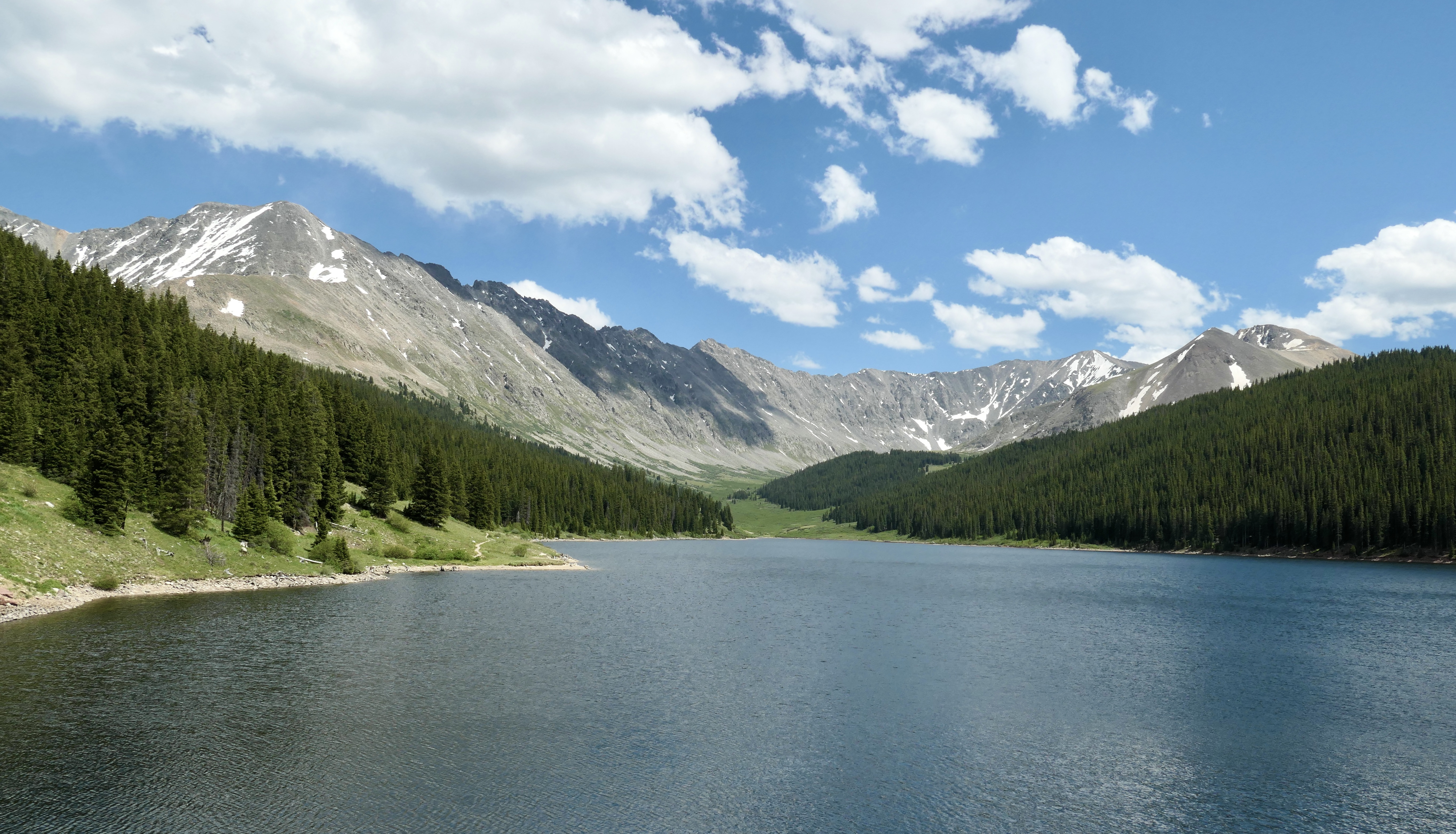
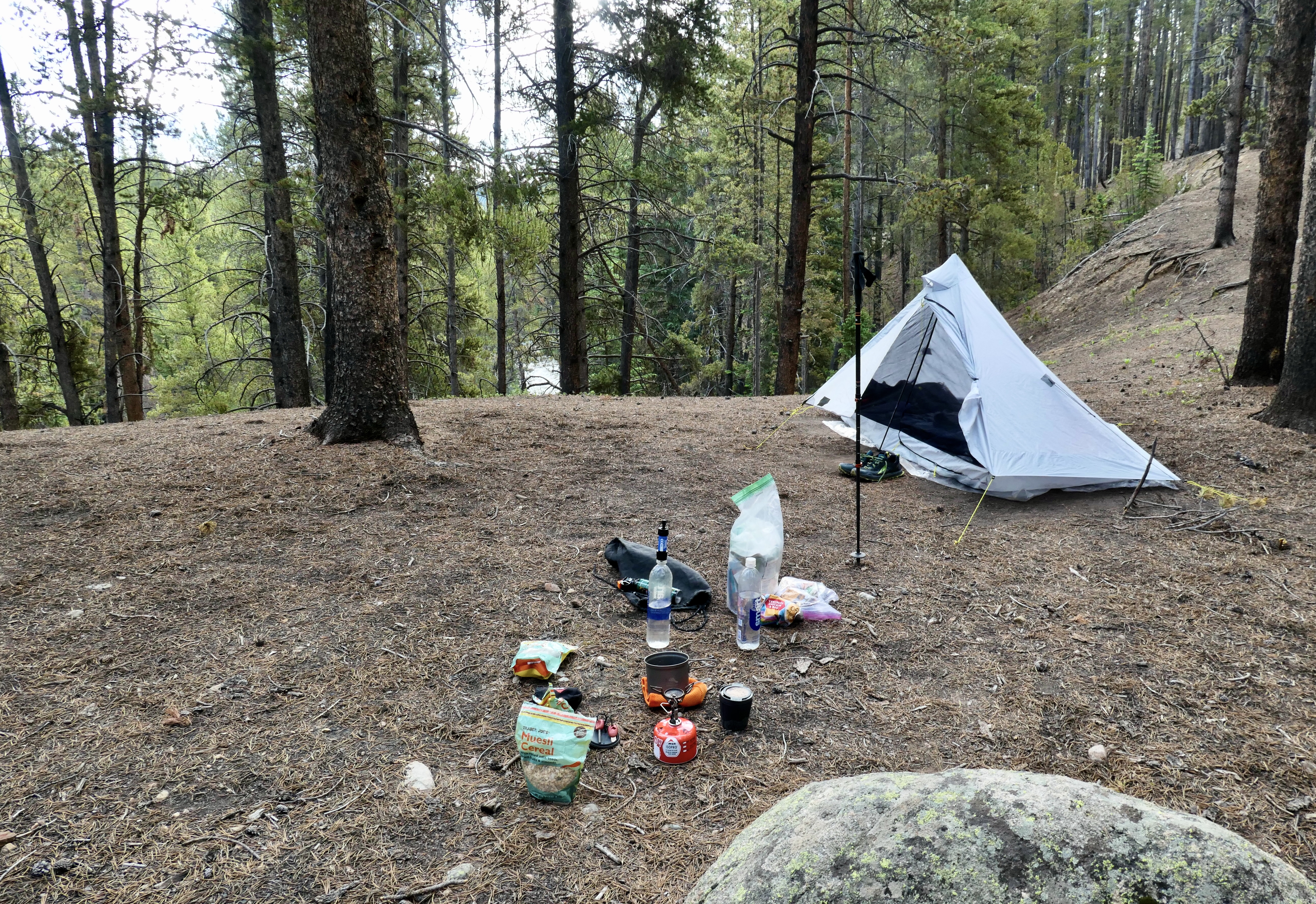
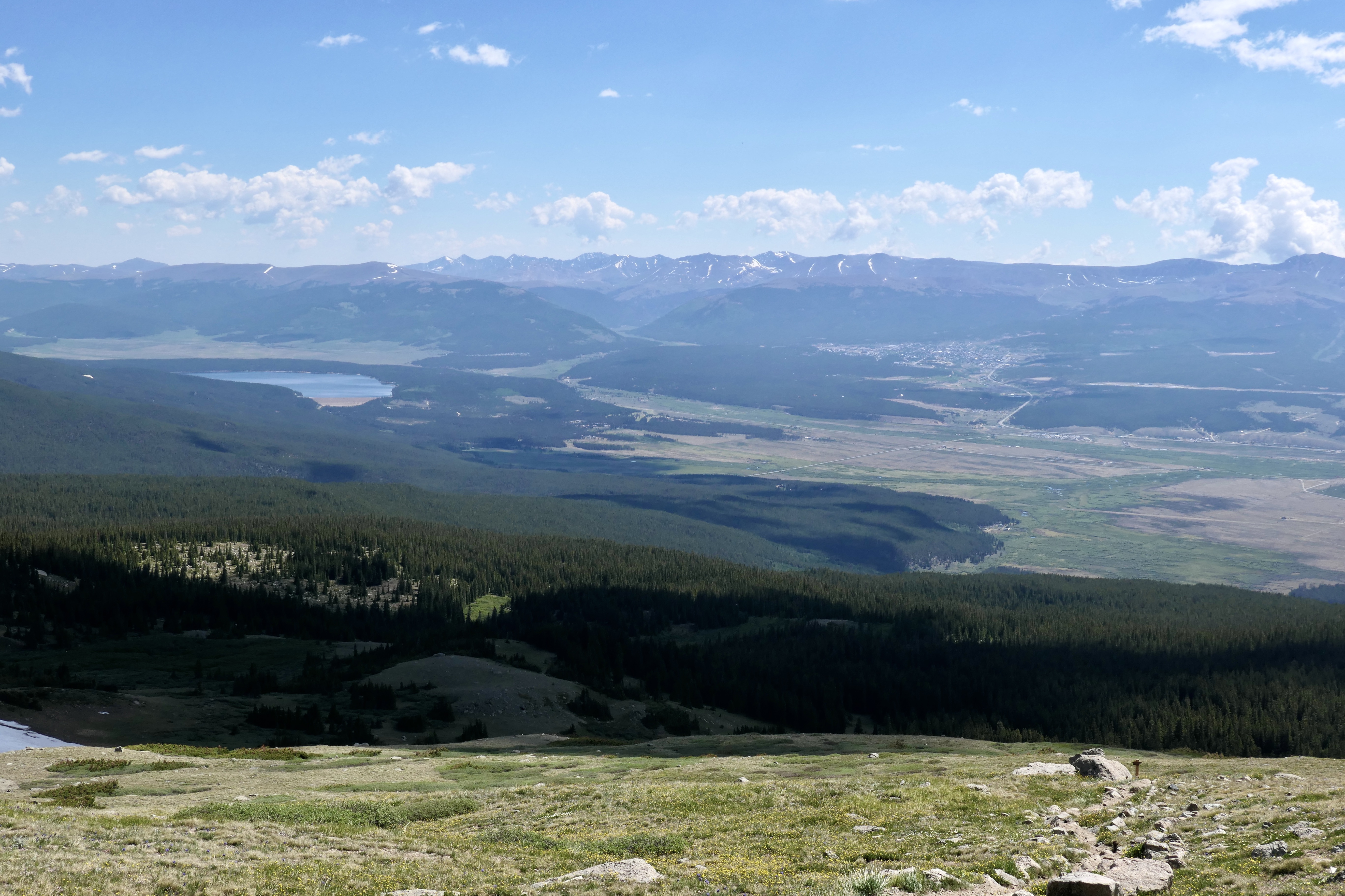
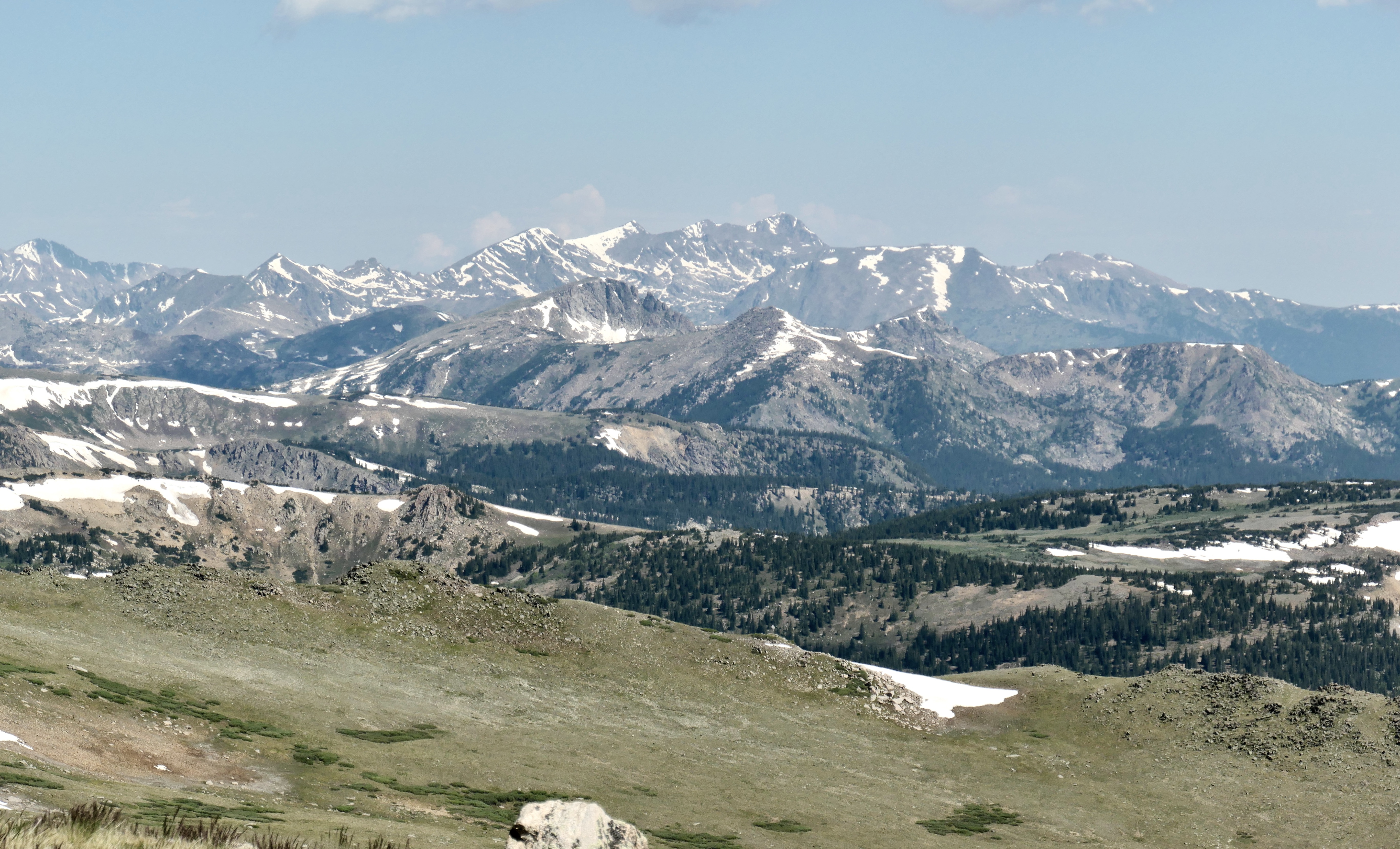
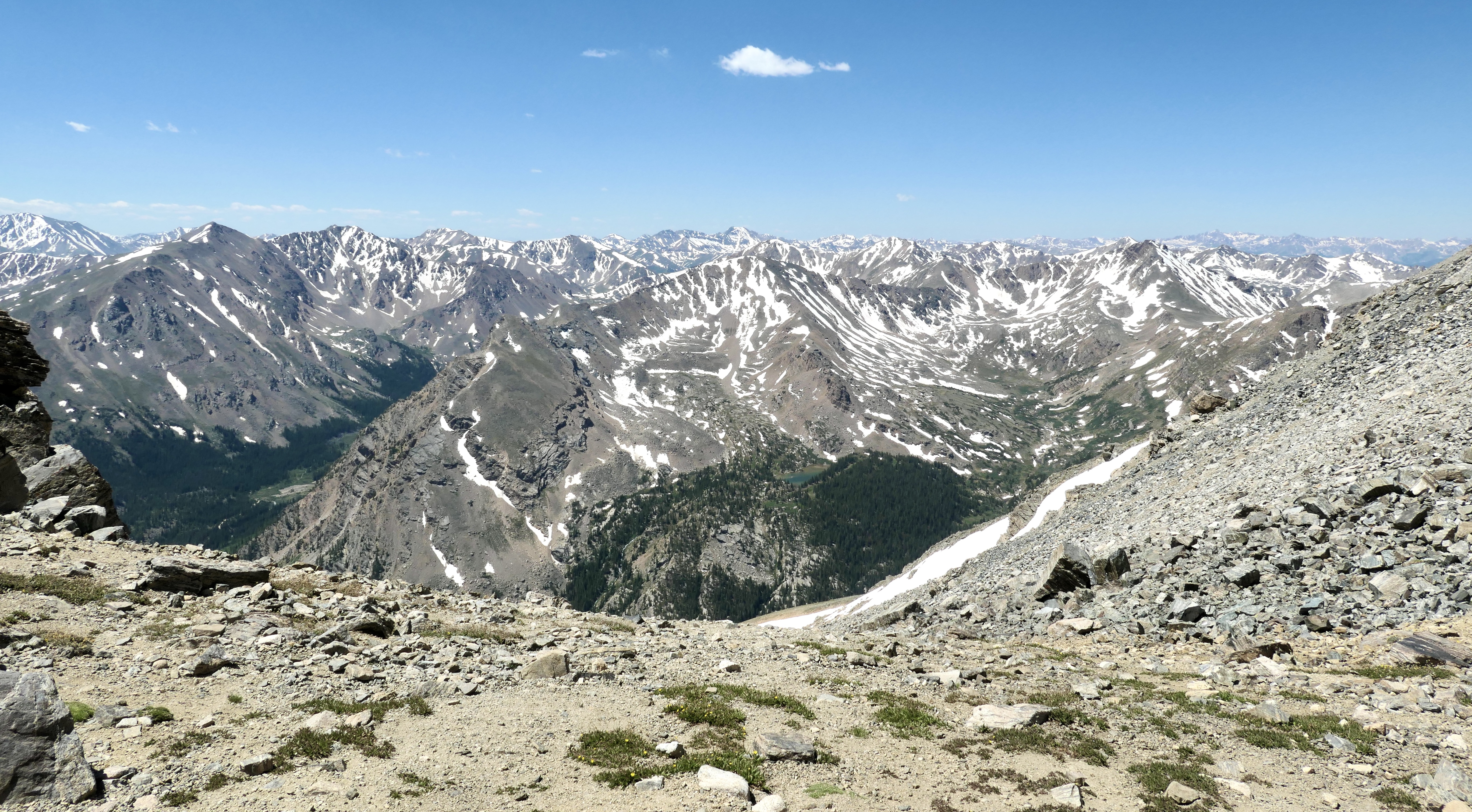
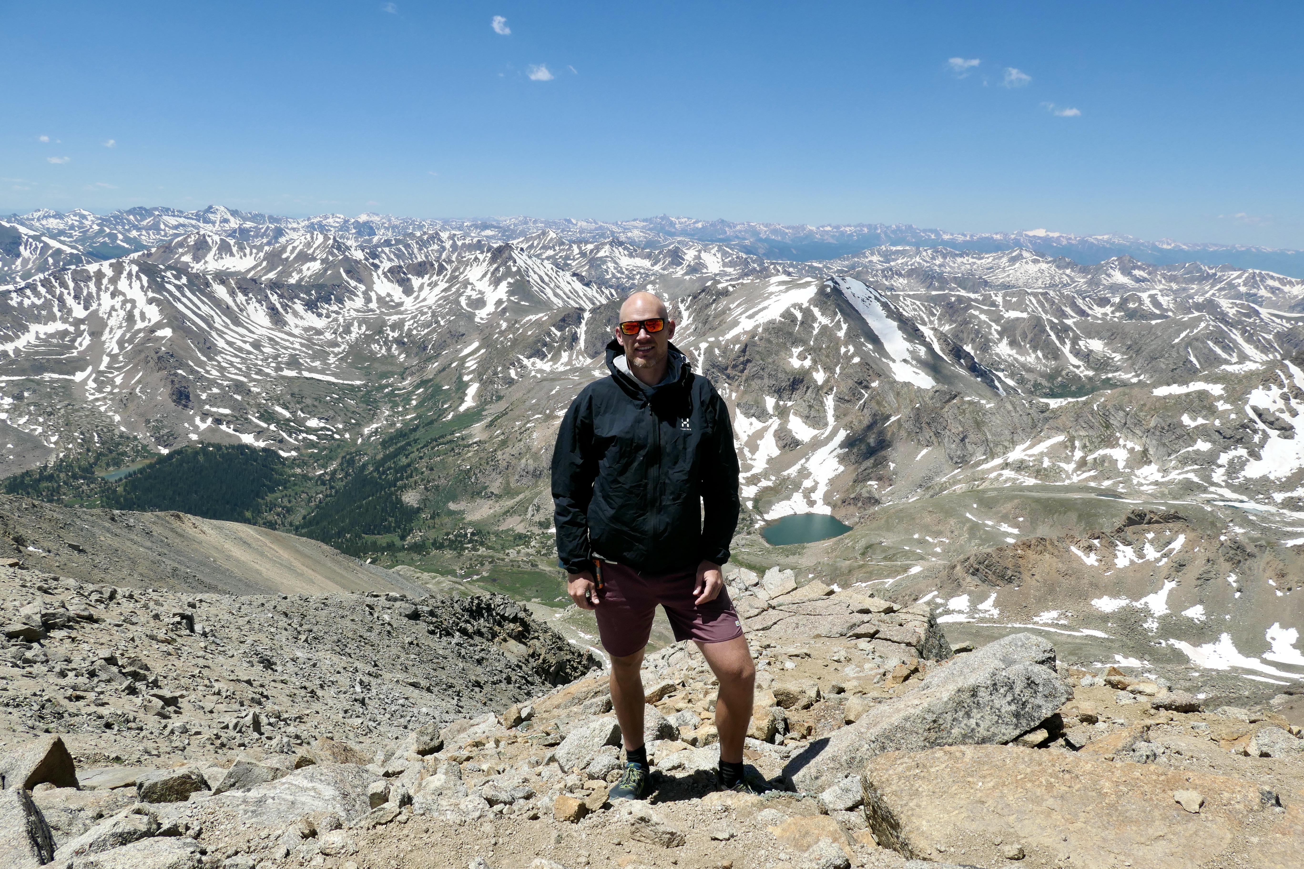
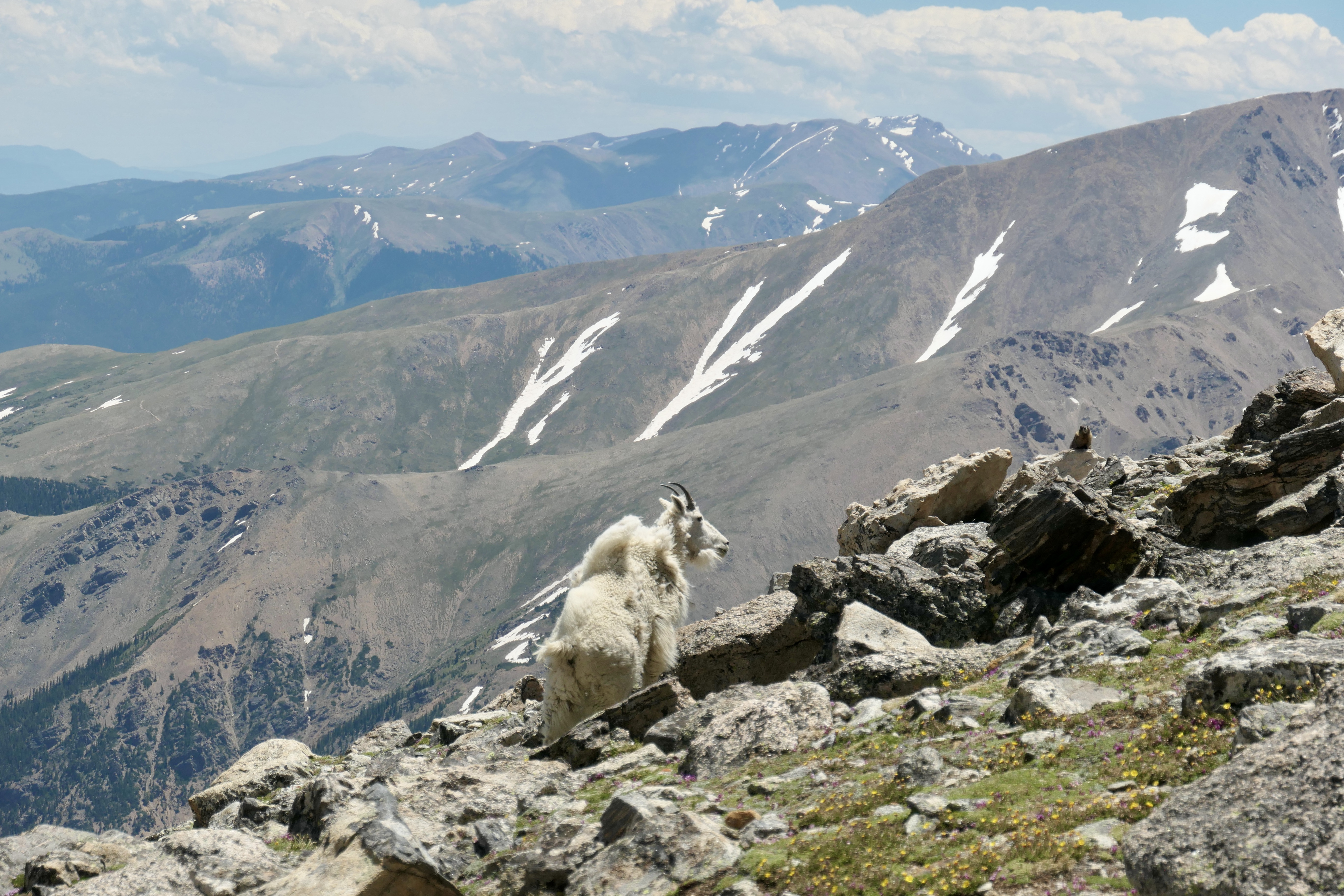
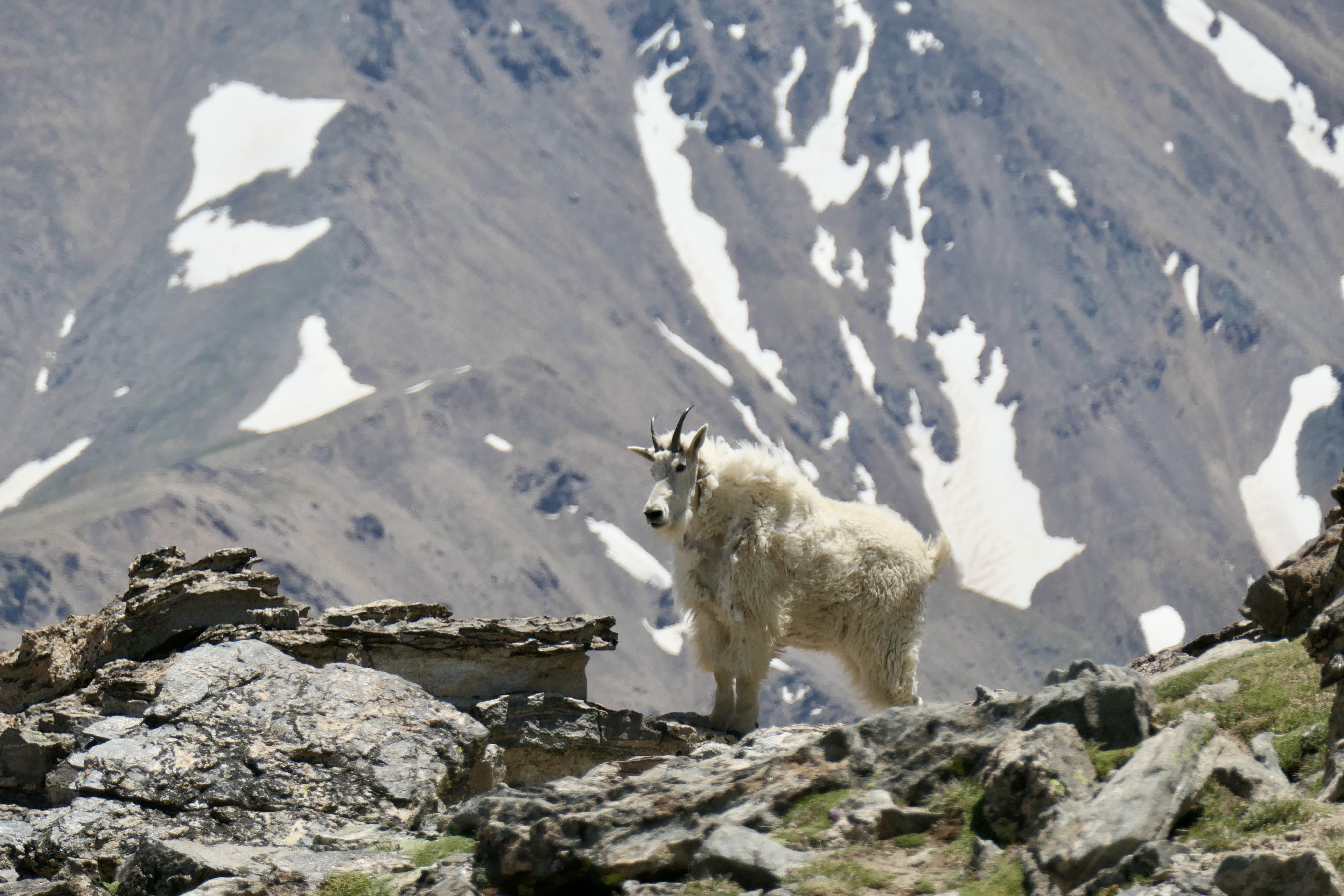
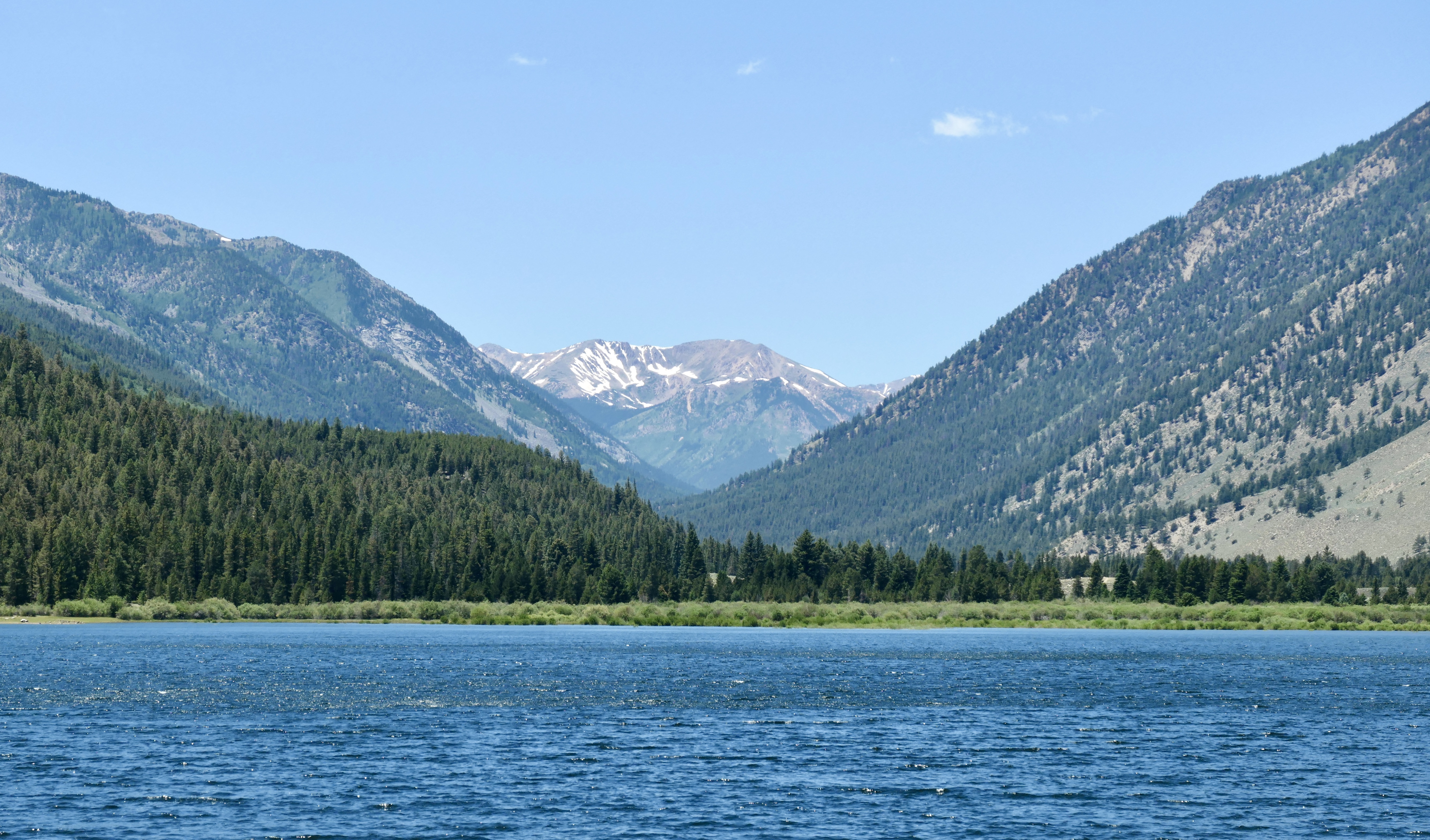
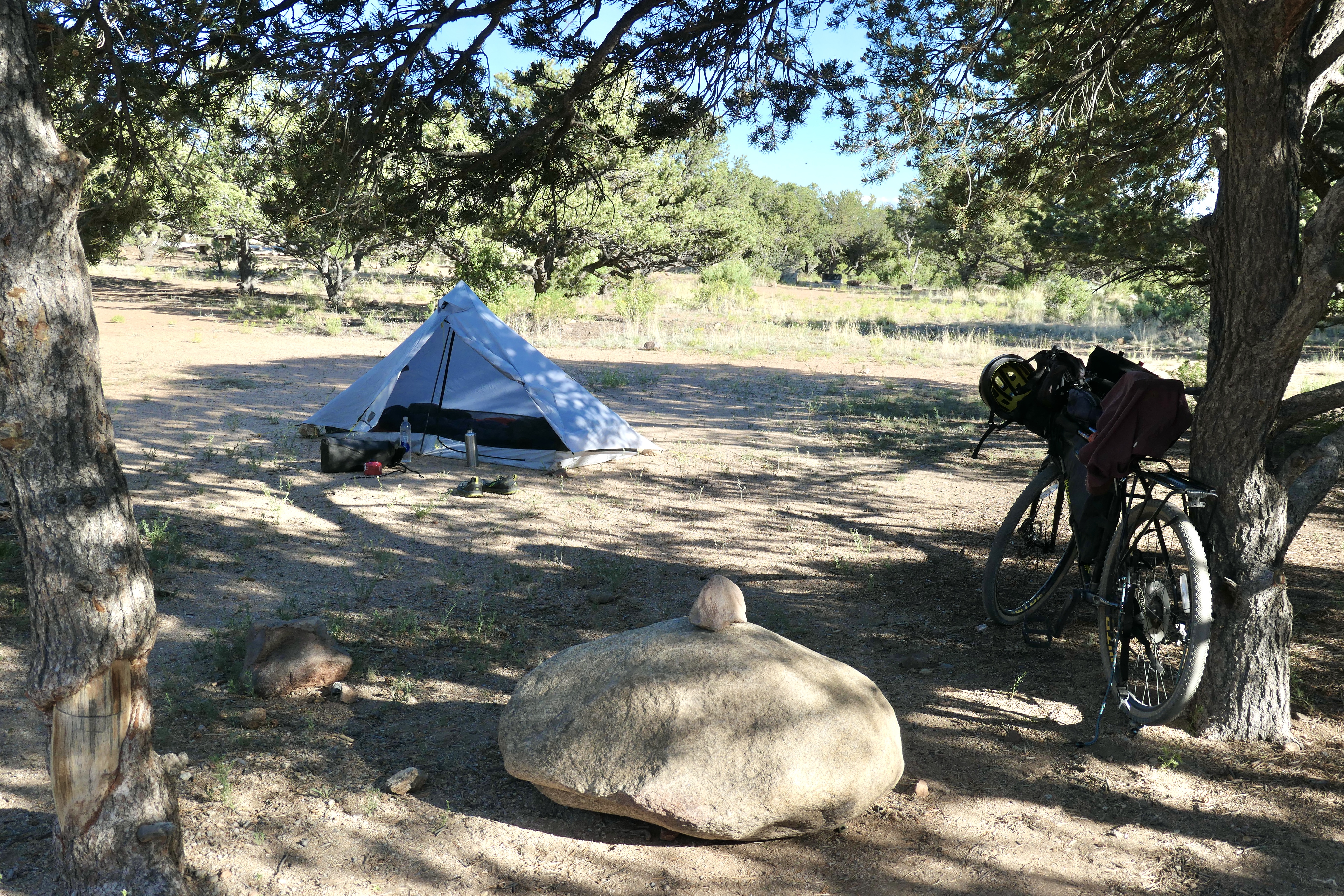
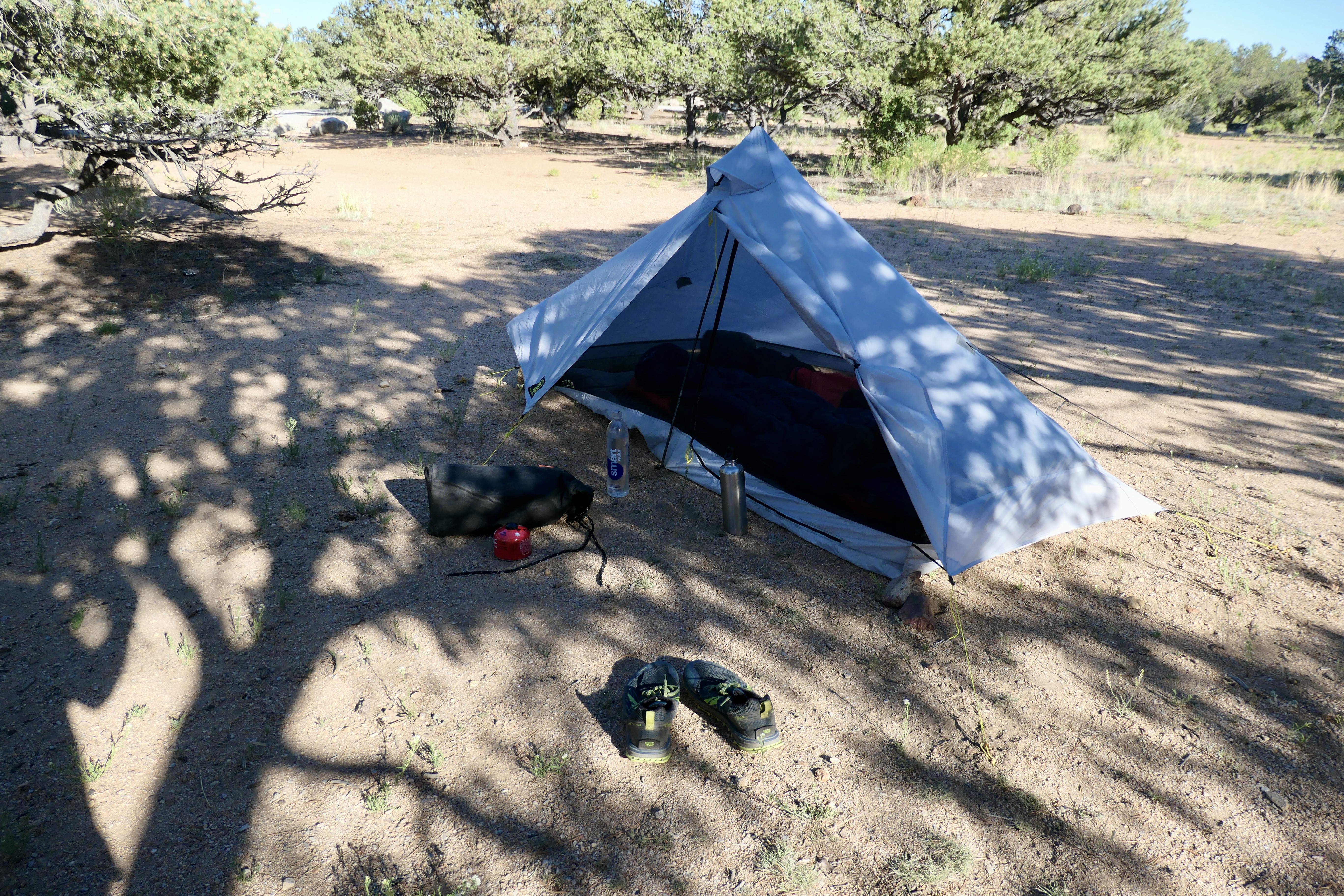
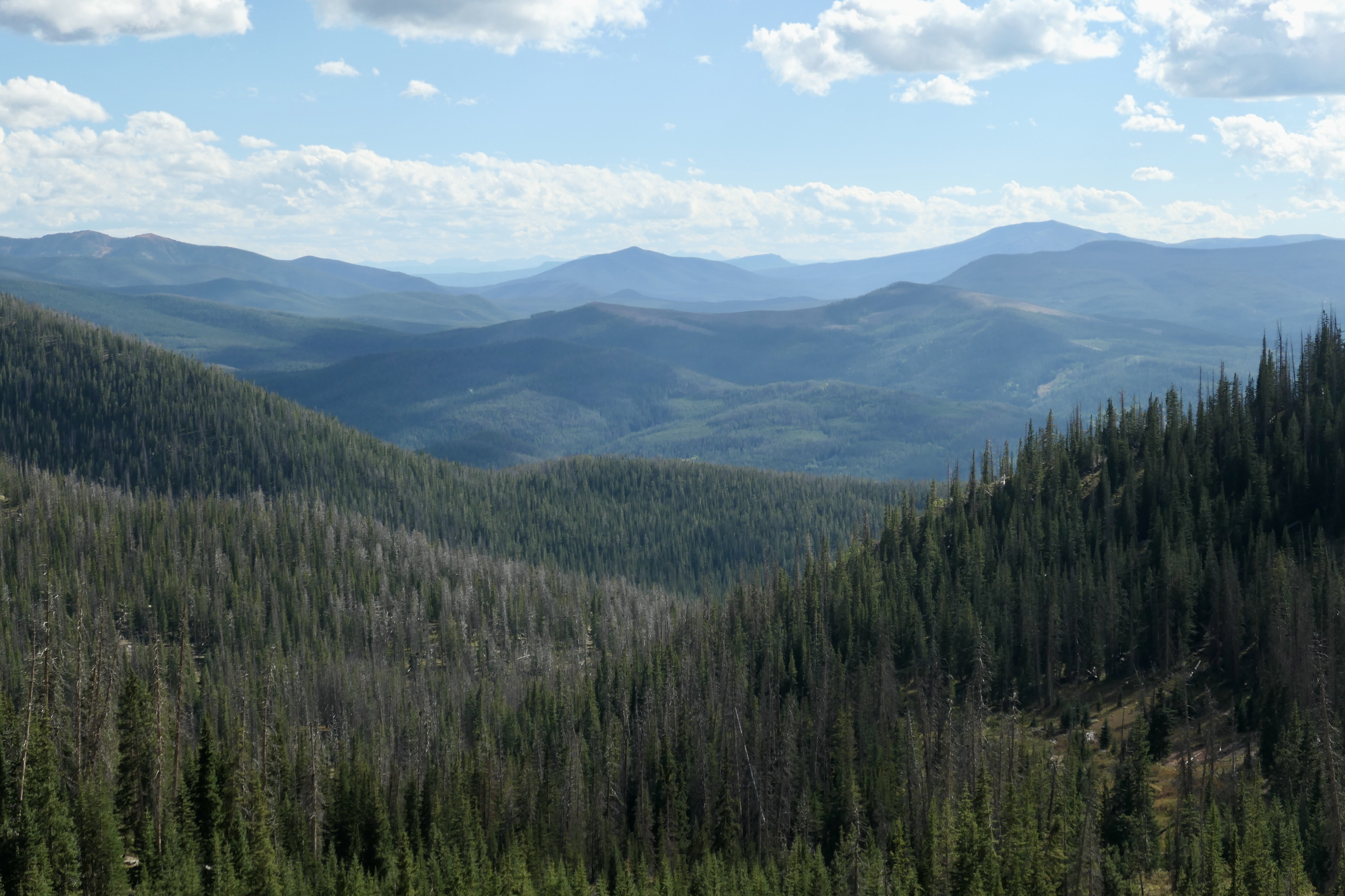
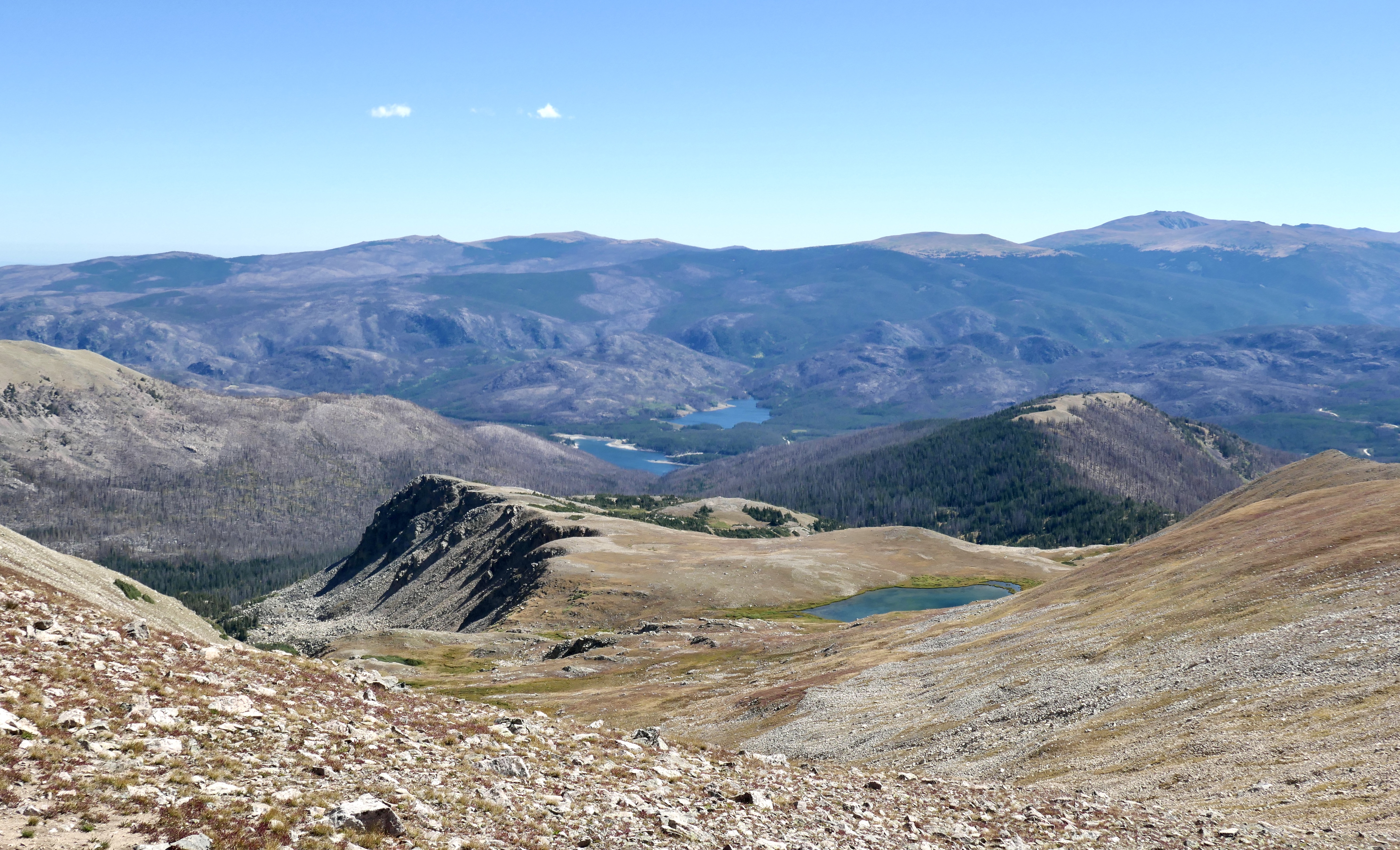
I got up already at 6:15 to make some coffee. I grinded fresh beans before I left and that paired with the MSR coffee filter is a winner every time. Best way to get good coffee on trail unless you want to bring the grinder. It was only my second night in my new tent (Six Moon Designs Lunar Solo) and generally i was very happy with it the whole trip. It stayed dry the whole trip so still have to put it to the test in rainy weather. It’s a one man tent but i can still have all of my gear inside which i like. The first part of the trail is on the Colorado Trail so I already met a bunch of people that were going all the way to Durango. The whole trail usually is 4-6 weeks. After around 6k on the CT the trail breaks off and goes up the mountain. Theres a nice big stream just before it breaks off so I took a little break and filled up my bottles. I climbed it on a Saturday so I met quit a few people on the way. To my surprise I didn’t need to cross any snow and it was not a very technical climb. I could basically walk the whole way up (it’s classified as class 2). The views where amazing as always when you climb a mountain and I met a family of mountain goats all the way on the top. It was a very cool experience since it was my first time seeing them. I got down after 24k, 1400m elevation, and almost 7h of walking, and had a really good lunch in camp. The rest of the day I was just eating and chilling in camp, another great day.
Day 3 – Mt. Massive trailhead to Turtle Rock Campground
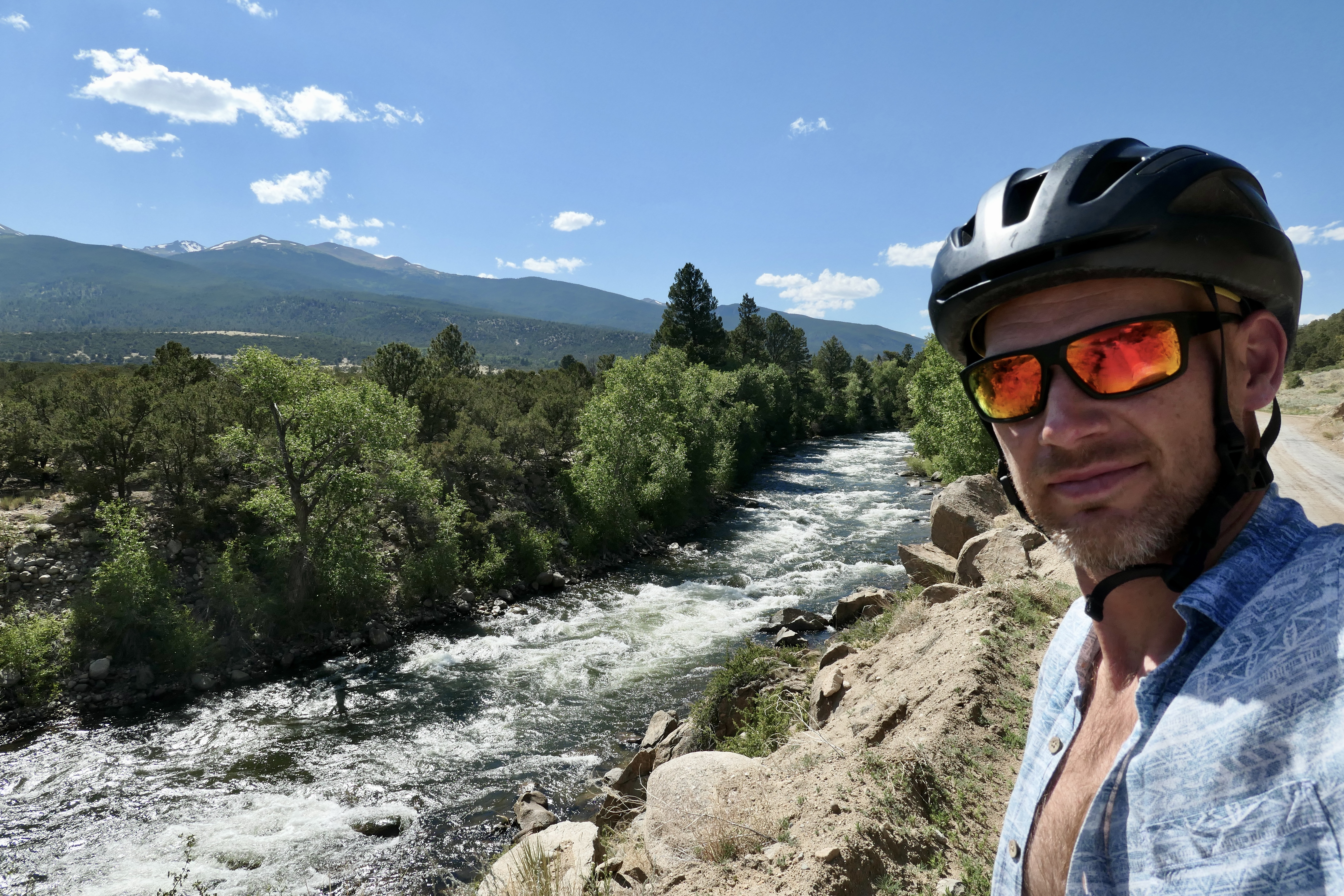
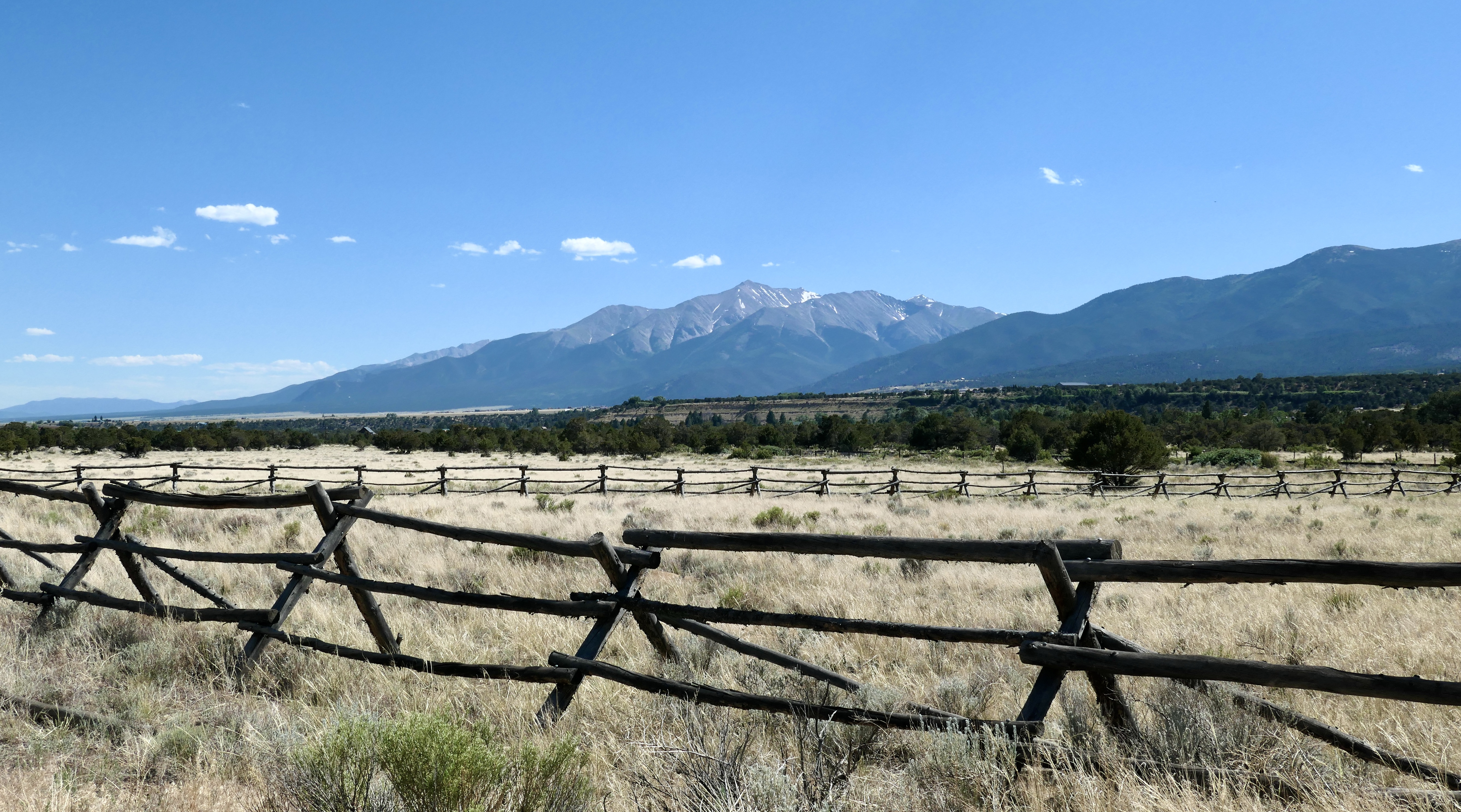
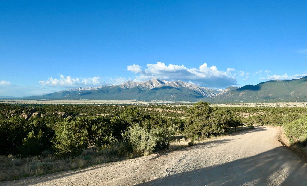
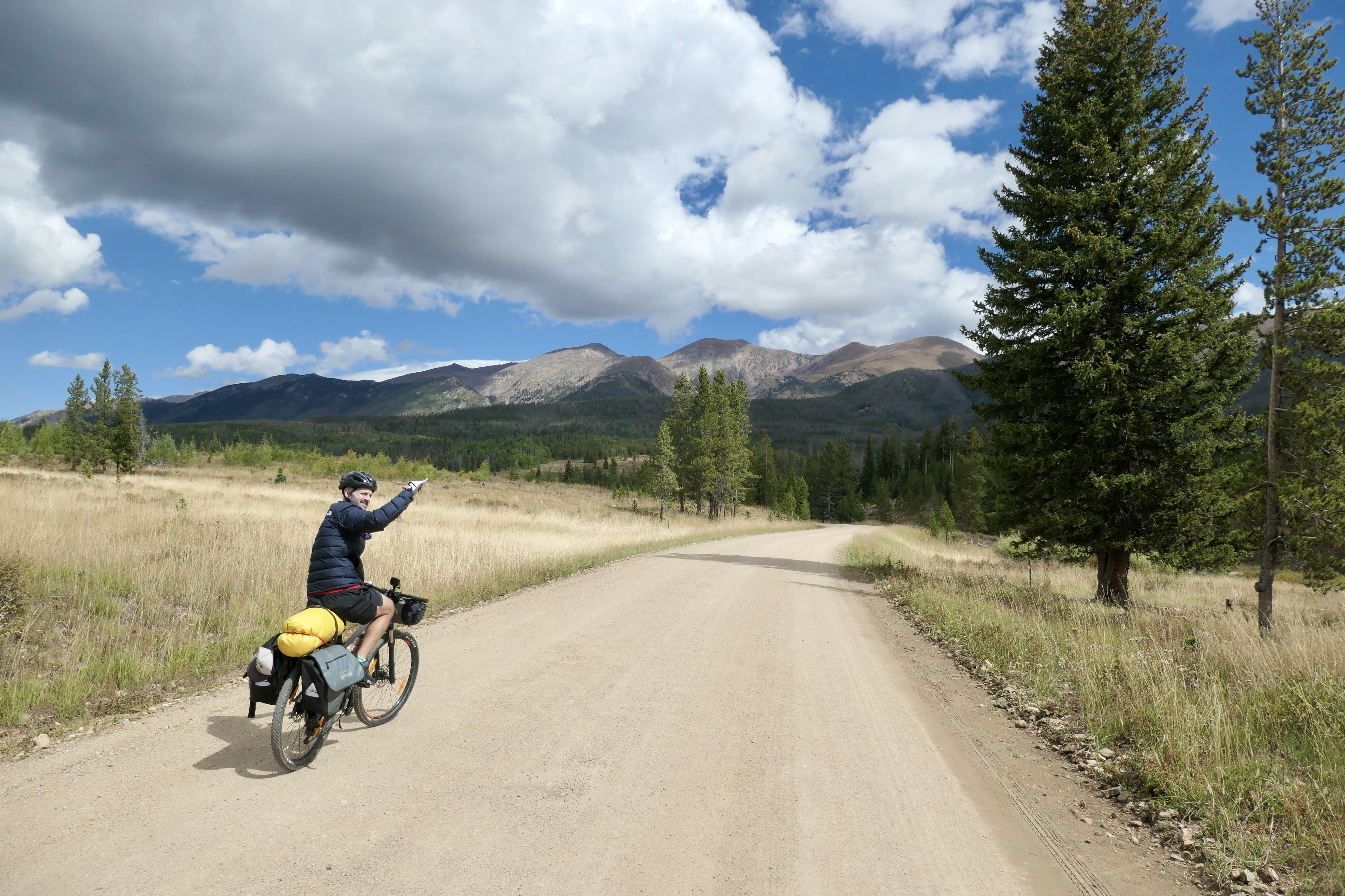
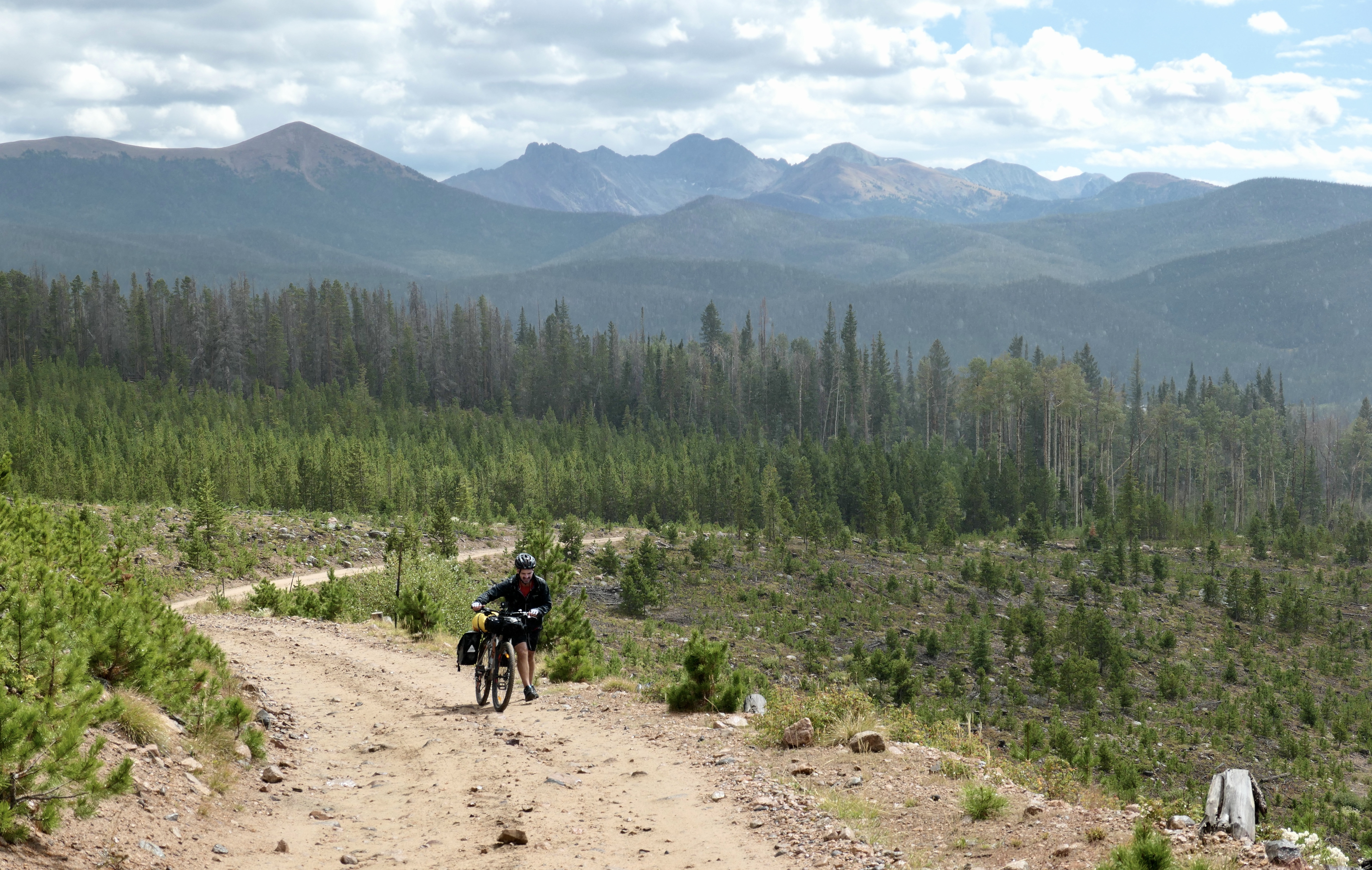
On day 3 I decided to take it very easy, I felt it a bit after the first two days so I didn’t want to rush anything and I just wanted to take my time. I spent a loooong time drinking coffee and eating Müesli, packed up and started riding down the mountain around 9:30. I rode south in the direction of Buena Vista and there was a lot of dirt roads running along the main road so it was a really beautiful ride and mostly downhill which I truly appreciated! I thought about biking to Huron Peak and climb it on the following day but decided against it and leave that for another day. I rode past Twin Lakes and onwards to Clear Creek Reservoir where I had lunch. I had brought tomatoes and cucumbers which are super heavy but definitely makes me happy when I’m eating it in the tortilla sandwiches that I make. It’s a fine balance – my food definitely weight a lot this trip but I also packed for 5 days. After lunch I rode down the main road for a few k’s and then connected with and old dirt road running on the east side of the Arkansas River. It was so cool to ride on that with beautiful views of 14’ers to the west, amazing rock formations to the east, and the river running right next to me. I went up to Turtle Rock campground which was still free. Riding up the hill I met this cool guy Brian who was living in his car for a few months and kayaking in the area. I was out of water and thankfully he had some extra. We talked for about half an hour before I rode up the last bit to the campsite. It was a beautiful site with views of Mount Princeton, Yale, and Havard. It ended up being another amazing full day riding almost 80k.
It was time to go to Buena Vista and catch the bus early. I had an amazing sleep and felt like I was just getting used to it now. Man I could continue forever doing this! But I have a 2,5 year old son at home now that depends on me. When he gets older I can do it and bring him on some trips and introduce him to this life. When I do this for a longer period of time I feel like I can almost tap into another dimension of life. I still have big plans of doing long epic trips like this in the future, so I stay mobile and in shape, but for now it has to wait. Anyway, I packed down my stuff and went early to ride the last 5k to Buena Vista Roastery Café to get some coffee and pastry before catching the bus. The bus ride to Denver from Buena Vista took around 2,5 hours and was beautiful. It cost me 24 usd with the Bustang Outrider bus.
In Denver I had to kill a few hours before catching the bus to Fort Collins, so I went to Denver Beer Co and tasted a few of their beers. They make really good stuff. While I was sitting there I reflected on my trip and how nice it was to have had a few day with no distractions to affect my thoughts and mindset, everything came from within and that is an amazing feeling and where original thoughts and ideas are born. Sure, it can be scary to set out on your own but once I’m out there the fear is gone. I’ve never regretted it and the knowledge I get about myself facing fears and challenges is invaluable.
Maps & stats
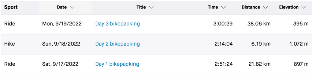
Below is the 4 day overview screenshot from Strava (Day 2 climb was 6h 54min, not 3h 15min. My watch wouldn’t track the last two days so I plotted the route manually in ridewithgps, I guess it’s getting old).
Here’s the link to the route on google maps and below is the screenshot
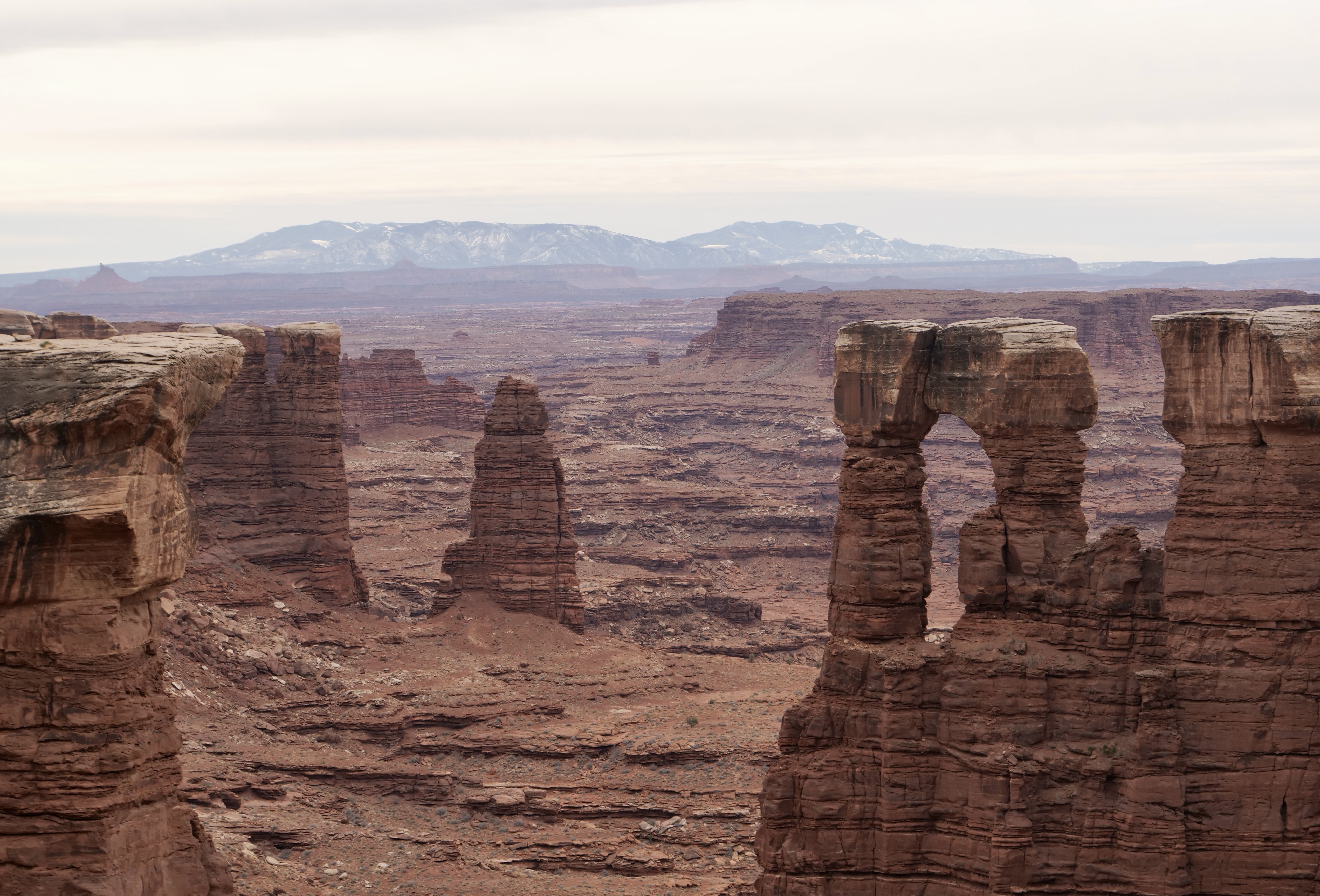
I’ve had my eye on the area around State Forest State Park and Rawah Wilderness for some time and wanted to explore it deeper. Also, I wanted to climb Clark Peak (highest peak in the that area) which I discovered from the book “Best summit hikes in Colorado” by James Dziezynski. Lastly I’ve been wanting to do a true bikepacking adventure and test my beloved Breezer bike‘s capabilities in rugged conditions, so why not combine all of those things.
I planned a route that combined dirt roads and hiking trails. I used local maps, Cotrex, Mapout, Google Maps and Ridewithgps to plan the trip. I knew there was a risk that some sections would be too technical and that we would have to carry the bikes a lot, but the elevation changes looked doable and I had a backup plan if things didn’t work out. I couldn’t find any info on people bikepacking there before so there was a big unknown factor but I think that’s part of a true adventure. If you know exactly what you’re going into some of the excitement goes away. With an element of unknown the fear and awareness level goes up and coming out on the other side gives a big confidence boost and expands the comfort zone. To me it is necessary to go beyond the comfort zone sometimes in order to truly live and grow as a human being.
Day 1 – Seven Utes parking to Jewel Lake (Strava link)
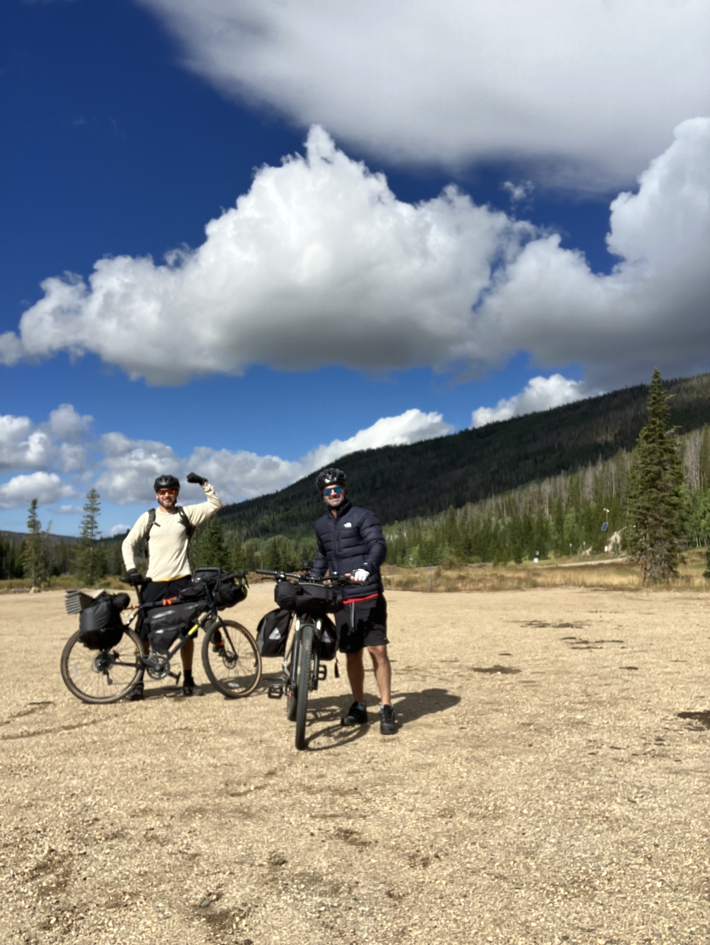
We logged in at the Moose Visitor Center, parked the car at 7 Utes parking (close to where Bockman road connects to the main road) and began our adventure. I was joined by my friend Josh who was on his own personal journey to find his balls. Rumor had it that at least one of them would be located atop Clark Peak. I thought it was an important journey and was very happy to partake in that, besides I think it’s a good idea to be looking for them once in a while to make sure they don’t get lost.
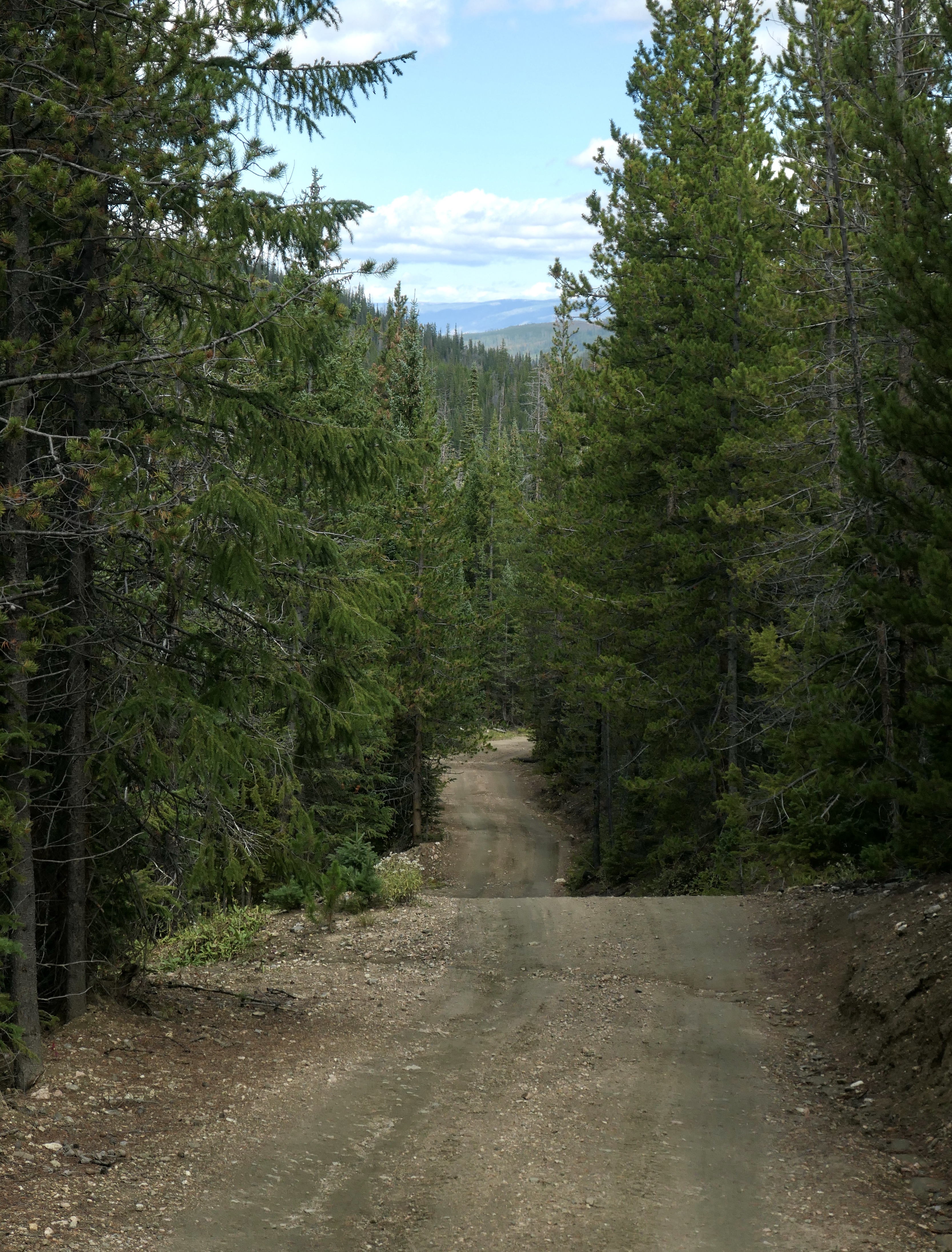
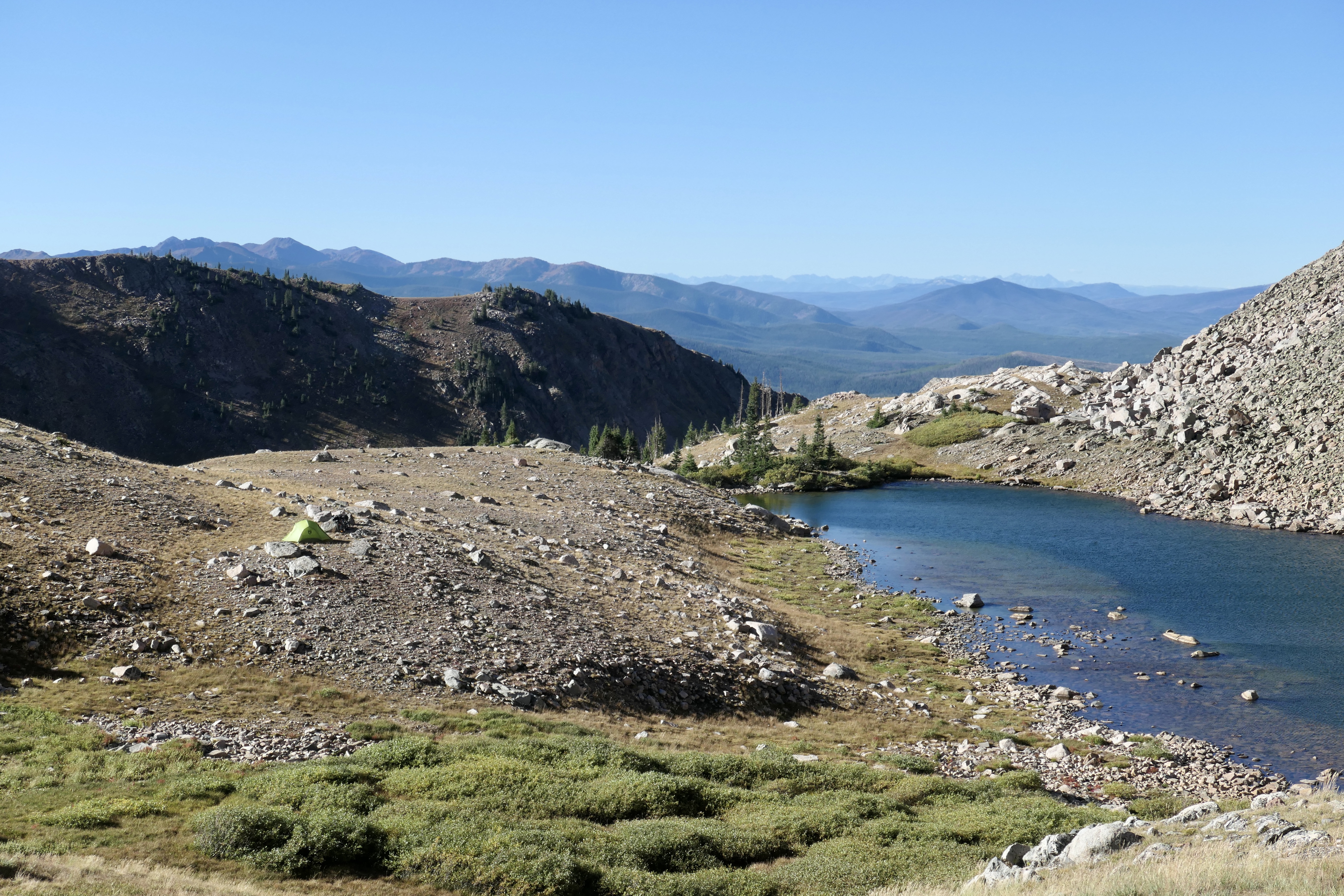
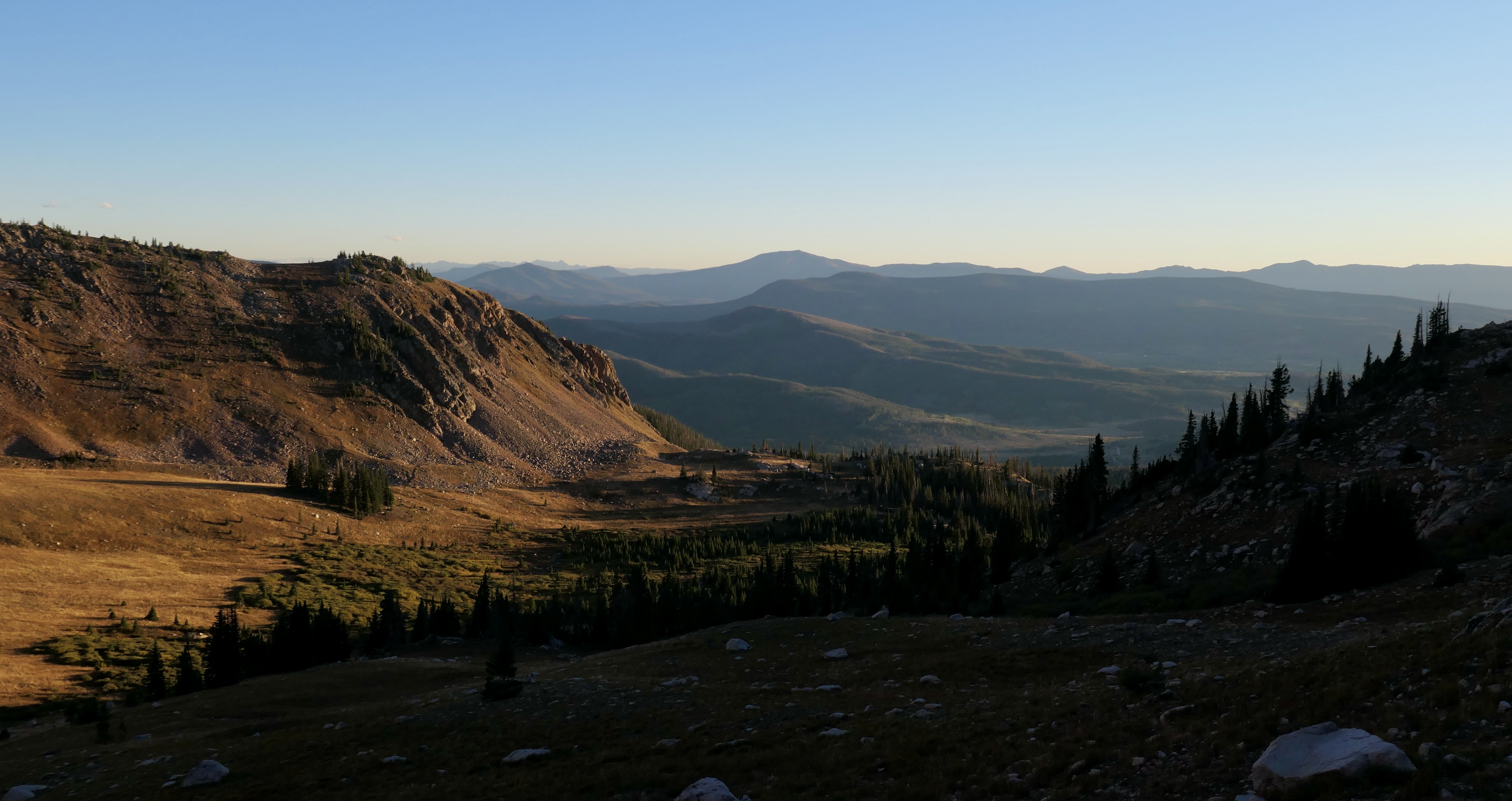
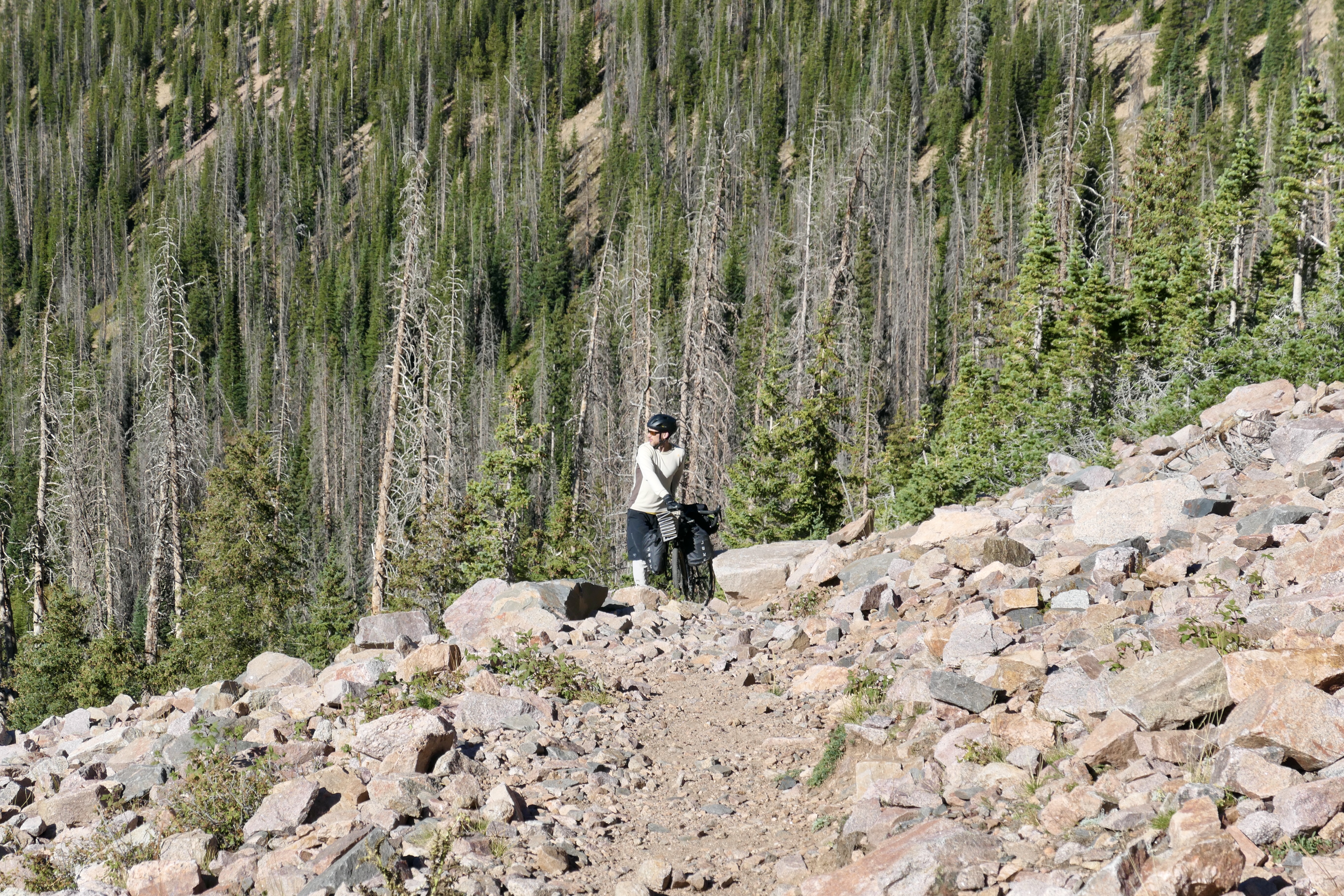
We were off to a great start hitting Bockman road which is a fun and beautiful 4×4 dirt road to ride. We passed by Bockman camping and hit the Fransisco Loop road that connects with Ruby Jewel road and eventually Ruby Jewel trail. The Ruby Jewel road is a very rough and steep 4×4 road that was very hard to bike with a big load so eventually we got more into pushing the bike and that’s what we did for more or less the rest of that day. The trail is beautiful going up into the valley of Jewel Lake below Clark Peak. Mountain biking the whole thing without load is definitely possible (if you’re in shape) and would be an awesome day adventure looping around Kelly Lake. In fact that’s the original route that I planned but we ended up staying by Jewel Lake for 2 nights instead.
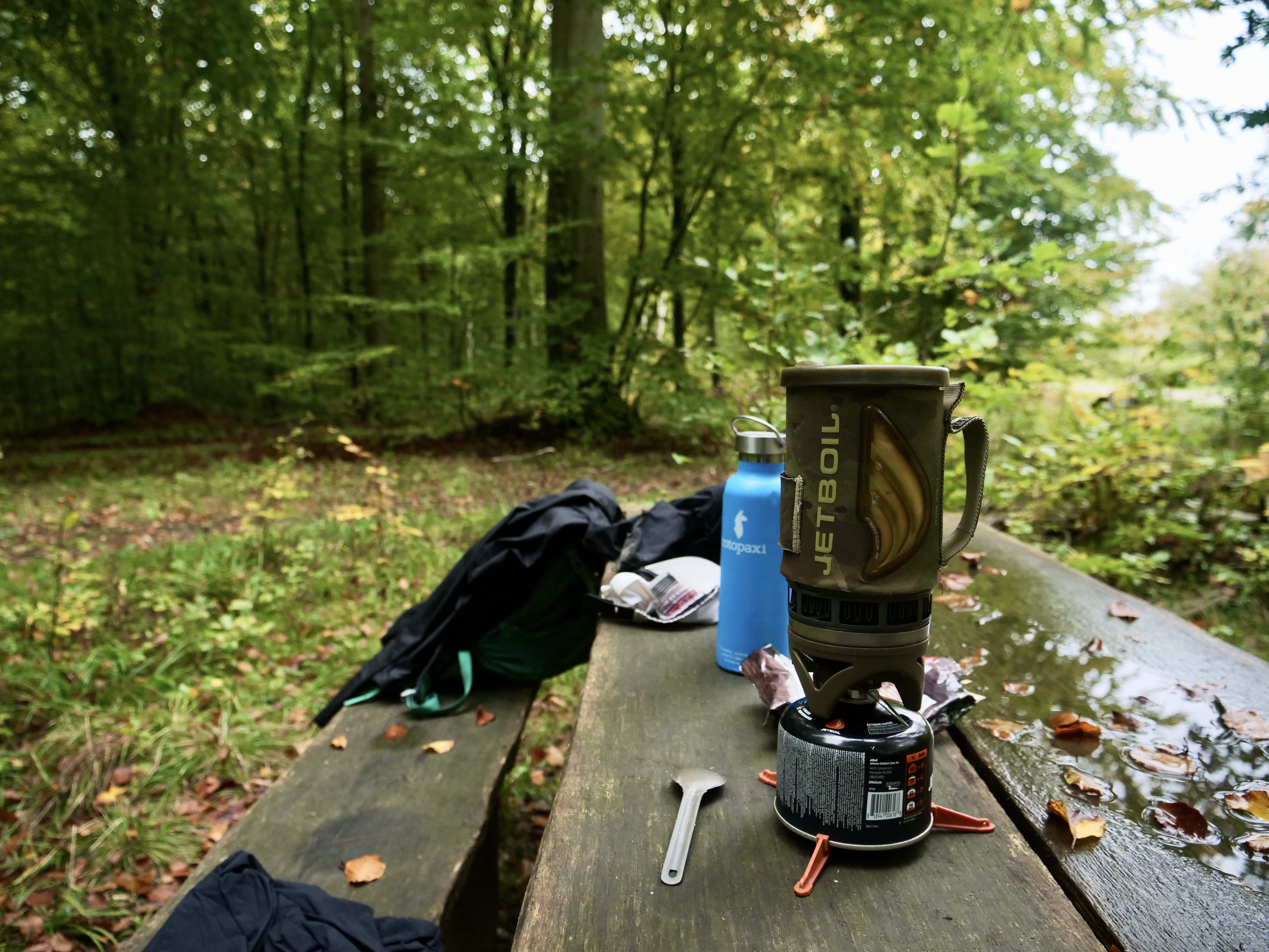
We set up the tent and I broke out my new cooking gear: The Pocketrocket Deluxe, a Toaks Titanium 900 ml pot and a Mugmate coffee filter. I decided to change my cook system from my beloved jetboil that i used for the last 10 years since I want to cook my food instead of the pre made meals. I loved the new setup, it performed beautifully and it’s actually a lighter system. I could even cook enough couscous for 2 people in the 900 ml pot. So dinner was couscous with tuna and spices, on day 2 I added some mayo which turned out to be a golden move.
Here are some shots from day 1, click the pictures for description and more story…
Dqy 2 – Clark Peak round trip climb from Jewel Lake(Strava link)
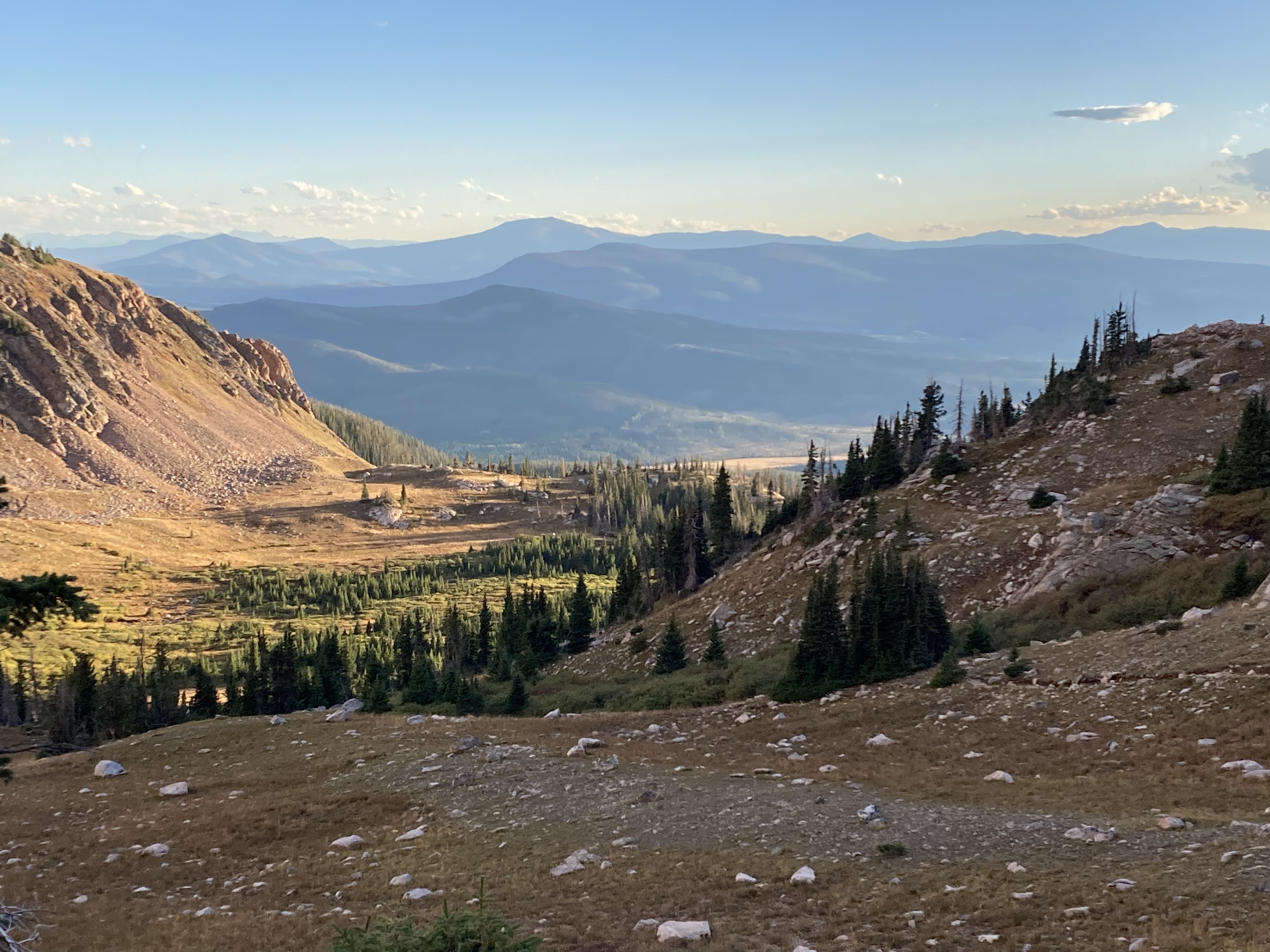
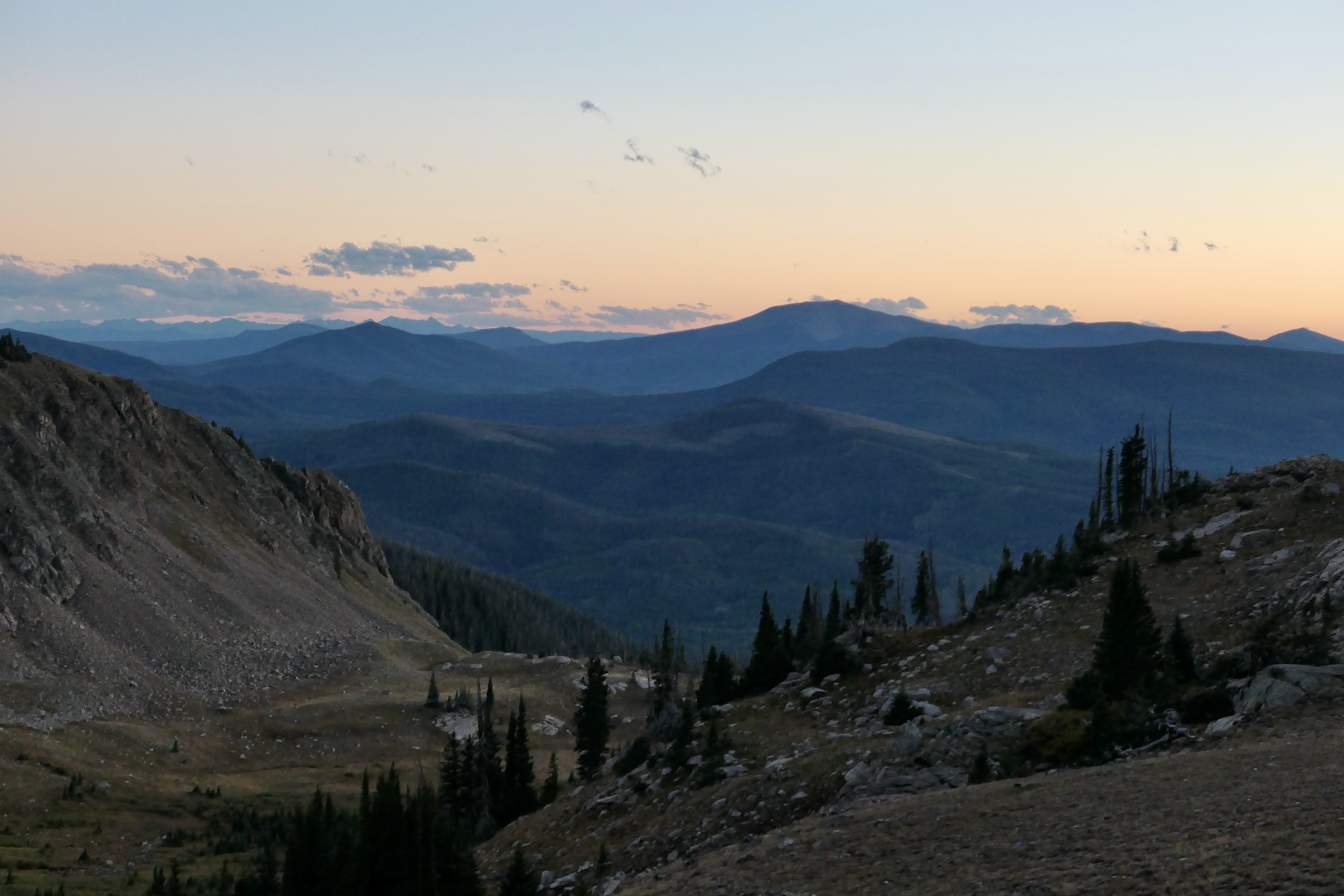
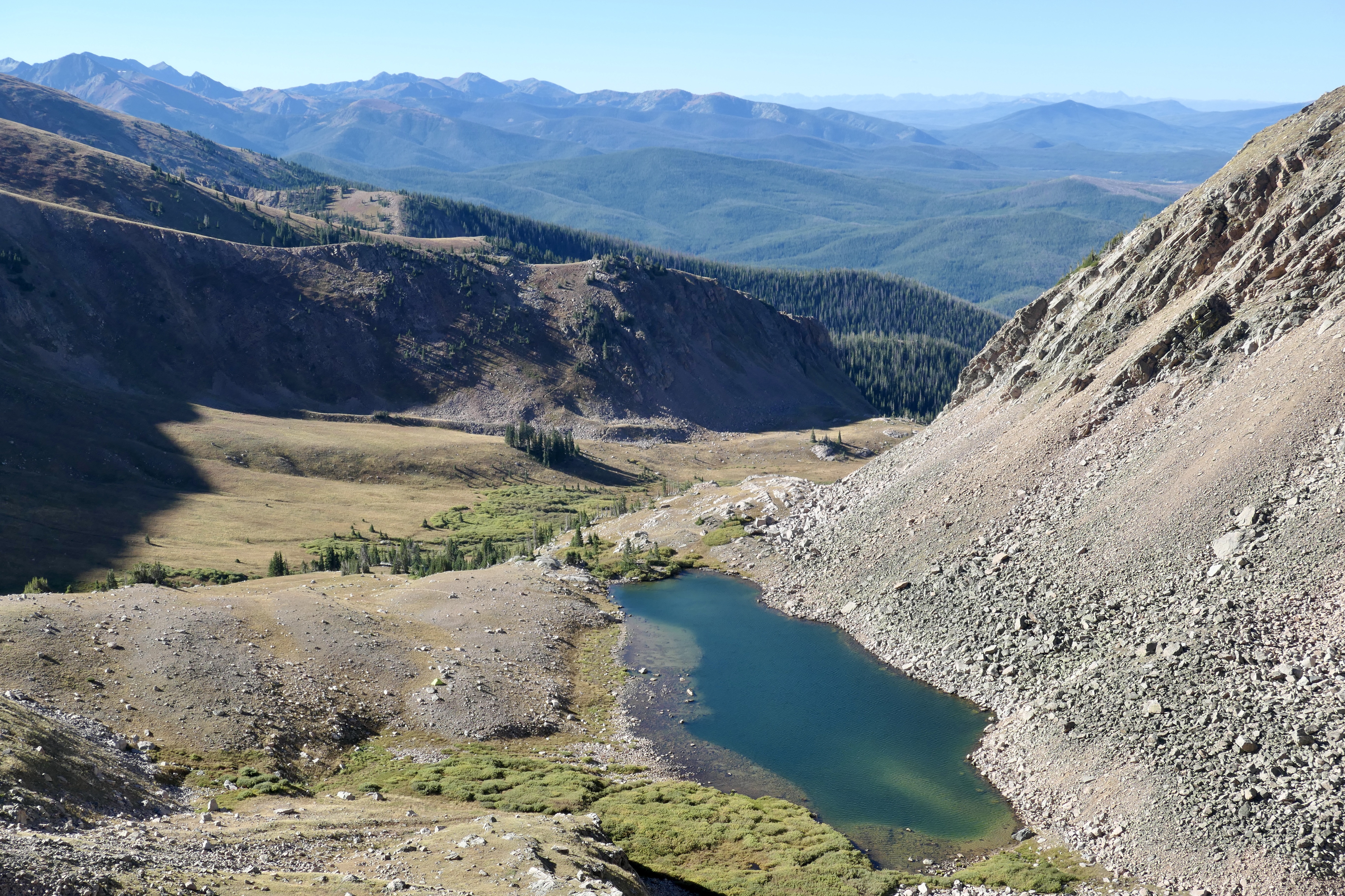
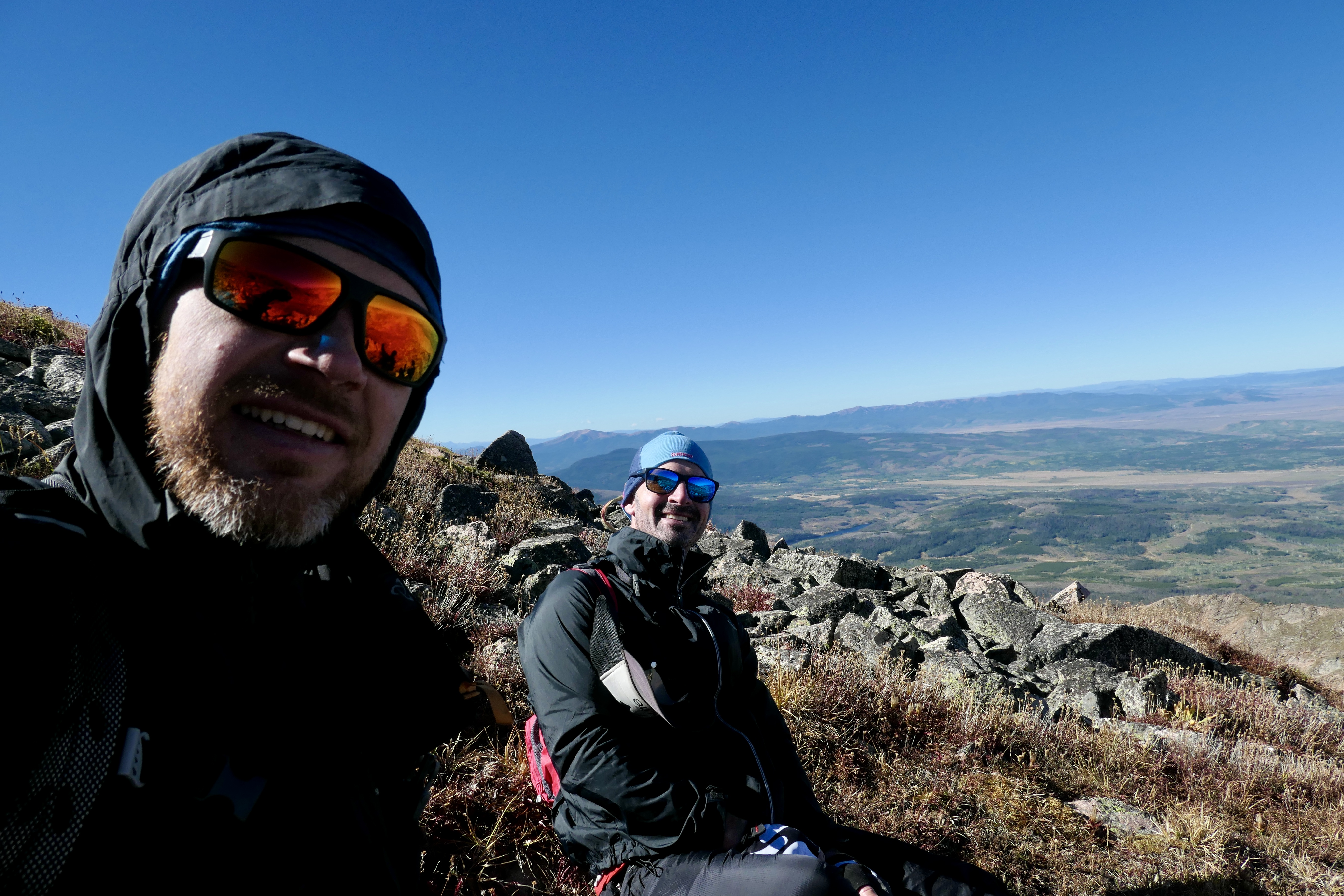
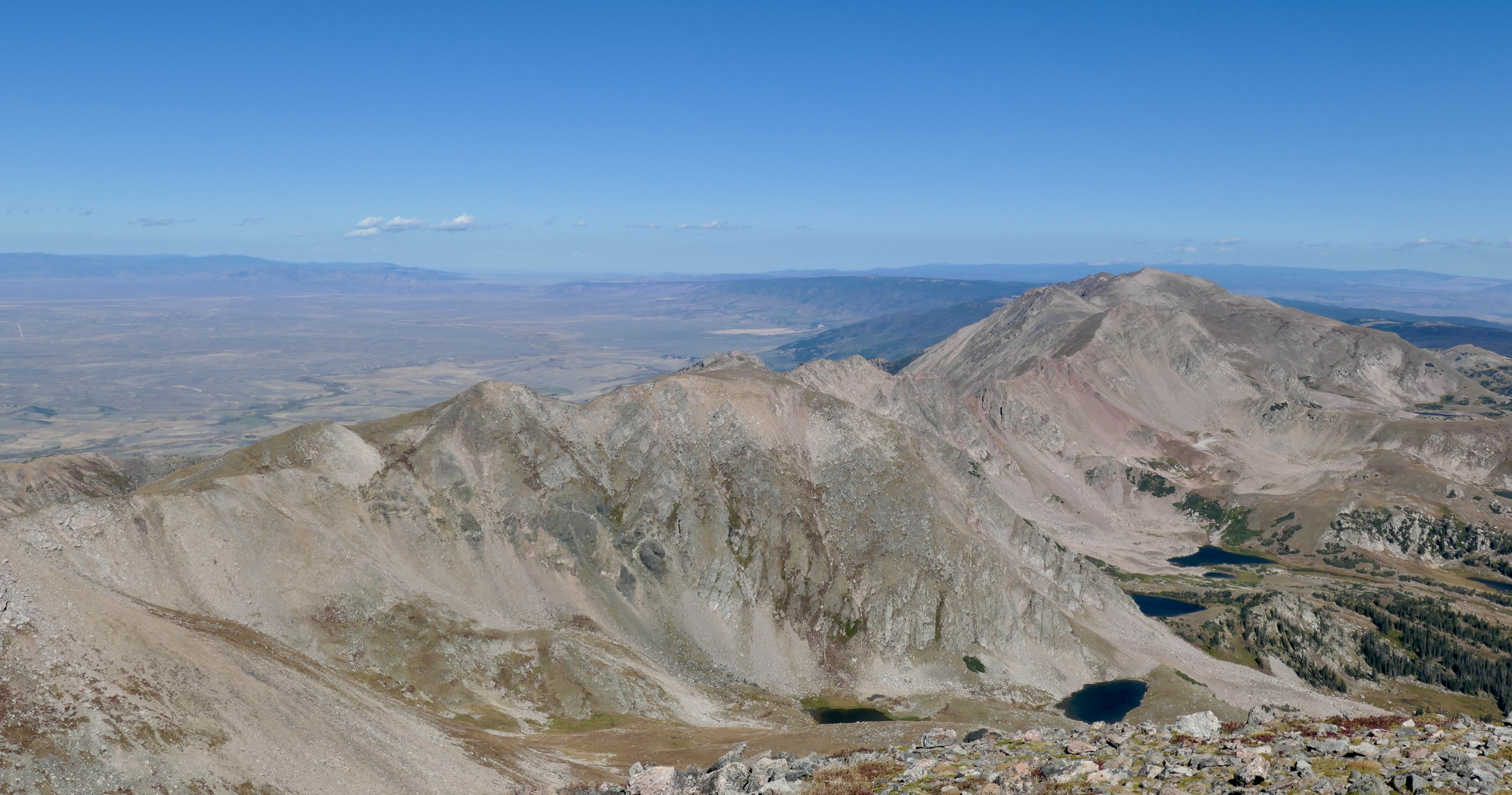
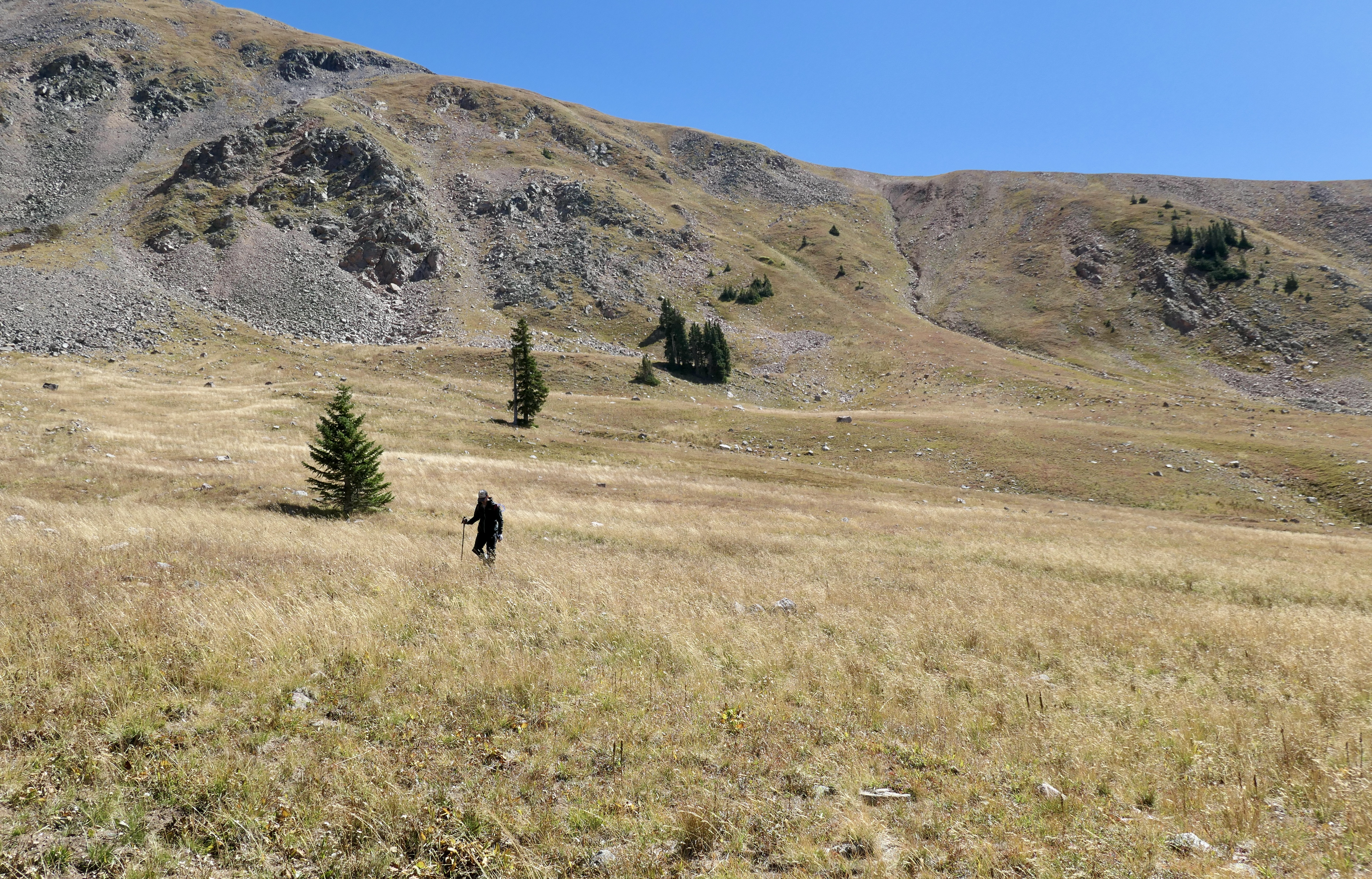
The plan was to climb Clark Peak scrambling up from the north side of the lake and loop around on the ridge as described in the book. Getting out of the tent was pretty cold but not freezing, also it was pretty windy so it felt a lot colder than it was. After some good coffee from the new stove system Josh stopped shaking and we started the scramble. It was steep but not technically difficult. It’s such a beautiful loop with amazing views into the Never Summer Wilderness and Rocky Mountain NP to the south, Rawah Wilderness to the east, Medicine Bow Range to the north and the flat area and Zirkel Wilderness to the west. Thankfully Josh located one of his nuts on the top, he was very happy since it has been lost for a while. The other one was nowhere to be seen so the search continues, but still, one is better than none!
We had a rest back in camp and decided to explore the valley a little bit. When we came back we ate some good food and had some whisky watching the sun set. I have to give it to Josh, he did a very good job on the whisky, What a day!
Shots from day 2, click the pictures for description and more story…
Day 3 – Jewel Lake to Seven Utes Parking(Strava link)
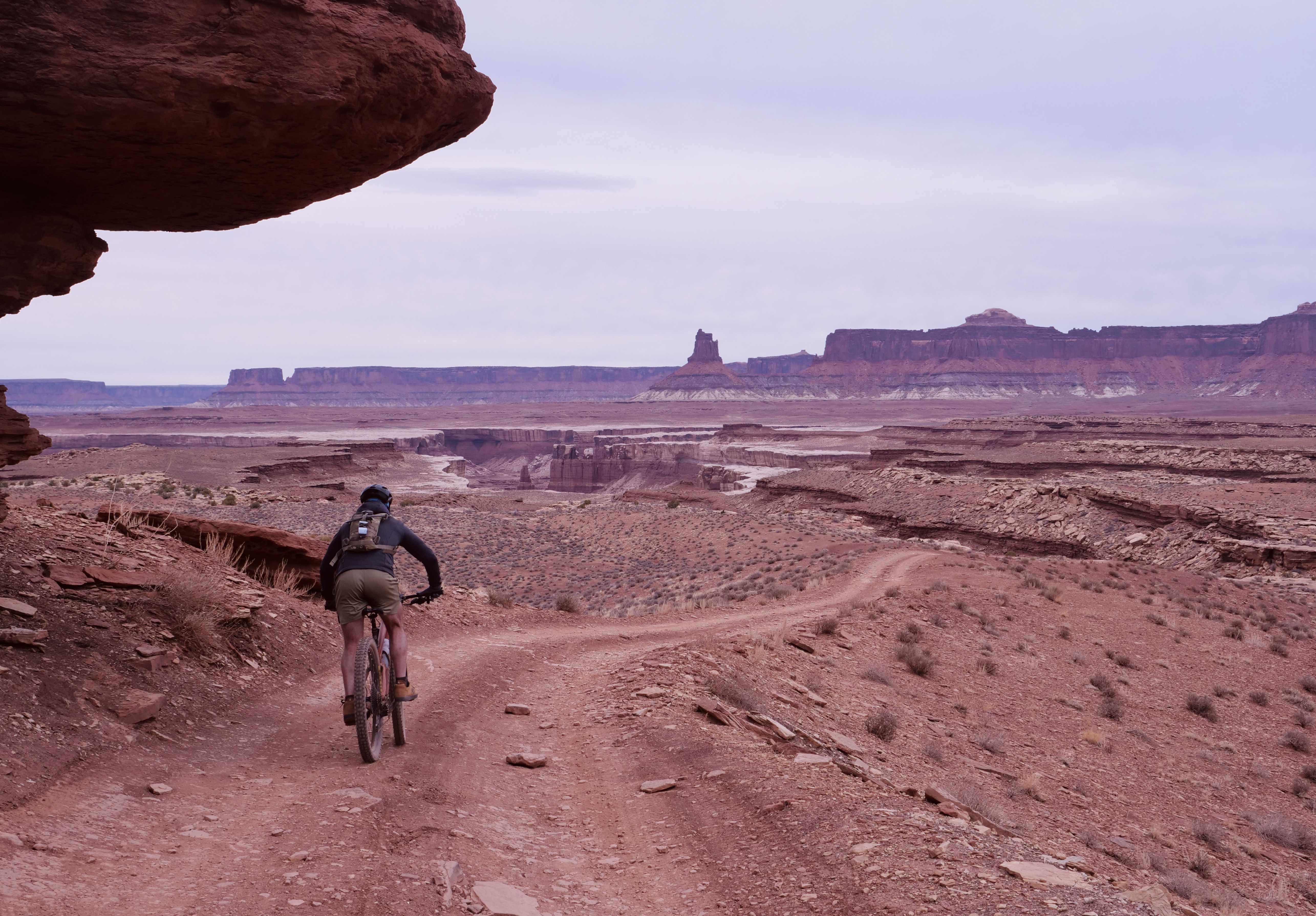
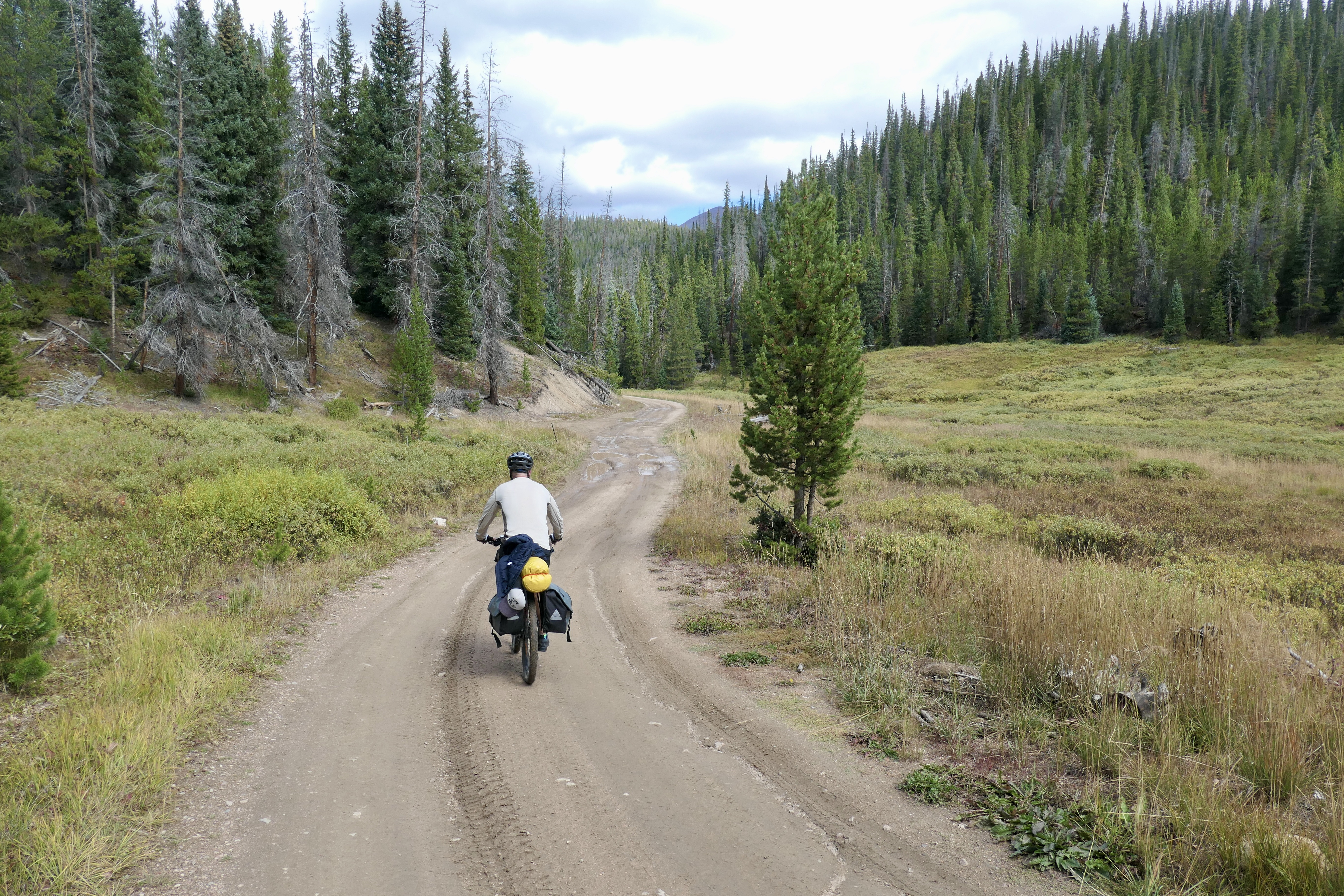
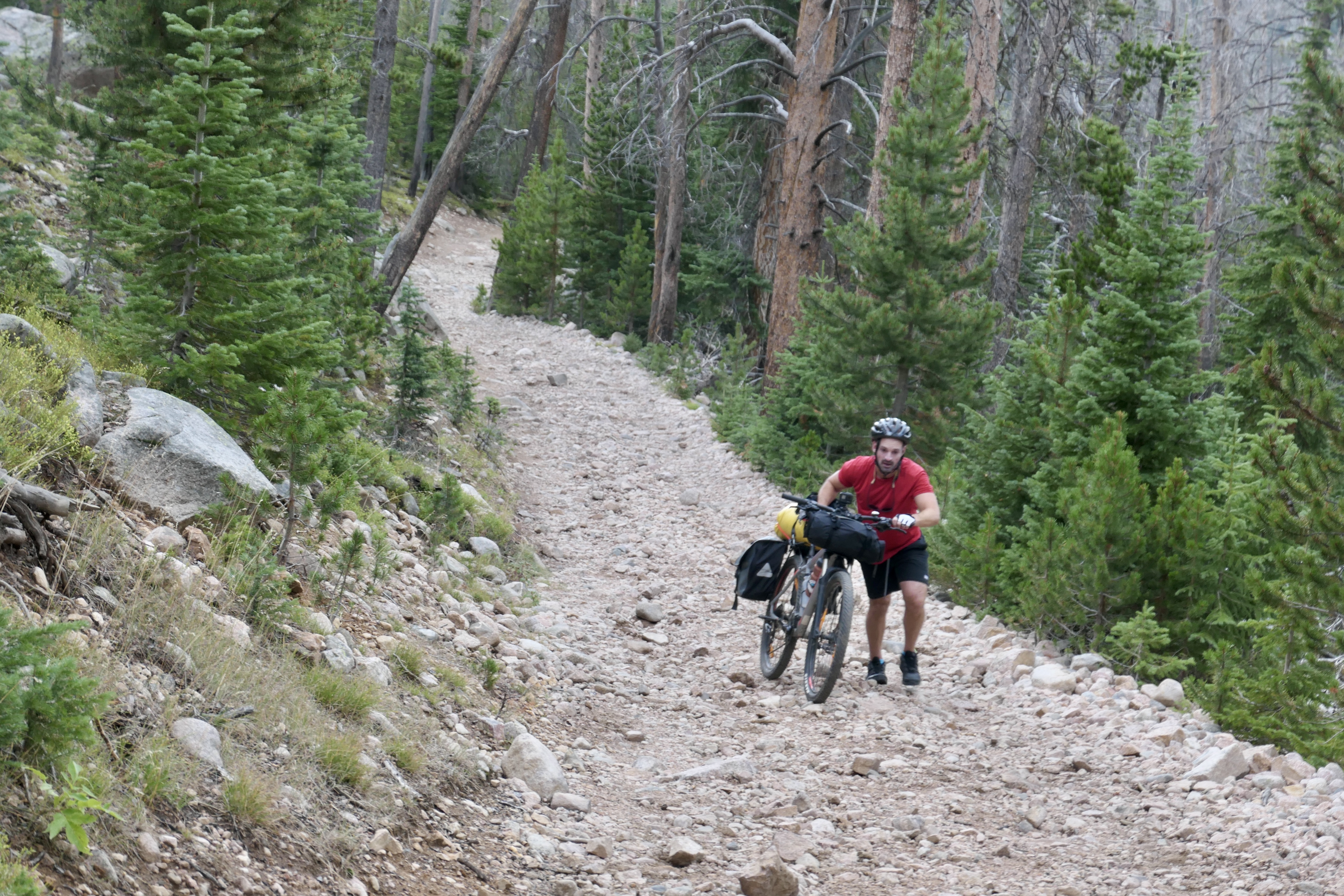
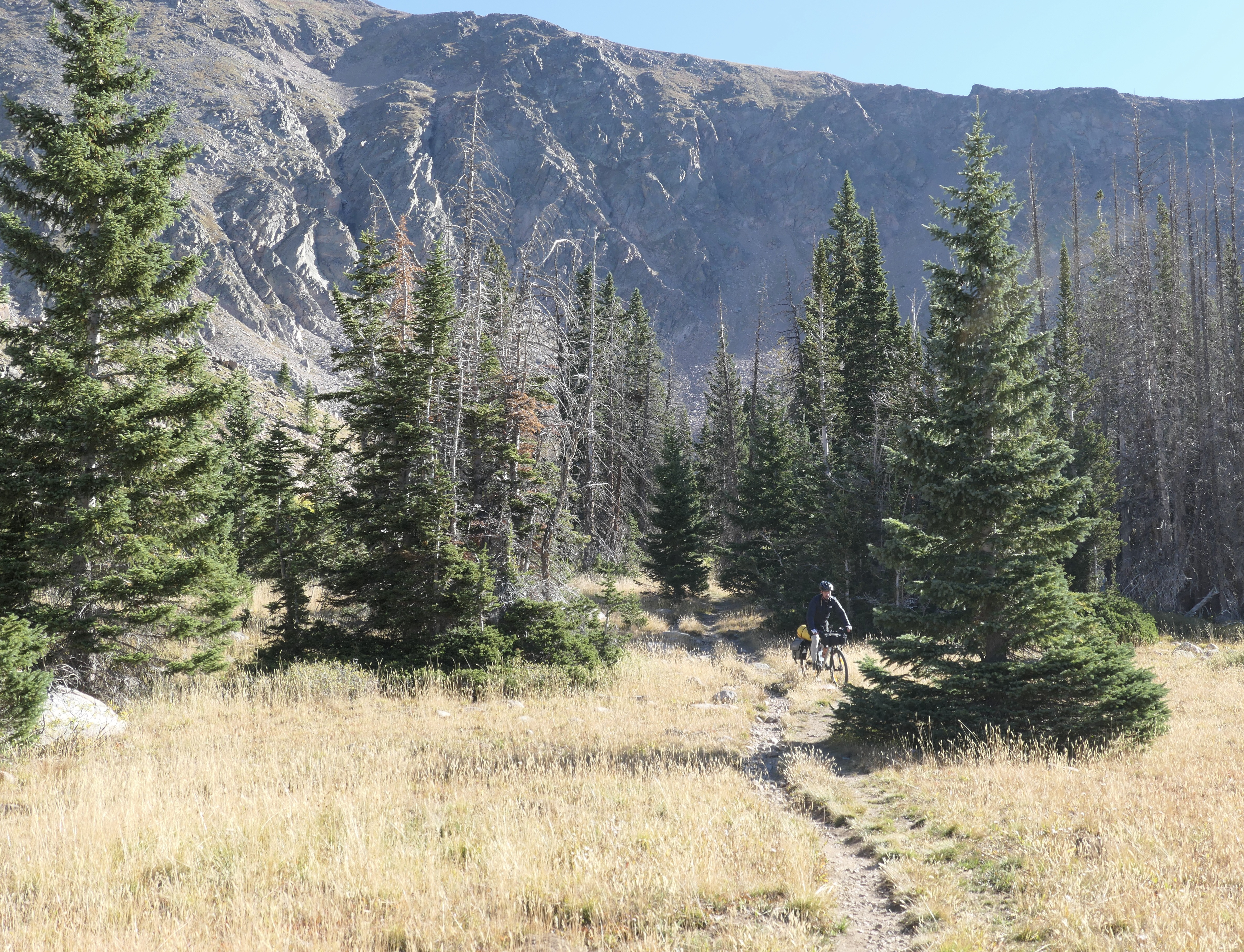
We reserved day 3 for some pure bikepacking. After breakfast we started to ride down the mountain, and to my surprise most of the way was actually rideable even on my Breezer Doppler Pro bike which is a hard tail with 650b and 47mm tires, and fully loaded too! Yes, of course it would be better on a mountain bike but that’s the bike I have and I’d rather go with less optimal equipment than not go at all. There wasn’t one single moment where I wished I had another bike and besides we weren’t in a hurry. It confirmed the versatility of this bike and that I can take it almost anywhere!
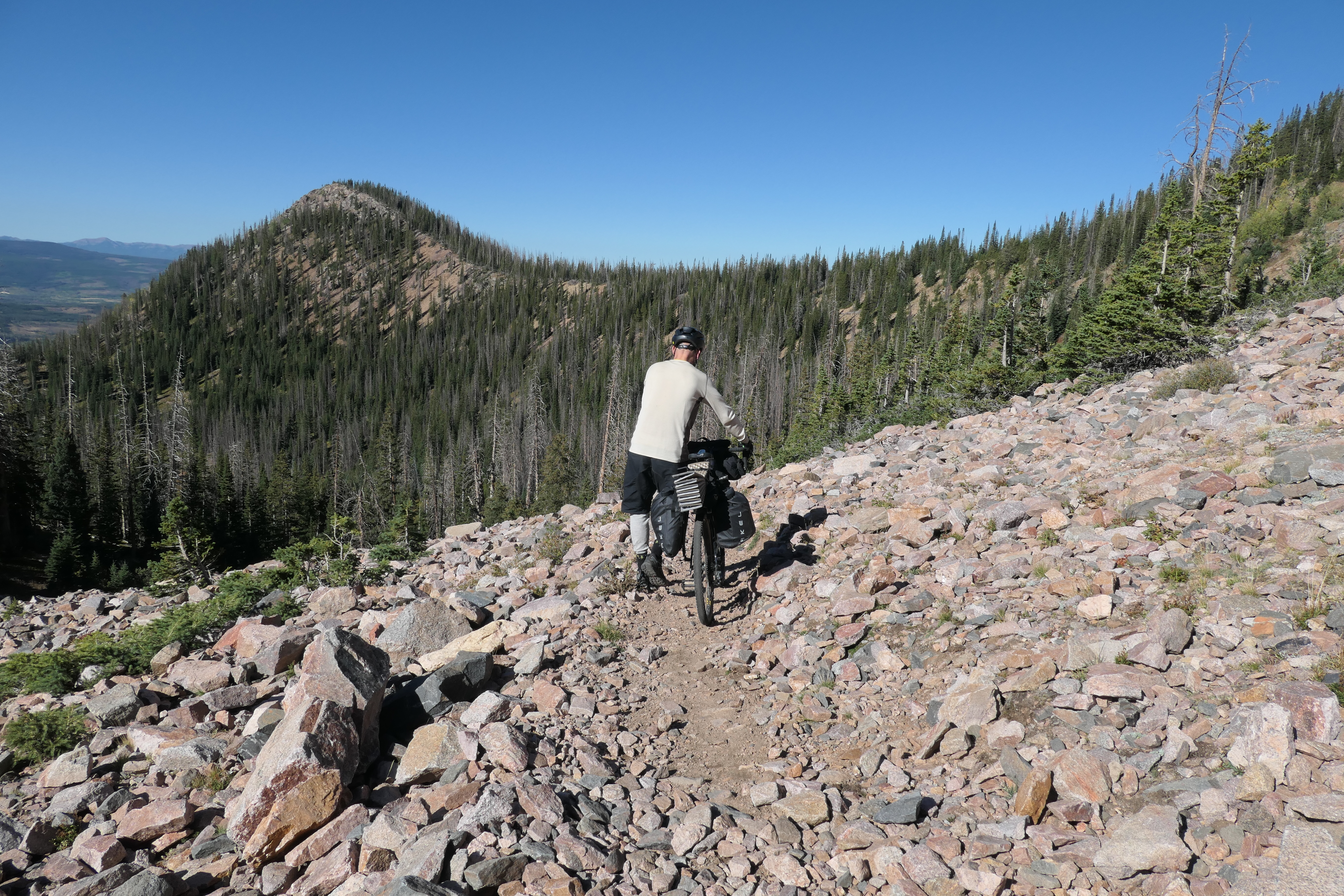
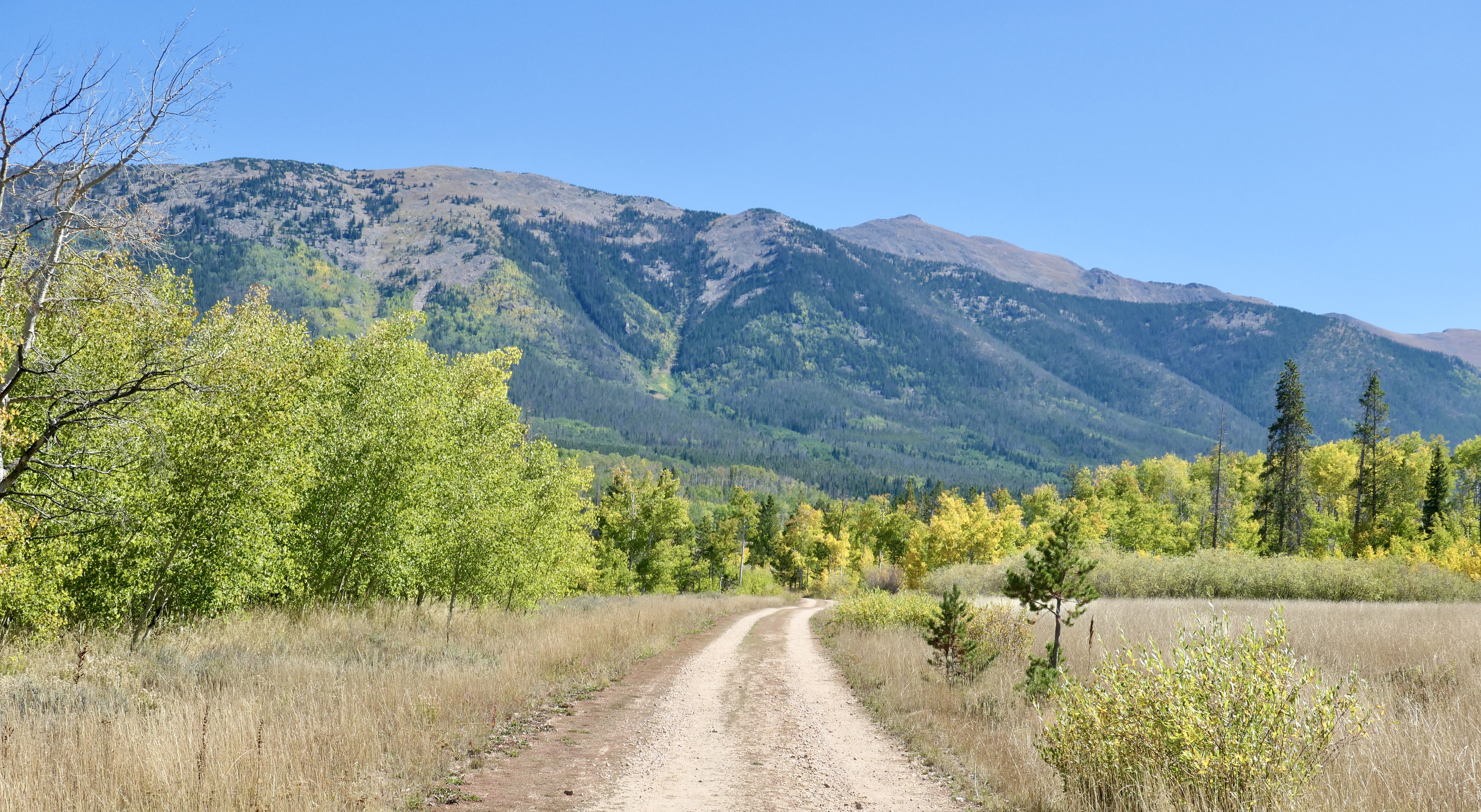
Coming down from Ruby Jewel road we turned right on the Canadian Trail which was a beautiful forest trail and didn’t seem like it was getting a lot of visitors. Eventually we linked up with the main dirt road and then the main road. It was a beautiful 3rd day ride with a nice lunch break by North Michigan Creek Reservoir. We logged out at the visitor center on our way back before getting to the car park, what a great trip!!!
Shots from day 3, click the pictures for description and more story…
Thank you Josh for some great company, I have a feeling we’ll be doing it again soon.
Oh and btw “balls” and “nuts” are just metaphors for courage – I know I had you all fooled!
Maps & Stats
Here’s a screenshot of our route. Check it out in more detail on my google map and of course my Strava (day 1, day 2 and day 3)
It’s been a little bit since the last post but long story short I’ve been in the process of moving to Colorado. Finally here, so I anticipate to post more often now since I have mountain adventure right on my doorstep.
Adventuring in Colorado presents more challenges in terms of wildlife compared to what I’m used to: Black bears, mountain lions, moose, mini bears, snakes etc. So that’s obviously a concern and something that is a big mental challenge to me. The thought of bears and mountain lions scares the shit out of me! In terms of preparation I have to think more about how I handle food and be more aware when I’m hiking. At the end of the day I have to remind myself that animals in general prefer to stay away from humans and animal attacks are extremely rare and most times they could have been avoided. When it happens it’s usually either because they want to get to your food, you surprise them, or come too close to them. To put things into perspective Colorado has had 4 fatal black bear attacks since 1971 and in 2017 and 2019 there where 5 total black bear attacks both years (not fatal). There has been 3 fatal mountain lion encounters since 1990 with 25 total mountain lion attacks since then. Finding moose stats is a bit harder but it looks like there’s about 5 recorded last year (2021, none fatal). Looking objectively on these stats I should be extremely unlucky if something bad happens to me, especially if I take good care of my food handling. Also if you look closer into every incident most of them happened because of the before mentioned reasons.
I’ve been doing some research of how to handle food and decided to get the Ursack in combination with two odor proof Opsak’s, so I have one for my food and one for my trash. I keep both of them in the Ursack and tie it to a tree or hide it under some rocks in good distance away from the tent when I’m sleeping. Bears are hibernating now so they don’t pose much of a threat but I still want to practice doing it right. This method is recognized as a pretty safe way to do it and I think the best way for me and what I plan to do (the bear canister would be the safest but with obvious downsides like weight and bulk it would be hard to fit on the bike). However different methods works better in different areas so do your own research. In addition to the food gear I got a bear spray and a good knife.
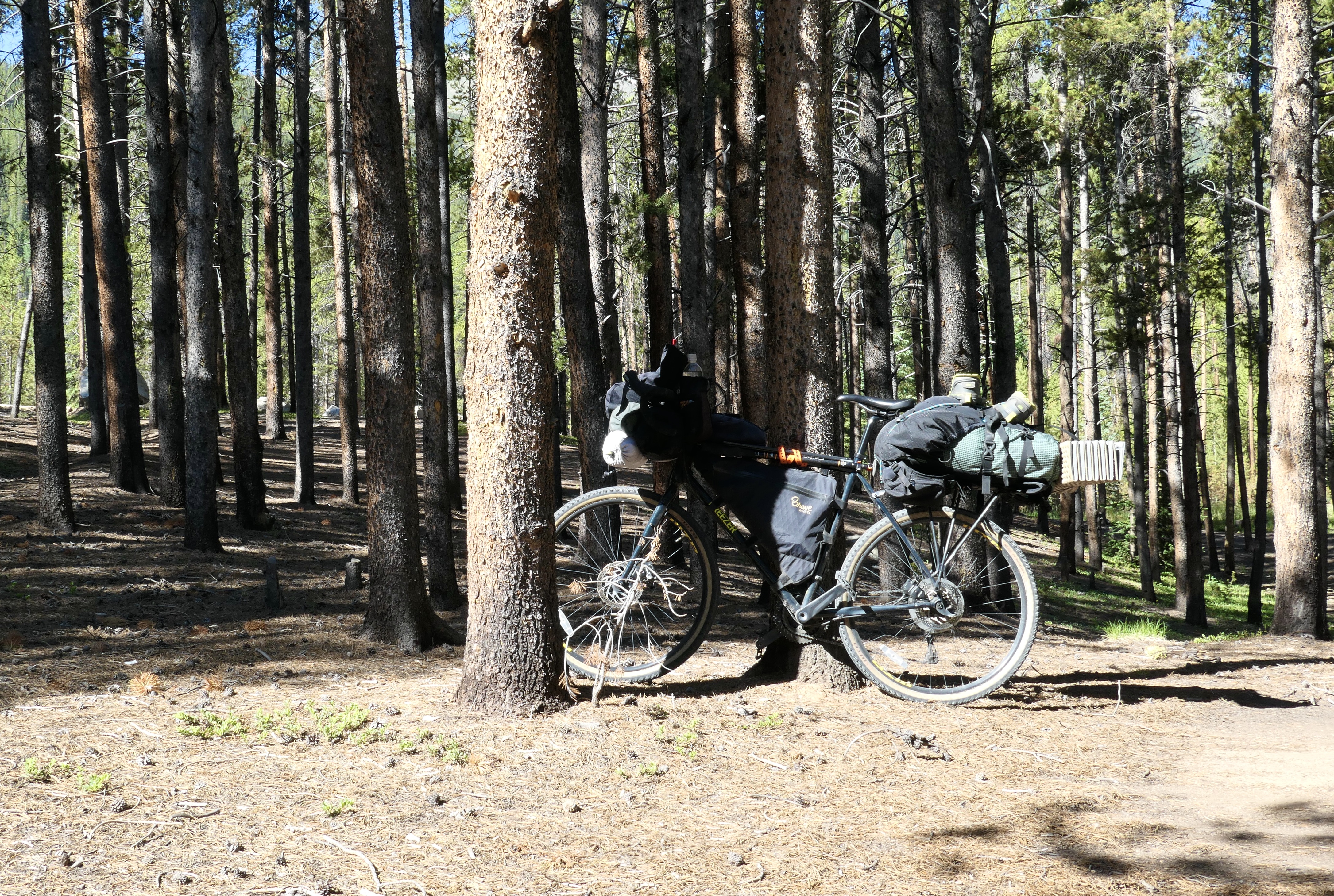
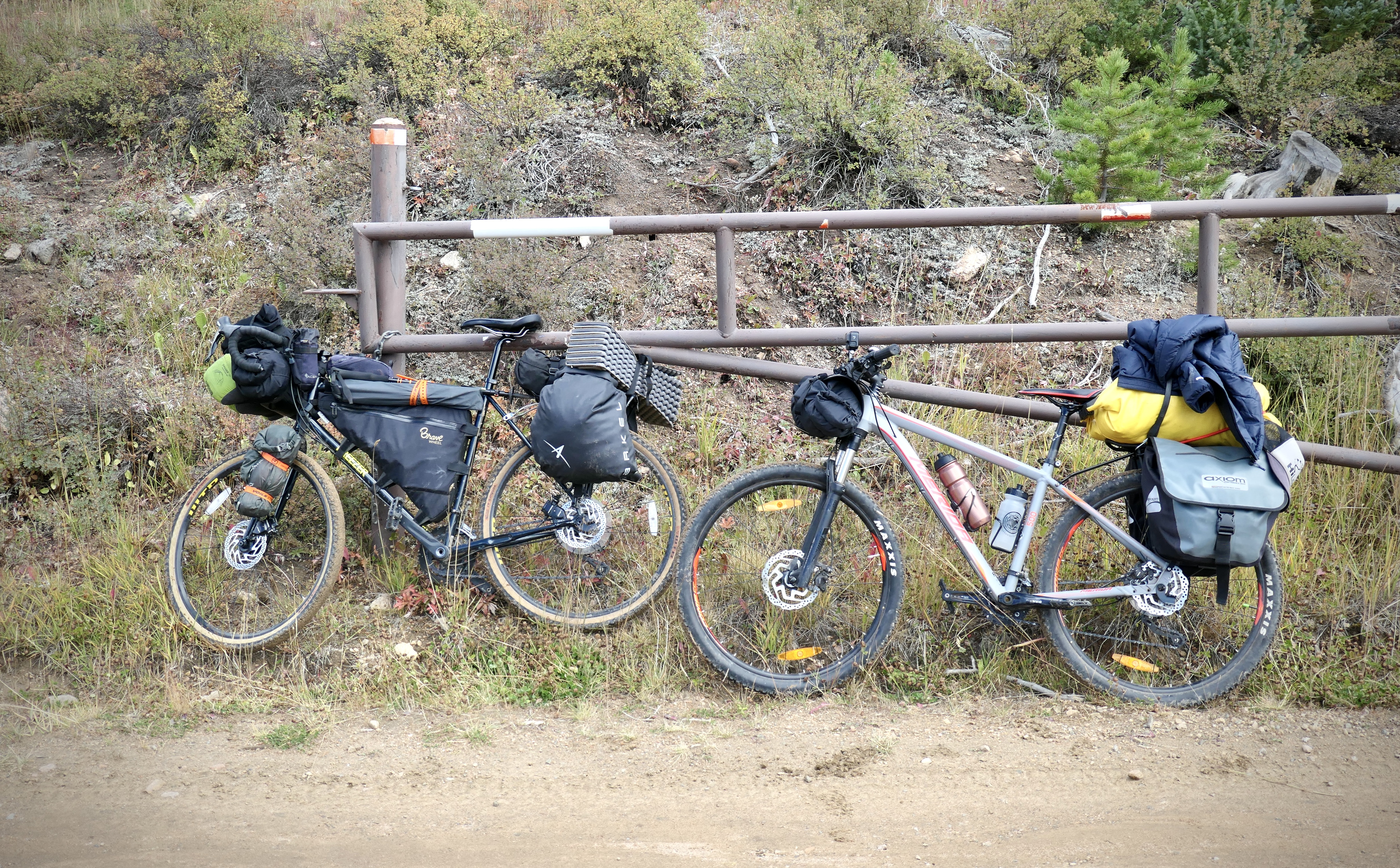
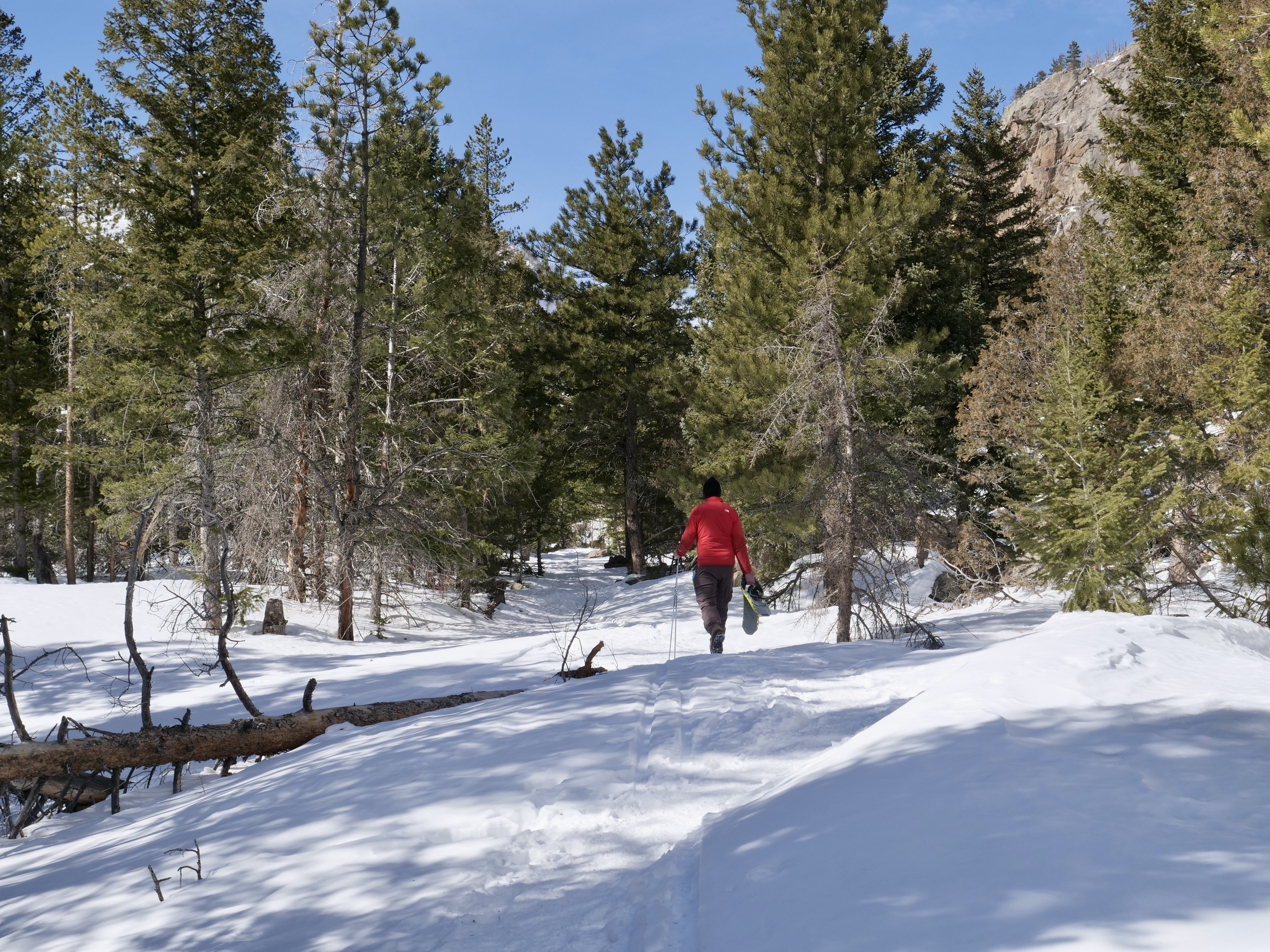
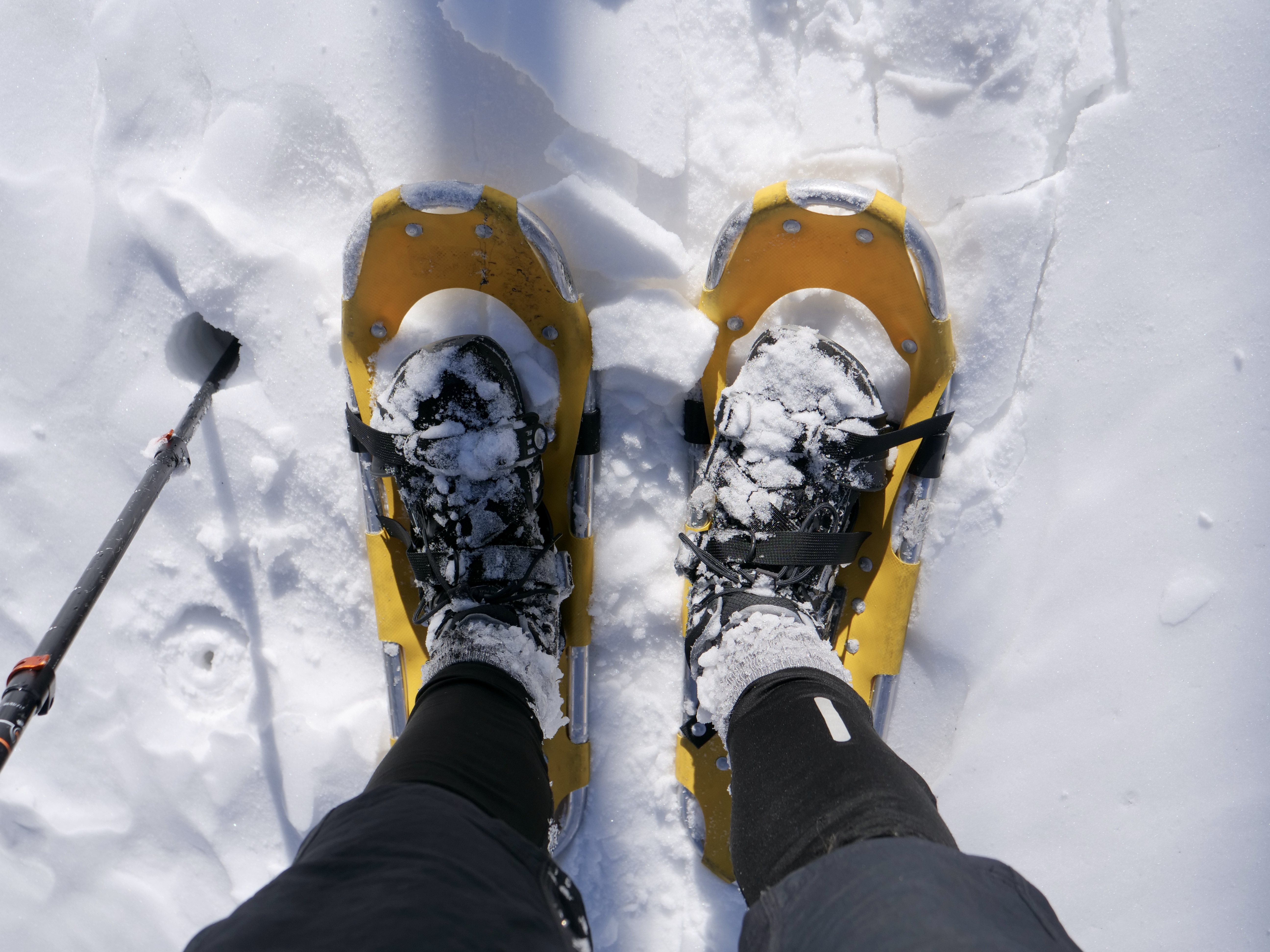
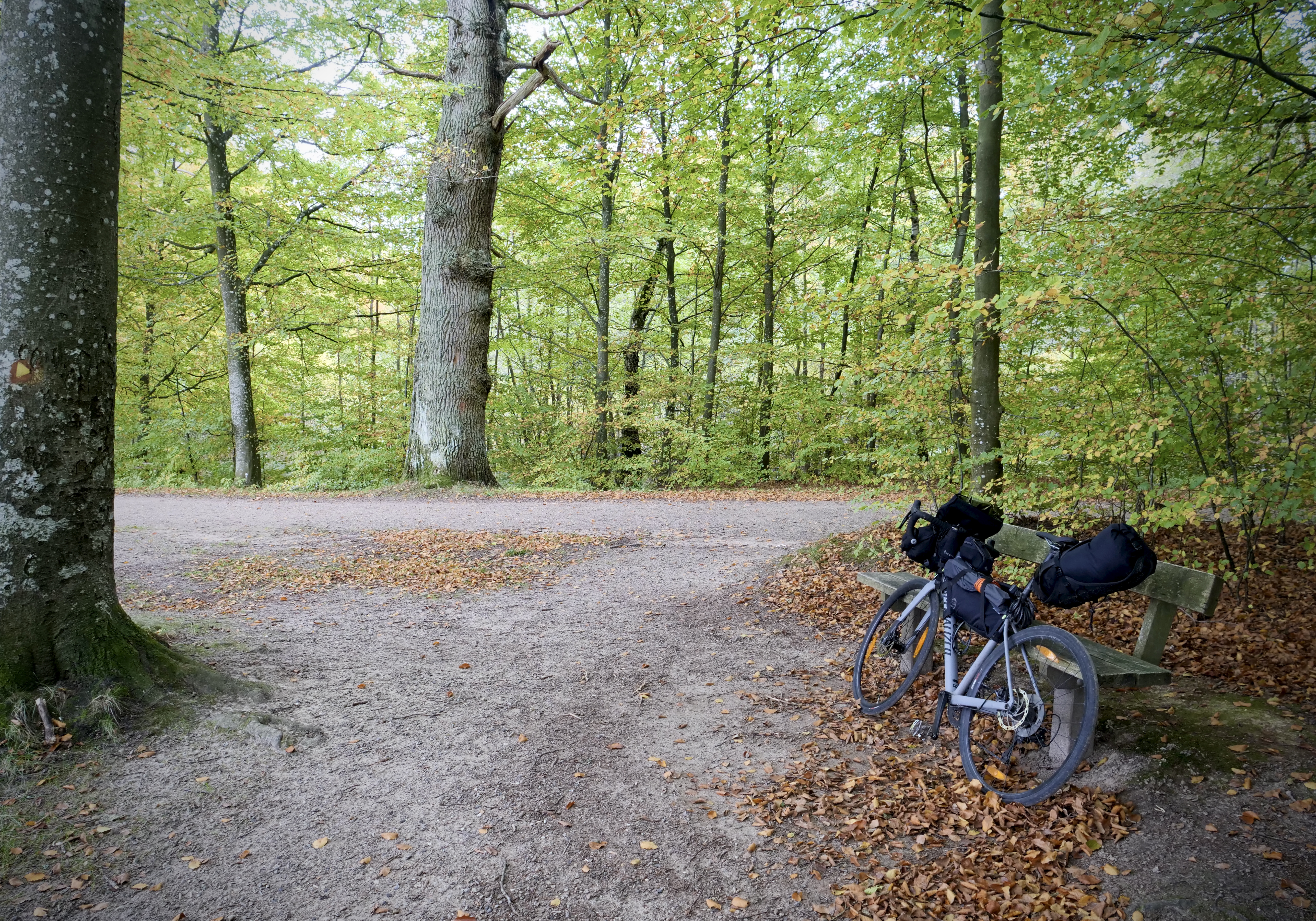
Anyway, I decided to bike towards Rocky Mountain National Park (RMNP) from Fort Collins and pitch the tent somewhere on the way before sunset. Normally I can make it to RMNP in a day but I was off to a late start. Packing and setup took longer than expected but it’s also a new approach bringing snowshoes and everything. In addition to the bike setup I carry a 58 L lightweight pack so I can pack everything into that when I transition to hiking or snowshoeing and lock the bike somewhere in the woods. Check out the setup below…
Day 1
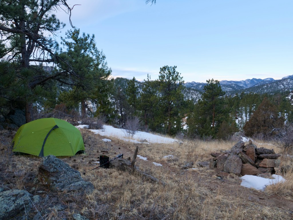
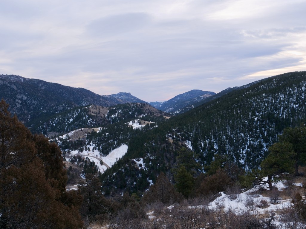
Started out with a nice uphill ride from Fort Collins to (almost) Glen Haven where I found a nice spot for my tent in the mountains. Check out the stats for day 1…
Day 1
Time on bike:
3:12 h
Distance:
59 k
Asc:
774 m
Dsc:
149 m
Average speed:
18,4 km/h
In addition to this I hiked 30 minutes ascending 151 m into the mountains to find a good spot for the tent. I would have liked to take more pictures up there but I was a bit late and it was getting dark and I had to figure out all the new routines with cooking and food handling. By the time I was done cooking and about to eat it was already dark, SUDDENLY I see 3 sets of eyes staring at me and immediately I go into fight mode thinking it’s mountain lions! Adrenaline runs through my body and I let them know I’ve seen them by letting out a short deep roar. One of them runs to the side and immediately I’m thinking they are attacking me by one flanking me and the other two going straight at me. To my own surprise I stayed pretty calm staying where I was and finishing my food but paying close attention with my headlamp. The two of them where still staying up there looking at me, I couldn’t see the third one anymore. I was at a pretty flat space so they couldn’t surprise me since I could see in all directions. I had my knife in my hand and was ready if something happened. However, nothing happened and they probably just wanted to check me out or maybe they had been there the whole time and I didn’t see them until then. I never found out if it was mountain lions. Thinking about it afterwards my best guess would be coyotes since they were the only tracks I could find. I packed my food into the Opsacks and into the Ursack, tied the Ursack to a tree and went back to my tent. Once I was in the tent I was pretty calm and ended up with a descent sleep…I didn’t get up next morning until after sunrise though.
Campsite at sunsetLooking down the valley I had been biking earlier
Day 2
I was already in a hurry since I got up a little late. I had to meet Dave-The-Rave in Estes Park. Packed up everything, got my food sack…it was still there, and went down to my bike…it was also still there, great!
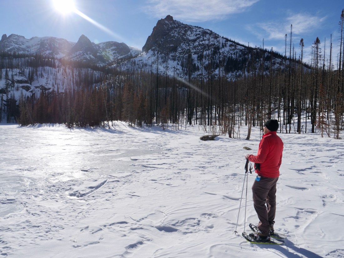
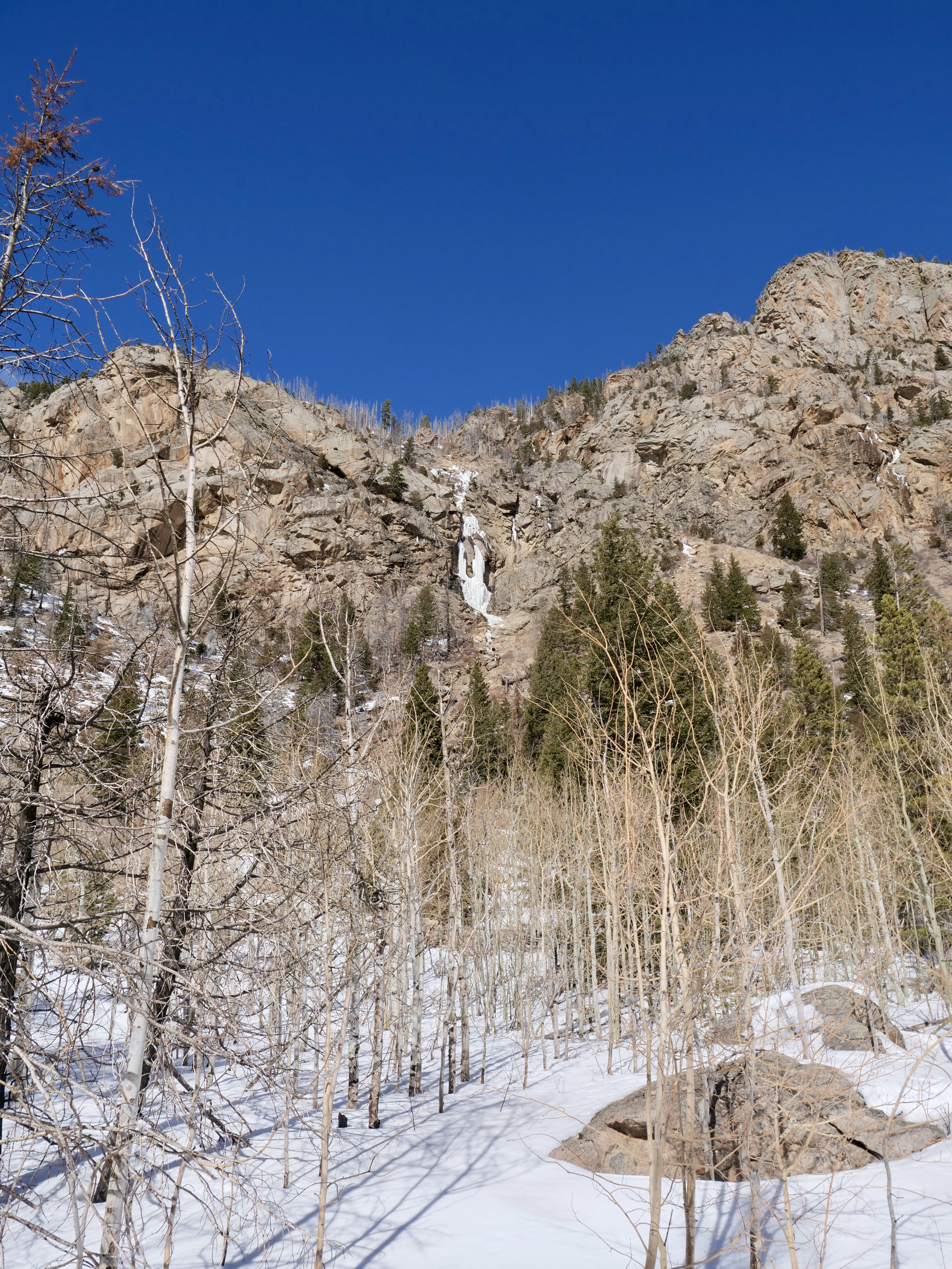
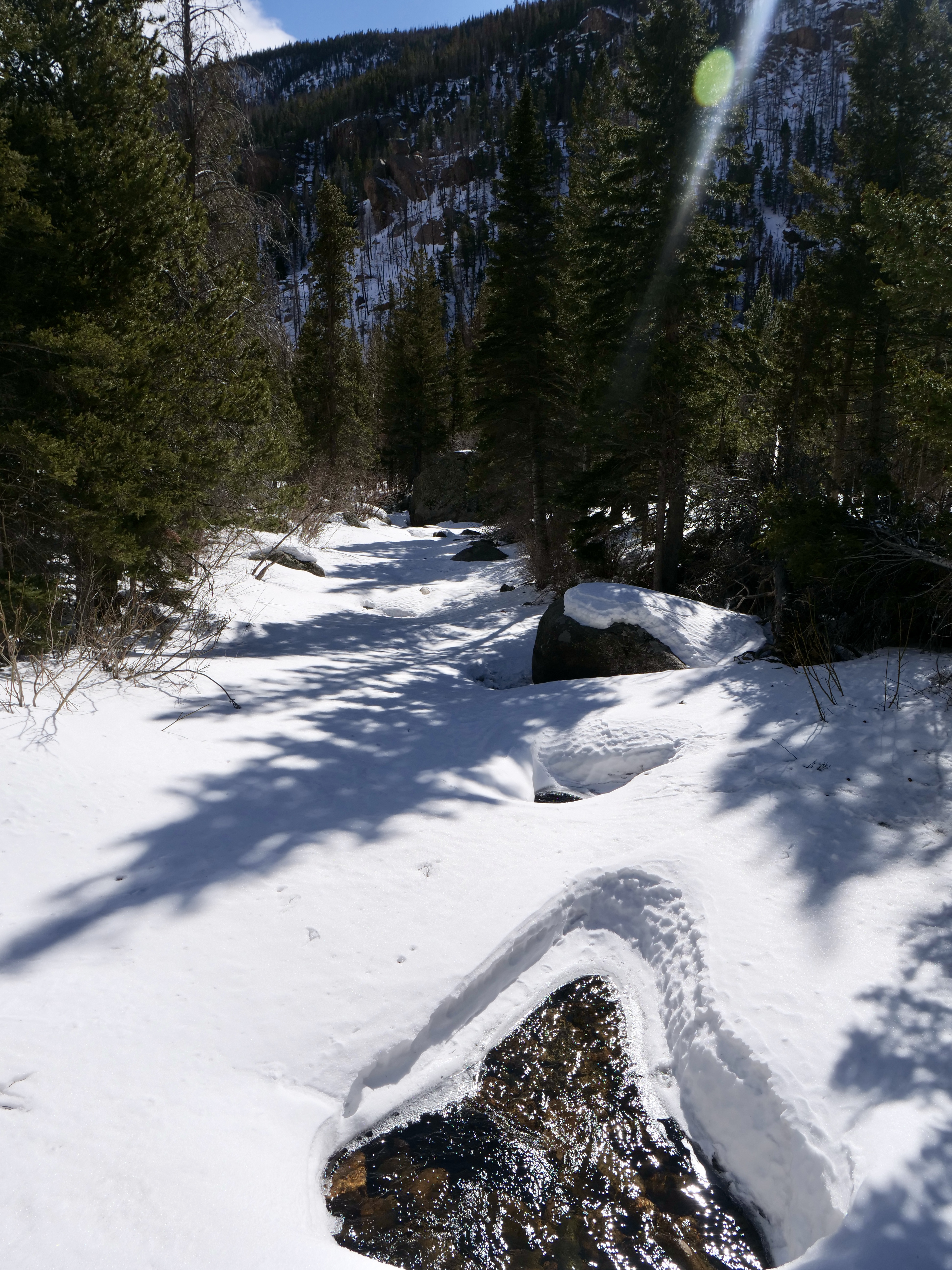
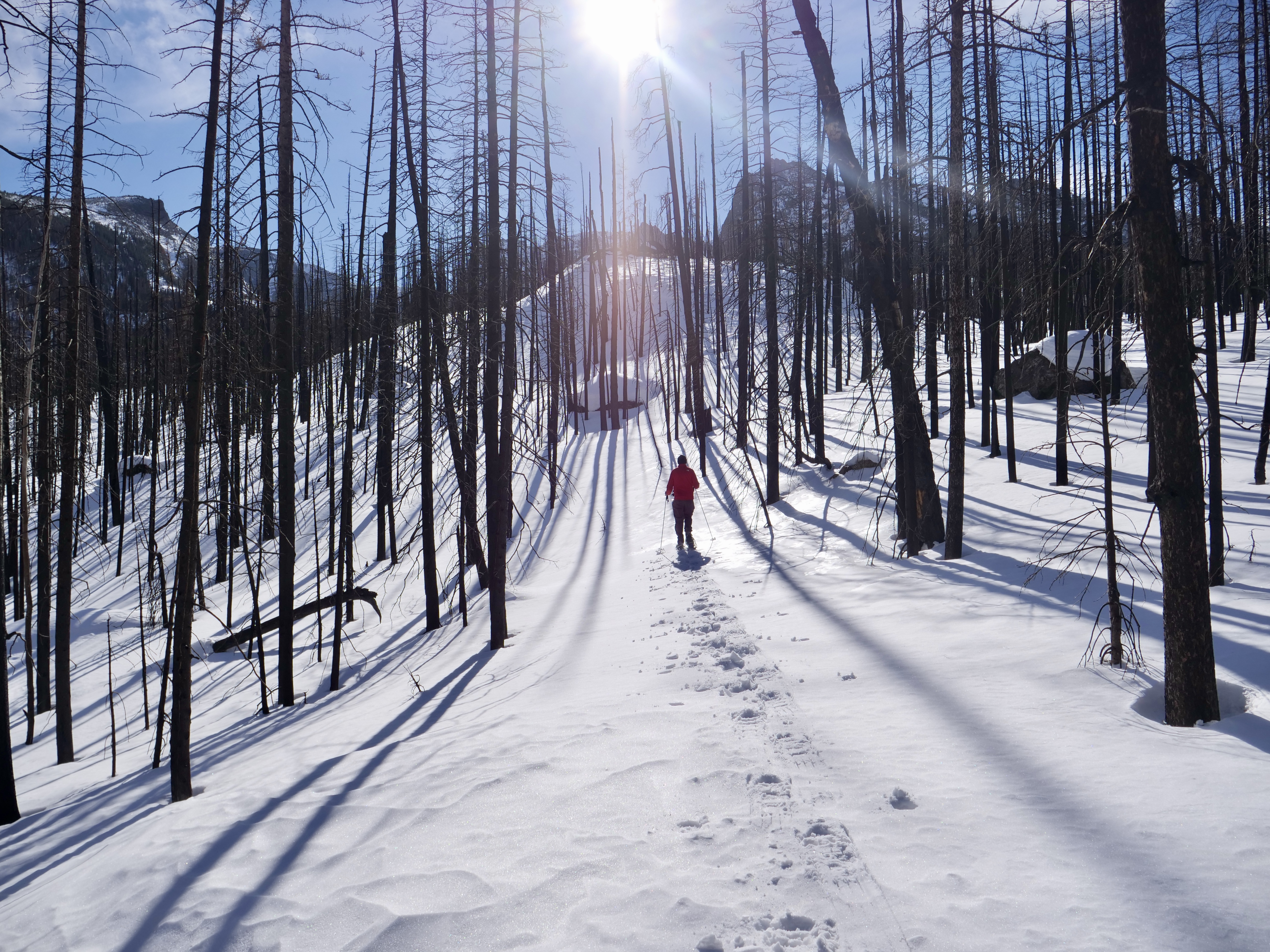
It was a gentle climb up to Glen Haven but right after there was a brutal climb and I had to push the bike for a little bit. But once at the top it was a beautiful downhill to Estes Park. I had breakfast with Dave-The-Rave and we went for a great snowshoe hike where we broke trail up to Fern Lake in RMNP.
Highlights: Frozen waterfalls, huge boulders, winter landscapes, breaking trail in deep snow, a frozen lake, big mountains, beautiful elk with huge antlers, and a beautiful sunset.
Besides it being a great little trip I learned a lot with regards to the winter bikehiking approach, what gear to bring, and how to handle food. I’m pretty happy with my preparation and packing, everything worked great!
I was born and grew up in the area of North Zealand (Nordsjælland) which is an area just north of Copenhagen. I have always looked outside of Denmark for adventure since it’s very flat and has no wild nature, so i didn’t have much expectation other than to ride my bike, take some fall pictures and explore the area were i grew up. Usually when I set my expectations low I get positively surprised…
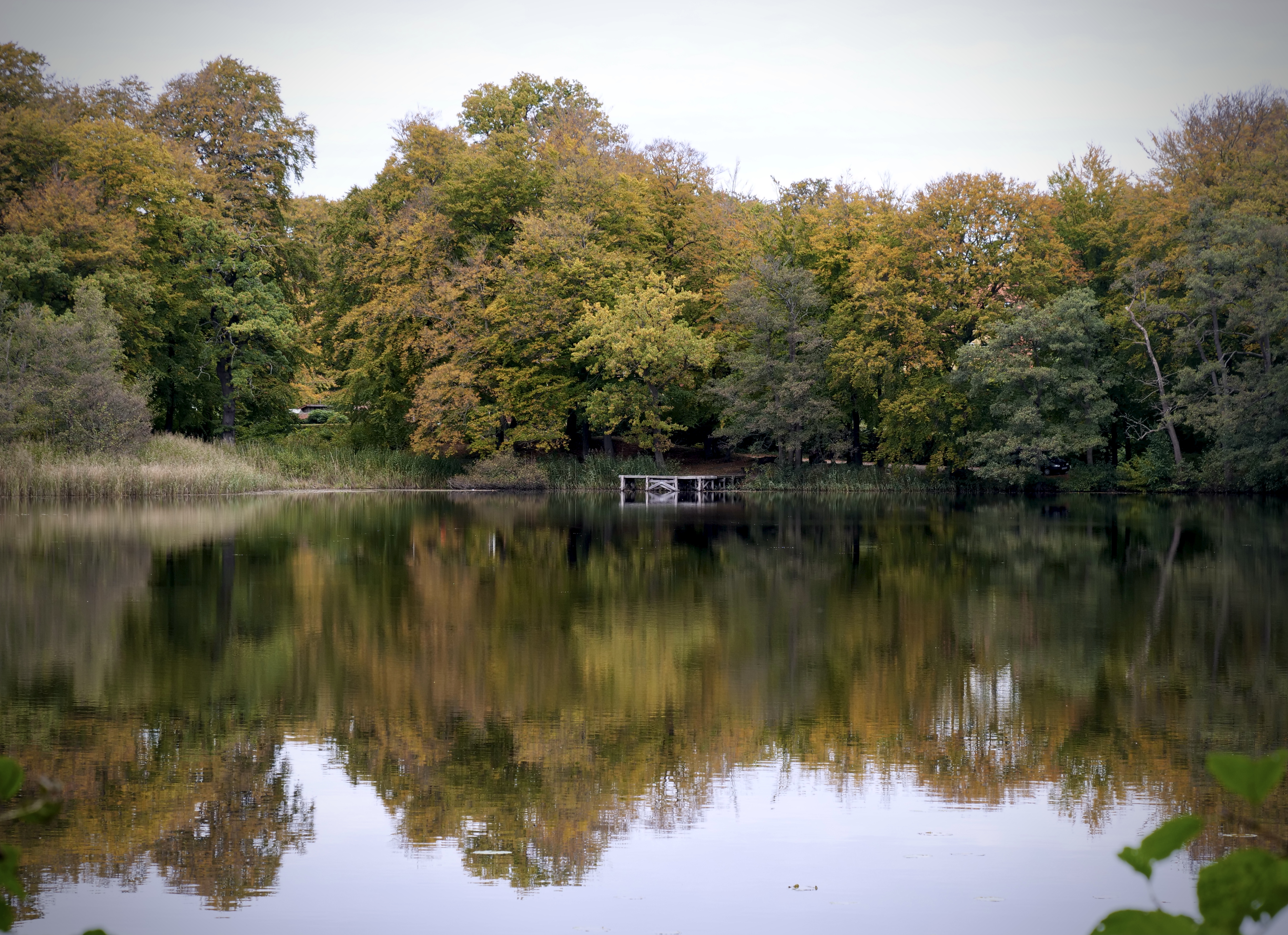
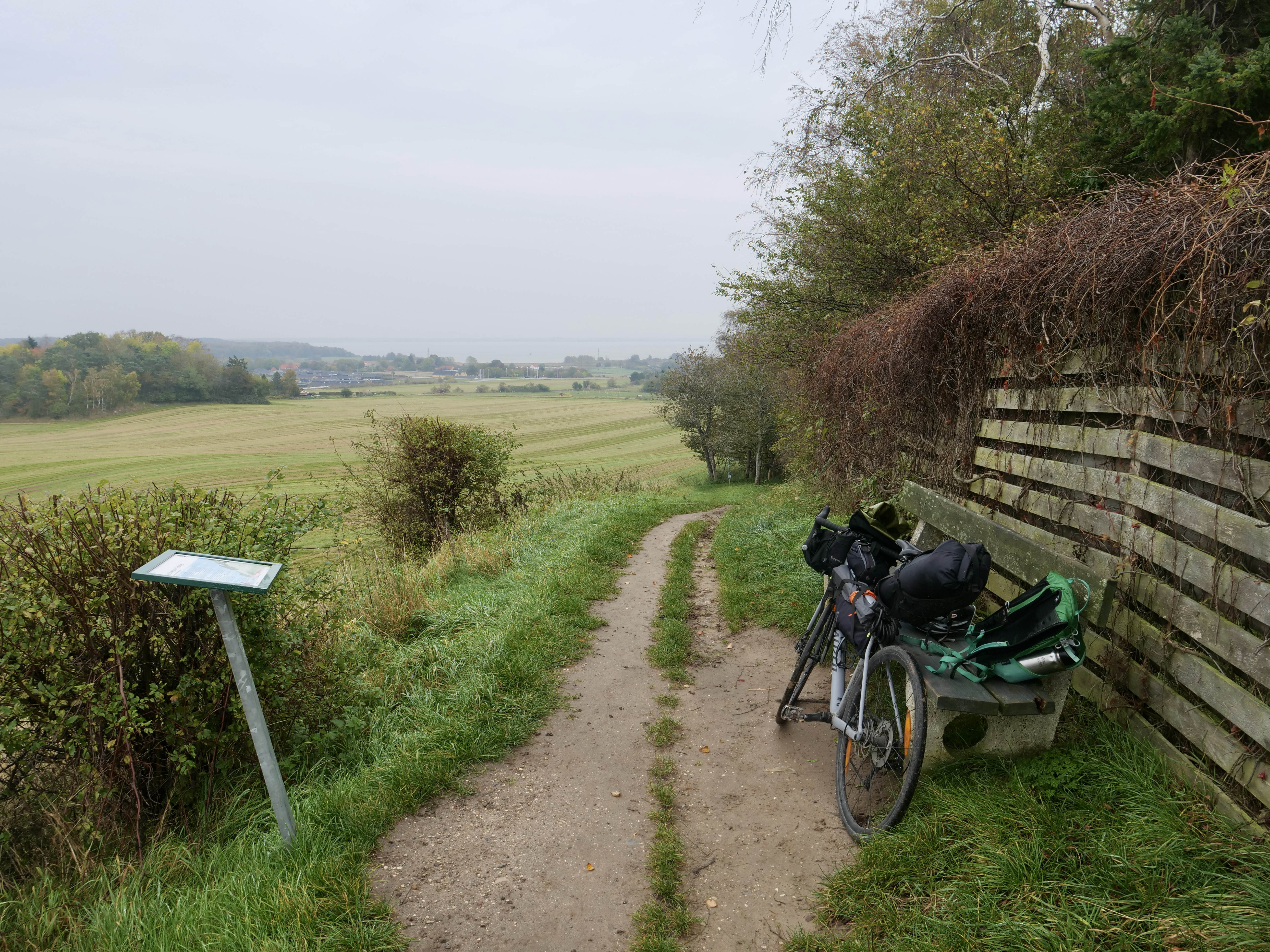
Now, there is no big wild nature here or anywhere in Denmark, so i set my expectation just for the ride itself and no crazy nature experiences. The first day i biked along the east coast straight from Østerbro in Copenhagen I stopped for lunch in Helsingør which is a beautiful and historic town. On the way along strandvejen the ride goes past some of the most expensive houses in Denmark. I more or less followed the northern part of the number 9 national bicycle route that goes from Gedser to Helsingør (https://www.visitdenmark.dk/danmark/oplevelser/cykelferie/danmarks-11-nationale-cykelruter). There are small hubs of forest on the way so it’s possible to do some detours (especially “Dyrehaven” if you want to see some big red deer) but i just stayed on the road to not distract my mind with on-the-go route planning. I had a nice lunch in Helsingør and continued along bike route 47 “Nordkystruten” to Tisvildeleje (https://www.visitnordsjaelland.dk/nordsjaelland/det-sker/nordkystcykelstien-rute-47-gdk680396). The first part to Hornbæk is really nice going through a forest and lake area and from there to Tisvildeleje it’s basically one big summerhouse area. The beach in Hornbæk is really nice and I used to go there in summers with my friends but I also got excited about the area around Rågeleje and Tisvildeleje, it was quite hilly by danish standards.
In Tisvildeleje I did a pitstop in “Brød & Vin”. It’s a really good bakery that also serves wine and I decided to go to Asserbo shelter for the night. I biked through Tisvilde Hegn that serves as home base of the Red deer in Denmark (or at least in Sjælland). Unfortunately it was getting dark so I didn’t see them when I biked through the woods. There was one trying to invade the shelter but he took off quickly when he saw me. The shelter was great with plenty of room.
That more or less wrapped up day 1. The summerhouse towns are extremely lively in the summer but more mellow at this time in the fall which is I like. There are still plenty of good places to stop for coffee and food though.
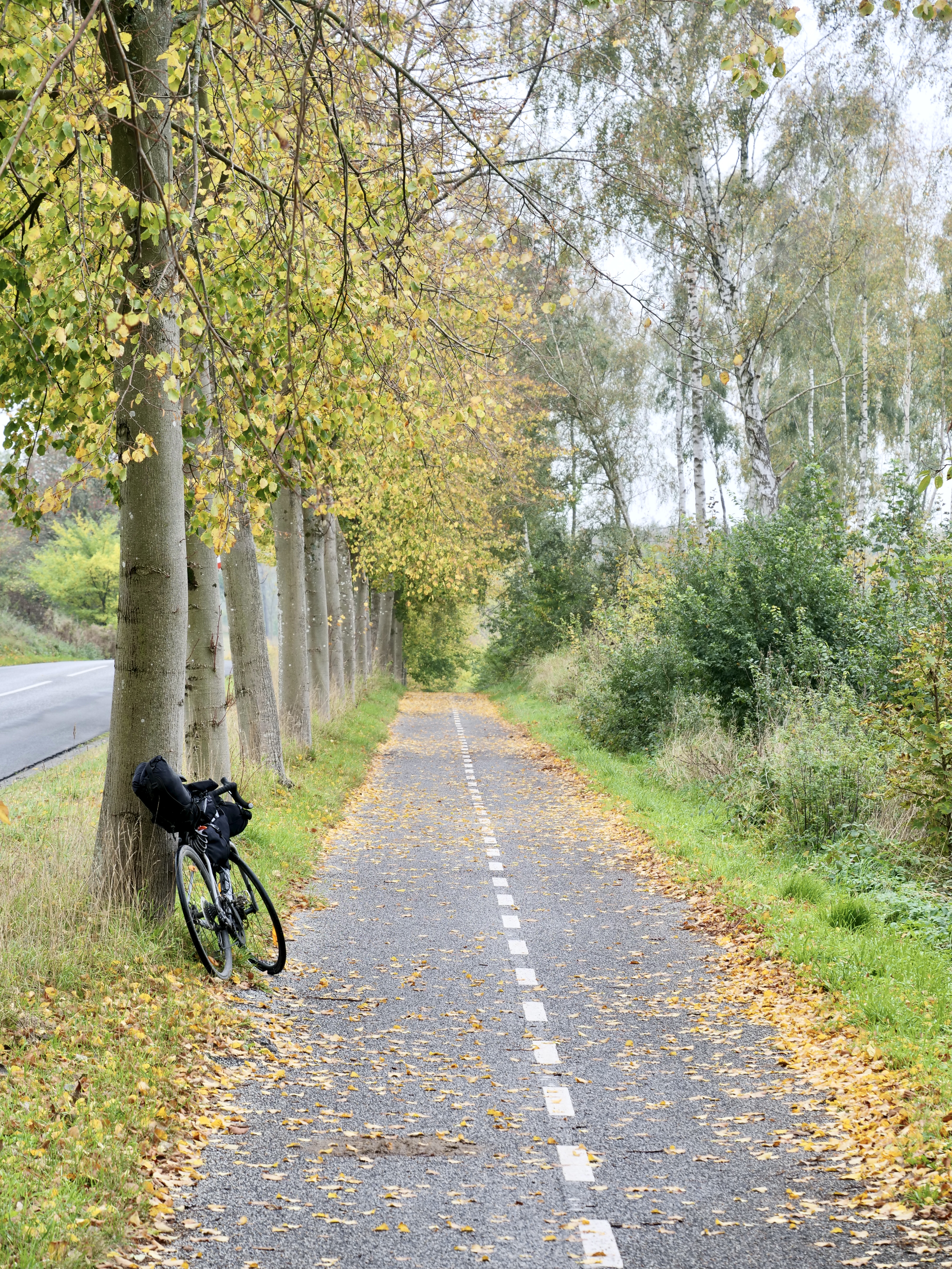
Day 2 I went to Frederiksværk to eat breakfast at a bakery, from here the plan was to hit bike route 40 west towards Hundested and connect it south with route 2 towards Kulhuse and cross Roskilde Fjord. However I discovered that I made a big mistake…there was no bridge, and the ferry only sails in the summer, so I had to go all the way back to Frederiksværk and continue south along bike route 40 and connect it with route 2 in Frederikssund, a 20 k extra warm up. The 40 route turned out to be quite nice and pretty hilly. After connection with route 2 I ate lunch as soon as I hit the forest south of Buresø. Then just before Bastrup Sø I decided to go with the Buresø – Fiskebæk bike route (that I also discovered on Naviki, more info: https://www.furesoe.dk/oplevelser/brug-naturen/cykelruter/#moelleaadalen-2:-fiskebaek-til-lyngby). This route actually went through my old hood around Farum and was the highlight of the trip for me. There is quite a lot of singletrack on this route, so my road tires didn’t do very well but I managed without falling. A really nice stretch. Then from Farum i followed bike route 2 again along the freeway into Copenhagen. Originally i wanted to bike north of Furesøen through “Vaserne” to Holte which is a really nice stretch but that will be next time…
Naviki is an awesome free app that I use both for planning and on the road. I could even see the route number on the map in the app. It automatically gives you the best routes for biking. Highly recommend !
I also used this: https://trafikkort.vejdirektoratet.dk/index.html?usertype=3 where you can plot the 11 big bike routes in Denmark. Makes for an easy overview if you want to connect them. Fx i connected 9 and 2 with the smaller 47 “Nordkystruten” that i got from Naviki. I also connected bike route 40 so the whole route went: 9, 47, 40, 2, Buresø – Fiskebæk (BF) and 2 again. Route 47, 40 and BF I both discovered in Naviki on the road.